Gonbad Kabud Mosque: Eight Centuries Under a Blue Dome
The blue dome gives the mosque its name. Gonbad Kabud -- "Blue Dome" -- sits in the town of Kalat in Iran's Razavi Khorasan province, tucked into a mountainous corner of the country's northeast that has served as a natural fortress for centuries. Nader Shah chose Kalat as his treasury precisely because its terrain made it nearly impregnable. The mosque he expanded still stands, but its story reaches back further than the eighteenth-century conqueror -- to the Seljuk Turks who first raised walls here, and to the Mongol governors who added their dead to its grounds.
Seljuk Foundations
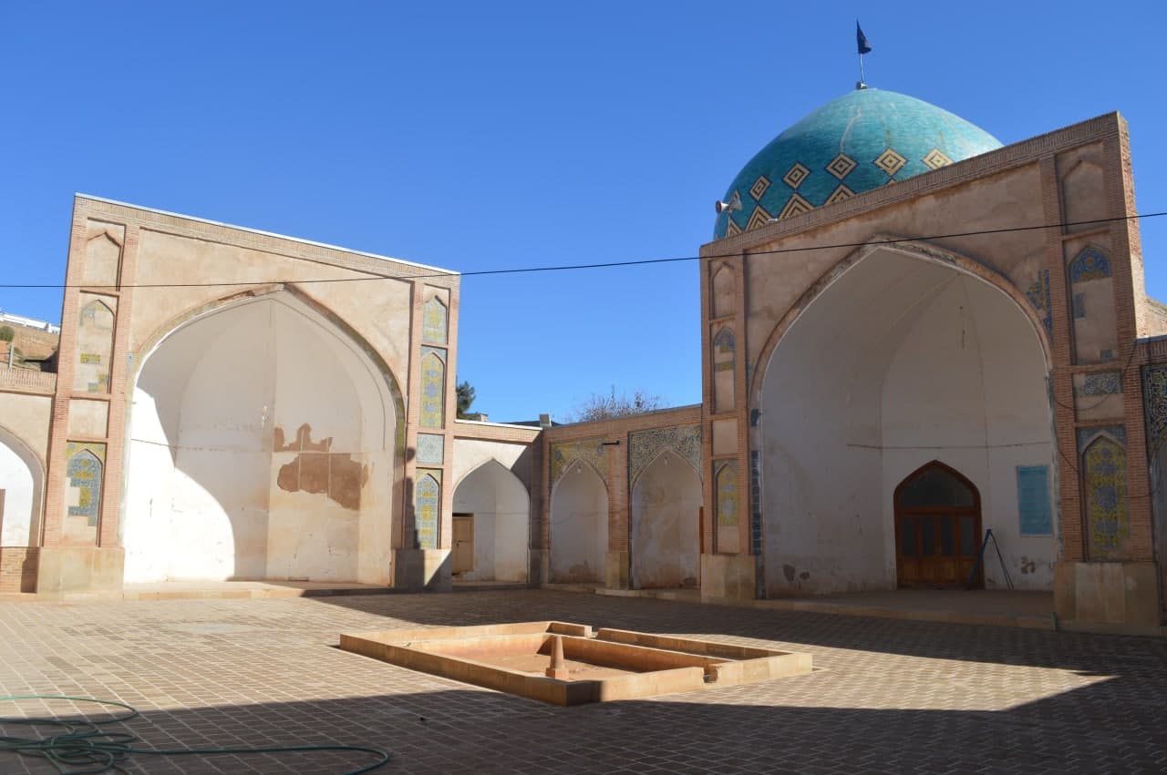
The oldest layers of the Gonbad Kabud Mosque date to the Seljuk period, sometime in the twelfth century. The Seljuks, a Turkic dynasty that dominated much of the Islamic world from Anatolia to Central Asia, built mosques with a distinctive architectural vocabulary: iwans -- vaulted halls open at one end -- arranged around a central courtyard. Fragments of yellow-and-blue tilework still cling to the mosque's four iwans, colors that have survived nearly nine hundred years of weather, warfare, and renovation. The rectangular sahn measures nineteen meters wide and twenty-seven meters long, a courtyard proportioned for both prayer and gathering. What stands today is not purely Seljuk -- too many hands have reshaped the building for that -- but the bones of the original structure remain, the skeleton around which later dynasties built their additions.
Mongol Tombs in the Shadows
During the rule of the Ilkhanate -- the Mongol successor state that governed Persia after Genghis Khan's conquests -- a mausoleum was added to the mosque grounds. Next to the eastern shabestan, the underground prayer hall, sits a tomb belonging to the family of the Mongol Jalairs. The Jalairs were a Mongol tribe that governed parts of Iran under the supervision of larger powers for generations, eventually being absorbed into the Qara Qoyunlu confederation. Their graves at Gonbad Kabud are quiet markers of a turbulent era. Stone slabs from the Ilkhanid period, weathered but intact, lie at the side of the mosque. They are easy to walk past. Most visitors come for the dome and the tilework. But these graves anchor the mosque to a particular moment in history -- the century after the Mongol invasion, when conquerors became settlers and began burying their dead in the places they had once destroyed.
Nader Shah's Fortress Town
Kalat's geography attracted Nader Shah Afshar, the eighteenth-century military genius who briefly united Persia and conquered as far as Delhi. He recognized Kalat's mountain-ringed terrain as a natural stronghold and used the town to store his treasury and house his court. When he turned his attention to the Gonbad Kabud Mosque, he did what conquerors do: he made it larger. Nader Shah added porches and shelters around the existing structure, expanding its footprint and its capacity for worship. The mosque gained a second name in his era -- the Naderi Mosque -- a title it carries alongside its original. His expansion gave the building the mixed architectural character it has today, where Seljuk proportions meet Afsharid ambition. The dome's cylindrical base rises to a blue crown above an octagonal interior, each wall approximately four meters long.
Restorations and Revolutions
The Qajar dynasty, which ruled Iran through the nineteenth century, undertook extensive renovations. In 1835, Yalangtush Khan, the governor of Kalat, ordered further repairs and restorations. Each round of work added something, removed something, altered the building's character while preserving its essential identity as a place of worship at the crossroads of empires. The mosque was added to the Iran National Heritage List on April 12, 1967 -- a formal recognition that this was not just a functioning mosque but a document in stone. One of the building's rooms was later converted into a memorial for martyrs of the Iranian Revolution who died in Kalat, their burial place sharing ground with the Mongol dead from seven centuries earlier. A historic fountain in the courtyard no longer functions, its basin dry. But the blue dome still catches the light the way it has for centuries, turning the afternoon sun into something that feels, from a distance, like a signal.
From the Air
Located at 36.99°N, 59.77°E in Kalat, Razavi Khorasan province, northeastern Iran. The town of Kalat sits in a mountainous, naturally fortified valley that once served as Nader Shah's treasury. The blue dome of the mosque is the most visible landmark in the small town. Nearest major city is Mashhad, approximately 130 km to the southwest. Nearest major airport is Mashhad International (OIMM). Best viewed at 3,000-5,000 feet AGL; the mountainous terrain surrounding Kalat creates a distinctive bowl-shaped landscape that makes the town easy to identify from the air.