Gooseberry Falls State Park
Three distinct layers of lava are visible from the highway bridge. That fact alone sets Gooseberry Falls State Park apart from the typical waterfall destination -- this is not just moving water but a geology lesson written in basalt, each ledge representing a separate volcanic eruption from a time when this stretch of Lake Superior's North Shore was a rift zone pouring molten rock across the landscape. The Gooseberry River has spent millennia cutting through at least 19 stacked lava flows, carving the Upper, Middle, and Lower Falls on its way to the largest of the Great Lakes. Located 13 miles northeast of Two Harbors along scenic Minnesota Highway 61, the park surrounds the river's mouth and draws visitors who come for the falls, stay for the trails, and leave with pockets full of agates.
Stone Upon Stone
The Minnesota Legislature authorized preservation of the Gooseberry Falls area in 1933, and the park received its official designation in 1937. Between those years, the Civilian Conservation Corps went to work. From 1934 to 1941, CCC crews built the park's shelters, walls, and structures in a distinctive rustic style using red, blue, brown, and black basalt quarried from the surrounding landscape. The designs came from the Minnesota Central Design Office of the National Park Service. Two Italian stonemasons supervised the construction, and the craftsmanship shows -- the buildings look as though they grew out of the bedrock. The structures earned a listing on the National Register of Historic Places, and they remain some of the finest examples of CCC stonework in the state. In 1996, the Joseph N. Alexander visitor center opened, adding interpretive displays, a cinema screening room, a gift shop, and programming that ranges from astronomy nights to live music.
Reading the Lava Layers
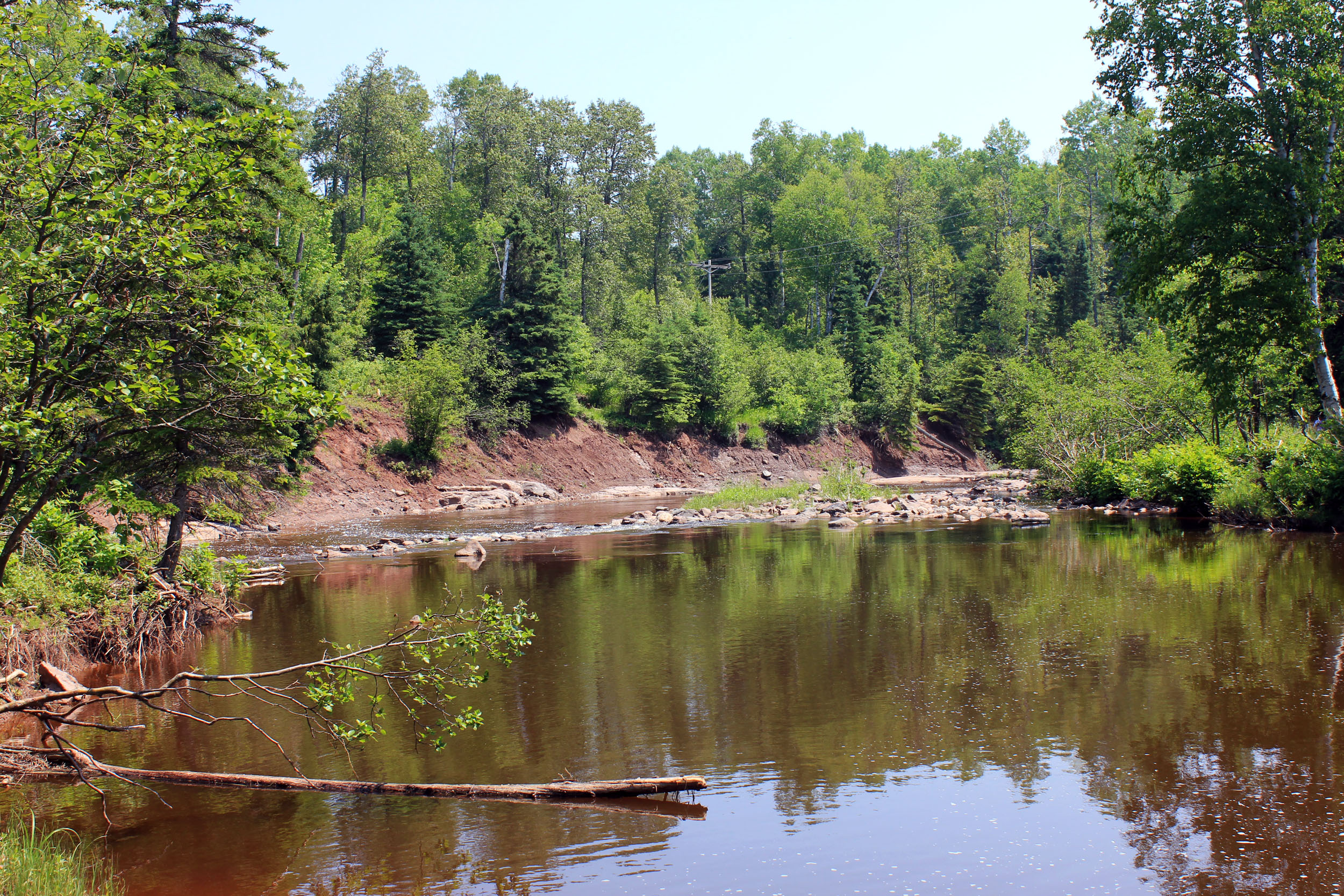
The North Shore of Lake Superior is almost entirely underlain by a series of ancient lava flows, remnants of the Midcontinent Rift that tore across this region roughly 1.1 billion years ago. At Gooseberry Falls, the river has sliced through these layers like a knife through a cake, exposing the geological record in cross-section. The lower flows are compact and hard -- dense basalt that resists erosion and forms the falls' dramatic ledges. The upper flows are vesicular, riddled with gas pockets that later filled with minerals. Among those minerals are the ones that form Lake Superior agates, the banded quartz stones prized by collectors and designated Minnesota's official state gem. Where the Gooseberry River empties into Lake Superior, the beach becomes a hunting ground. Patient searchers scan the wet gravel for the telltale rust-red bands that signal a keeper.
Trails Through the North Woods
The park's 18 miles of hiking trails fan out from the falls through boreal forest and along the Lake Superior shoreline. Some connect to the Superior Hiking Trail, which runs 310 miles along the ridgeline above the North Shore from Duluth to the Canadian border. Mountain bikers have their own designated routes. Seventy non-electric campsites offer year-round access for those who want to stay, and picnic spots and swimming areas dot the trail network. The forest here supports a robust community of wildlife: white-tailed deer, American black bear, American marten, and the elusive Canada lynx all make their home in these woods. Timber wolves patrol the backcountry. Along the river, migratory salmon and trout draw anglers, while ravens circle the falls and herring gulls patrol the lakeshore where the fresh water meets the vast cold expanse of Superior.
Highway 61 and the Pull of the Shore
Minnesota Highway 61 is one of the great scenic drives in the American Midwest, tracing the Lake Superior shoreline from Duluth northeast to the Canadian border. Gooseberry Falls sits roughly at the drive's emotional inflection point -- far enough from Duluth to feel remote, close enough to Two Harbors to remain accessible. The park is one of the most visited in the Minnesota state park system, its popularity owing to the simple magnetism of falling water and ancient rock. In autumn, the surrounding birch and maple forests ignite in golds and crimsons, and the falls take on a different character against the warm palette. In winter, ice builds around the cascade in sculpted formations that draw photographers. In every season, the sound of the Gooseberry River working its way down through billion-year-old basalt toward the largest freshwater lake on Earth provides the constant soundtrack.
From the Air
Located at 47.147°N, 91.463°W on the North Shore of Lake Superior in Lake County, Minnesota. The park sits along Minnesota Highway 61, approximately 13 miles northeast of Two Harbors. From altitude, look for the Gooseberry River cutting a dark line through boreal forest before emptying into Lake Superior -- the falls themselves are set back from the shoreline. The river mouth and beach are identifiable where the river widens at the lake. Two Harbors Airport (KTWM) is the nearest airfield, approximately 13 miles southwest. Duluth International Airport (KDLH) is about 40 miles southwest along the shore. The Highway 61 corridor is visible tracing the lakeshore. Best viewed at 3,000-6,000 feet to appreciate the river's course through layered basalt and the park's relationship to the Superior shoreline.