Gorongosa National Park
In the late 1960s, South African ecologist Kenneth Tinley flew over Gorongosa and counted what he saw below: 200 lions, 2,200 elephants, 14,000 buffaloes, 5,500 wildebeest, 3,500 hippos. By 1994, over ninety percent of those animals were gone -- slaughtered for ivory, shot for food, or starved as their habitat became a battlefield. The 4,000-square-kilometer park at the southern end of the East African Great Rift Valley had been consumed by fifteen years of civil war. What has happened since is one of the most remarkable conservation stories in the world.
Born from a Hunting Reserve
Gorongosa's formal protection began in 1920, when the Mozambique Company -- a Portuguese-chartered corporation that controlled all of central Mozambique between 1891 and 1940 -- set aside 1,000 square kilometers as a hunting reserve for company administrators and their guests. A local man named Jose Ferreira lived in a thatched hut at Chitengo camp, guarding the wildlife informally before anyone appointed him to do so. In 1935, he became the reserve's first official guide, the same year it was enlarged to 3,200 square kilometers to protect nyala antelope and black rhino habitat. By the 1950s, more than 6,000 tourists were visiting annually. In 1960, Portugal declared Gorongosa a national park, encompassing 5,300 square kilometers. Chitengo camp grew to accommodate 100 overnight guests, with two swimming pools, a restaurant serving 300 to 400 meals a day, a post office, and a petrol station.
The Mountain That Makes Rain
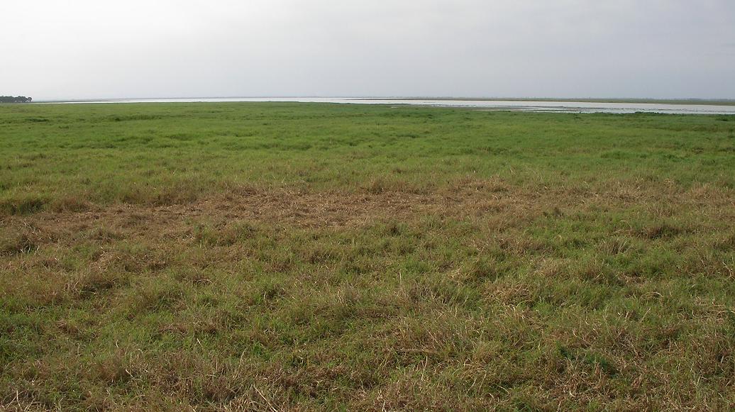
Everything in Gorongosa depends on water, and nearly all that water traces back to one source: 1,863-meter Mount Gorongosa, an isolated massif large enough to generate its own weather system. Two meters of rain fall on the mountain annually. Lush forests on its upper slopes absorb the downpour and release it gradually, feeding the Vunduzi River year-round. The Vunduzi, along with the Nhandungue from the Barue Plateau, flows into Lake Urema at the park's heart. Together, these rivers and their seasonal tributaries define the Urema Catchment -- 7,850 square kilometers of interdependent ecosystems. On calm days, the lake's surface reflects the mountain's green bulk. The indigenous people hold the mountain sacred, and the ecology confirms their reverence: without Gorongosa's peak, the valley below would be dust.
When the Lions Starved
Mozambique's independence war, launched in 1964 by the Mozambique Liberation Front, had little impact on the park until the early 1970s. A 1976 aerial survey still counted 6,000 elephants and roughly 500 lions -- possibly the largest lion population in all of Africa. Then the civil war began. South African-funded Renamo rebels clashed with the Frelimo government across Sofala Province, and Gorongosa became a battleground. The park was shut down in 1983 and abandoned. For nine years, opposing forces fought hand-to-hand among the acacias, bombed roads and buildings, and slaughtered elephants by the hundreds to sell ivory for weapons. Hungry soldiers gunned down thousands of zebras, wildebeest, and buffalo. Lions and leopards, deprived of prey, starved to death or were shot for sport. Thousands of civilians, brutalized by the fighting, sought refuge in the park and hunted what remained. When the war ended in 1992, large mammal populations had been reduced by ninety percent or more. Only the birds emerged relatively unscathed.
Africa's Lost Eden, Found Again
Recovery began tentatively in 1994, when the African Development Bank funded a rehabilitation plan. Fifty new staff were hired, most of them former soldiers. Baldeu Chande and Roberto Zolho, park employees from before the war, returned to lead the effort. 'We have established that all species that were here before the war are still here,' Chande told a reporter in 1996. 'None is extinct but many are in very small numbers.' In 2004, the US-based Carr Foundation partnered with the Mozambican government, pledging up to $40 million over 30 years under a co-management agreement finalized in 2008. The team built a 6,200-hectare wildlife sanctuary and reintroduced buffaloes and wildebeest. In 2008, a twenty-year co-management agreement was signed. The park that National Geographic titled 'Africa's Lost Eden' in a 2010 documentary was being brought back from the dead -- not through wishful thinking, but through sustained investment, community engagement, and the patient logic of ecology.
A Mosaic of Life
Today, Gorongosa's valley floor is a patchwork of acacia savanna, dry forest, seasonally flooded pans, and thickets growing on termite mounds. The surrounding plateaus hold miombo woodland, montane forest, and a spectacular rainforest at the base of limestone gorges. Lions, elephants, buffalo, hippos, leopards, crocodiles, and zebras have returned in growing numbers. Over 500 bird species have been recorded, including the green-headed oriole, found in southern Africa only on Mount Gorongosa. The park has its own endemic hissing cockroach. Trained guides lead early-morning and sunset game drives across roughly 100 kilometers of roads from Chitengo, traversing floodplains, miombo forest, and lowland savanna. The dry season, April through November, is prime visiting time. When the rains come, the roads flood and the park closes, letting the water do its ancient work.
From the Air
Located at 18.77S, 34.50E in central Mozambique, at the southern end of the East African Great Rift Valley. The park covers 4,000 square kilometers of valley floor and surrounding plateaus, dominated by the 1,863-meter Mount Gorongosa to the northwest. Chitengo HQ has a licensed airstrip suitable for charter aircraft. Beira Airport (FQBR), the main gateway, lies approximately 150 km to the southeast. The EN1 and EN6 highways provide road access via Inchope junction. Lake Urema is a prominent visual landmark from altitude, as is the distinct green massif of Mount Gorongosa rising from the surrounding lowlands.