The Graffiti Highway
For decades, a half-mile stretch of abandoned Pennsylvania highway attracted pilgrims from around the world. Old Route 61 once passed through Centralia; when the town was evacuated because of the underground mine fire, the road was abandoned and rerouted. Cracks appeared as the fire burned beneath. The pavement buckled. And people began spray-painting. Messages accumulated layer upon layer - declarations of love, political statements, crude jokes, memorial tributes, every form of human expression in fluorescent colors on crumbling asphalt. The Graffiti Highway became more famous than Centralia itself. Visitors drove hours to walk the painted road, add their own messages, and photograph the surreal landscape. In 2020, frustrated by liability concerns and trespassing, the property owner covered the highway with dirt. The Graffiti Highway, like the town it served, was buried.
The Abandonment
Route 61 was a main artery through eastern Pennsylvania's coal region, connecting towns and carrying traffic through Centralia. When the mine fire made the town uninhabitable in the 1980s, the road itself became dangerous - the ground beneath it unstable, fissures opening without warning, toxic gases seeping through cracks. In 1994, the state officially closed the section through Centralia and rerouted Route 61 around the town. The abandoned stretch remained, deteriorating, cracking, and attracting first curious visitors, then spray-paint-wielding artists, then social media-driven tourism.
The Canvas
Who painted first? No one knows. But by the 2000s, the Graffiti Highway was thickly covered. Each visit added new layers; older messages disappeared under fresh paint. Some were elaborate murals; most were simple tags. 'John loves Mary' appeared in a hundred variations. Political messages ranged from sincere to satirical. Memorial tributes to the dead accumulated. Visitors photographed their additions and posted them online, attracting more visitors, more paint, more layers. The road surface was estimated to have accumulated inches of paint in places - geological strata of human expression.
The Tourism
The Graffiti Highway put Centralia on the map in ways the mine fire never had. Thousands visited annually - driving from Philadelphia, New York, and beyond. They walked the painted road, posed for photos, added their own spray-painted contributions, and explored the ghost town nearby. Local businesses in surrounding towns benefited; Centralia's remaining residents (fewer than ten) were less enthusiastic. The highway was technically private property; visitors were technically trespassing. Liability concerns mounted. The property owners, tired of the circus, decided to end it.
The Burial
In April 2020, during the COVID-19 pandemic when traffic was lighter, heavy equipment arrived at the Graffiti Highway. Loads of dirt were trucked in and spread over the painted asphalt, burying the accumulated decades of spray paint. Warning signs went up. The property owners stated they'd had enough - the liability, the crowds, the occasional fights and accidents. Social media mourned. Visitors who'd delayed their pilgrimage discovered they'd waited too long. Some came anyway, finding only a dirt road where the colors once blazed. The highway joined Centralia's other ghosts.
Visiting What Remains
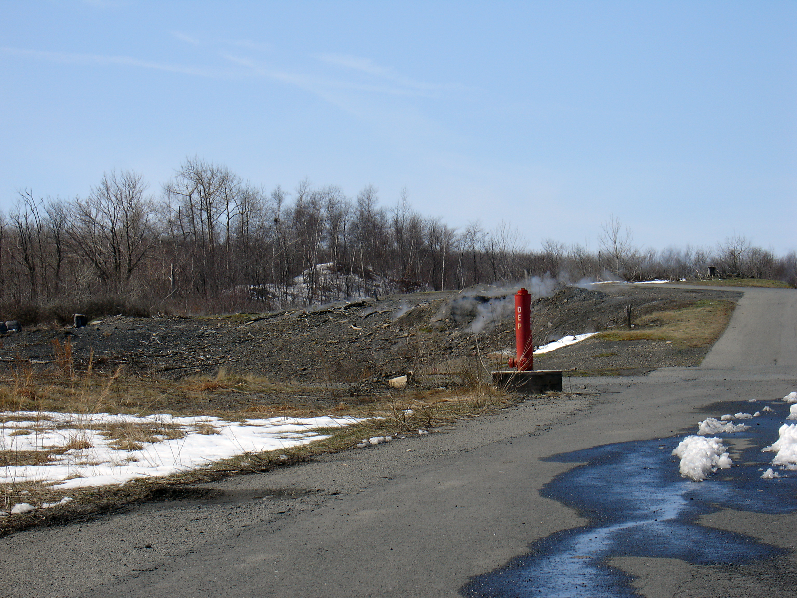
The Graffiti Highway is buried. The dirt-covered road is on private property and is posted against trespassing. Centralia itself remains accessible - the street grid exists, though most houses are gone. St. Ignatius Cemetery on the western edge is maintained and can be visited. Steam still rises from vents in the hillside beyond the cemetery - visible evidence of the fire that killed the town. The rerouted Route 61 bypasses Centralia; the turnoff onto Locust Avenue leads through the ghost town. Visitors are advised to stay on public roads and respect both the remaining residents' privacy and the property boundaries. The painted highway is gone; the burning earth remains.
From the Air
Located at 40.80°N, 76.34°W in Pennsylvania's anthracite region. From altitude, the former Graffiti Highway appears as a dirt path cutting through overgrown terrain - the colors now buried. Centralia's street grid is visible as cleared areas with almost no structures. The bypass of Route 61 curves around the abandoned town. Steam may be visible rising from the ground on cool days. Mount Carmel and Ashland lie to the south and north. The terrain is typical coal country - ridges, valleys, and the scars of mining. Wilkes-Barre/Scranton Airport is 50 miles northeast.