Grakallen Line
In 1988, the Trondheim city council voted to shut down the tramway. Workers pulled up the tracks on the eastern routes and hauled away the rail. But on the western line - the 8.8-kilometer stretch climbing from St. Olav's Gate through the hillside suburb of Byasen to the forest station at Lian - a group of enthusiasts refused to let go. Two years later, a private company reopened the route. Today, the Grakallen Line is the sole survivor of Trondheim's once-extensive tram network and, since the closure of the Arkhangelsk system in 2004, the northernmost operating tramway on Earth.
A Shipping Executive's Vision
The Grakallen Line exists because of Robert Millar, head of marketing at the Nordenfjeldske Dampskibsselskab shipping company. By the 1910s, the forested slopes near the peak of Grakallen had become Trondheim's primary recreational area, but getting there required considerable effort. Millar organized the first planning meeting on 3 November 1916, and the company A/S Graakalbanen was founded the following September with Nils Christoffer Bockman as chairman. Two routes were proposed. The first, designed by railway engineer Ferdinand Bjerke, would connect to the existing city tramway and climb Byasenveien as a street tram before entering its own right-of-way. The second was a pure suburban railway bypassing the city center entirely. Bjerke's hybrid approach won out, and when the line opened in 1924 it was Trondheim's only privately operated tramway - a distinction it held for decades.
Growing Into the Hills
The first section terminated at Munkvoll, but the line pushed deeper into the landscape almost immediately. An extension to Ugla opened in 1925, and by 1933 the trams reached Lian, their current terminus nestled at the edge of the Bymarka forest. The metre-gauge line had carved itself a niche that Trondheim's municipal tram network never matched: it was not merely urban transit but a lifeline between the city and the natural world above it. Riders could board near the cathedral and step off forty minutes later into silence and pine trees. The municipal Trondheim Trafikkselskap took over operations in 1972, absorbing the private line into the broader system. At Munkvoll, the tramway museum and depot preserve the line's independent heritage, housing vintage rolling stock alongside the Class 8 articulated trams that handle daily service today.
Death and Resurrection
The political battles of the 1980s nearly killed the Grakallen Line along with the rest of Trondheim's trams. In 1983, the city council voted to close the Elgeseter Line and consolidate service onto a single route between Lian and Lade. Eleven new trams were ordered and a depot built at Munkvoll, at a cost exceeding 100 million Norwegian kroner. Then, in 1988, the council reversed course entirely and shut the whole system down. Tracks were ripped up on the eastern sections, but the Grakallen route was spared physical destruction because enthusiasts had already begun organizing to run heritage services. What happened next surprised everyone. Rather than becoming a weekend novelty, the line was reborn as a genuine transit operation. The private company AS Grakallbanen reopened regular service in 1990, demonstrating that the route still had a practical role in the city's transportation network. The tram had outlasted the politicians who tried to bury it.
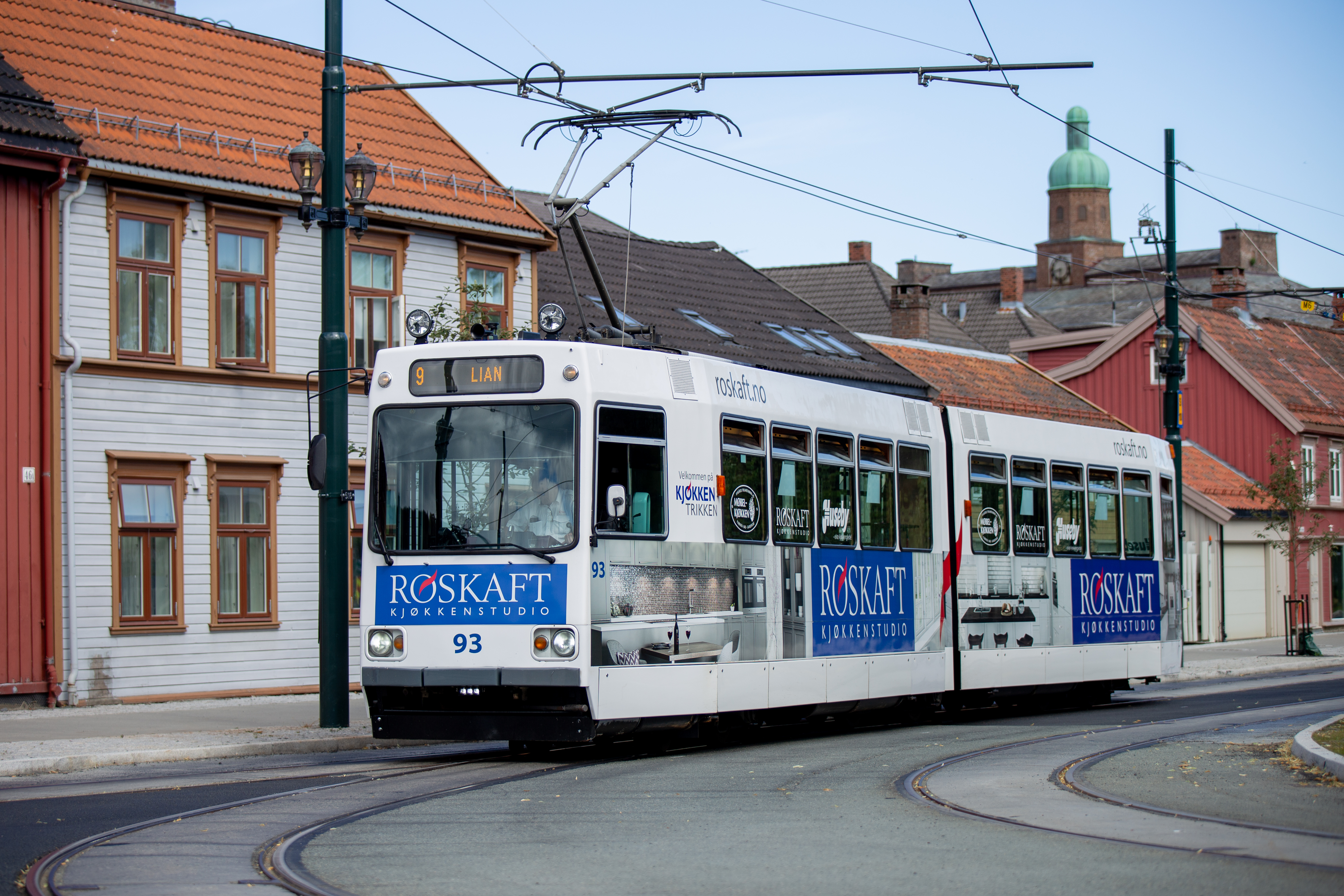
The Northernmost Ride
Six of the original eleven Class 8 trams - numbered 93 through 99, with gaps where retired units have been scrapped - still work the line today. They climb from the city center at 63 degrees north latitude, threading through residential streets before entering the steeper grades toward Lian. The Grakallen Line shares a peculiar distinction with only one other system in the world, the Cairo Tramway: both use the combination of metre-gauge track and overhead wire that makes their rolling stock interchangeable with almost nothing else. From the air, the line traces a thin thread up the western hillside of Trondheim, disappearing into the green canopy of Bymarka. At ground level, it remains what Millar envisioned over a century ago - a way for the people of Trondheim to reach the forests and the sky above their city, one stop at a time.
From the Air
Located at 63.41N, 10.38E on the western hillside of Trondheim. The tram line runs 8.8 km from St. Olav's Gate in the city center up through Byasen to Lian station at the edge of Bymarka forest. Visible from the air as a narrow cleared corridor ascending the western slopes. Nearest airport is Trondheim Airport Vaernes (ENVA), approximately 35 km northeast. Best viewed at 2,000-3,000 ft AGL to trace the line from city to forest.