Grand Bahama
The name itself is borrowed. The indigenous Lucayan people called this island Bahama - meaning 'large upper middle island' in their language - and the Spanish, who claimed it but never really wanted it, passed the word along to the entire archipelago. Grand Bahama gave its name to a nation of seven hundred islands, then spent centuries being ignored by nearly everyone. Pirates liked the treacherous coral reefs that could gut a passing ship. The Spanish liked the Lucayan people well enough to enslave them, then lost interest in the island entirely. By 1828, the place was almost unpopulated. It took rum runners, a bankrupt British holiday camp, and a Virginian financier with a tax-free dream to finally put Grand Bahama on the map.
Wreckers, Runners, and Ruin
For nearly two centuries after European contact, Grand Bahama's economy ran on misfortune. The coral reefs that ring the island were a natural trap, and pirates exploited them with grim efficiency, luring merchant ships onto the shallows to be plundered. When Charles II of England granted the Bahamas to the Lords Proprietors of the Carolinas in 1670, Grand Bahama was little more than a footnote - a flat, pine-covered strip of land with no harbor and no settlers worth taxing.
Prohibition changed everything, briefly. In the 1920s and early 1930s, West End became a waystation for smugglers running liquor to Florida, just 56 nautical miles across the strait. Money flowed in with the rum, and flowed out again when the Eighteenth Amendment was repealed. The British holiday firm Butlin's tried to build a thousand-guest resort at West End in the late 1940s, complete with a commercial airport. They ran the half-finished facility for a single season in 1950 before going broke. Grand Bahama, it seemed, had a talent for attracting ambition and watching it fail.
The Hawksbill Creek Gamble
Wallace Groves saw what others missed. In 1955, when the island's entire population hovered around five hundred, the Virginia-born financier negotiated the Hawksbill Creek Agreement with the Bahamian government - a deal that created the city of Freeport and the Grand Bahama Port Authority in a single stroke. The agreement offered something almost unheard of in the Caribbean: a tax-free zone for commerce and industry.
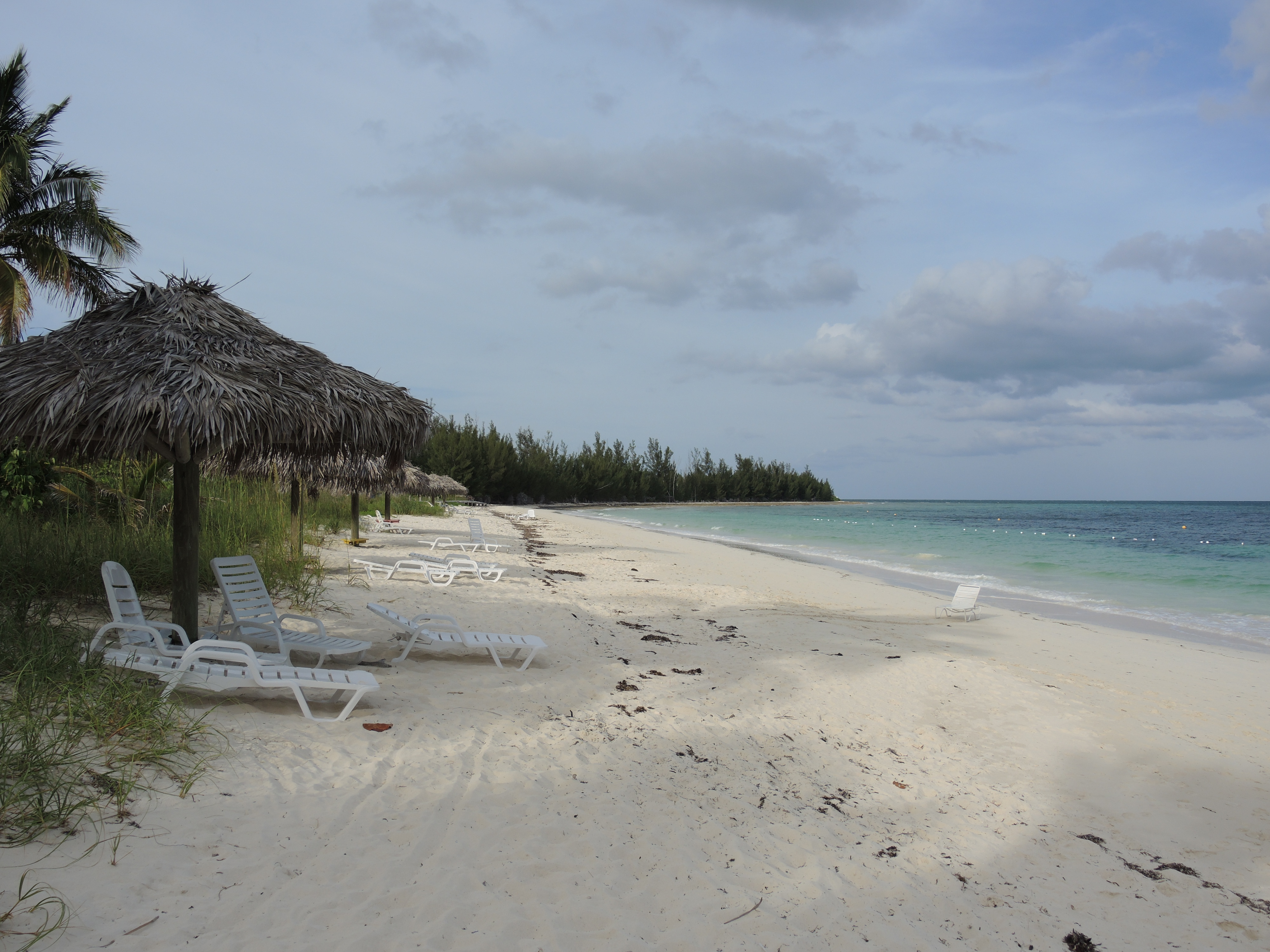
Edward St. George, backed by the wealth of Sir Jack Hayward, took the vision further. Watching Cuba draw wealthy American tourists, St. George bet that Grand Bahama could capture the same market. He built a harbor, then an airport, then the tourist center of Port Lucaya in 1962. The gamble paid off. Within decades, the island's population surged past fifty thousand, making Grand Bahama the second most populous island in the Bahamas. A place that had been virtually empty became a city almost overnight - one of the Caribbean's stranger success stories.
An Island of Neighborhoods
Freeport holds the commercial harbor and the main airport, but the island stretches 153 kilometers from end to end, and its settlements each carry their own character. West End, the official capital, still wears the faded glamor of its smuggling days. The Old Bahama Bay Resort opened in 2001 on the bones of the old Jack Tar marina, trying once more to make West End fashionable.
Eight Mile Rock sprawls along its namesake stretch of rocky shoreline and has produced two professional basketball players who reached the highest levels of American sport - Buddy Hield in the NBA and Jonquel Jones in the WNBA. McLean's Town, the easternmost settlement, sits close enough to the Abaco Islands for a thirty-minute ferry ride. Between these outposts lie Russell Town, Williams Town, Pinder's Point, and a half-dozen other hamlets where Bahamian life moves at a pace that Freeport's cruise ship visitors never quite experience.
When Dorian Came
On September 1, 2019, Hurricane Dorian struck Grand Bahama as a Category 5 storm and simply stopped moving. For more than a day, the hurricane stalled over the island, its sustained winds exceeding 185 miles per hour, its storm surge swallowing entire neighborhoods. Nearly half the homes on the island were damaged or destroyed. The airport became a debris field. Freeport, the city that Wallace Groves had conjured from pine forest, was torn apart.
Recovery has been slow and uneven. The tourism economy that St. George built depends on infrastructure - airports, harbors, hotels - and Dorian damaged all of it. But Grand Bahama has rebuilt before, from pirate raids and bankrupt resorts and the end of Prohibition. The island's history is a cycle of ambition, destruction, and stubborn reinvention.
Life Between the Reefs
Beyond the hotels and harbors, Grand Bahama harbors a quieter world. The Bahama swallow, an endangered bird with iridescent green plumage and blue wings, breeds in the island's pine woodlands - the same forests that once seemed worthless to colonial governors. Bahama woodstars, tiny non-migratory hummingbirds, dart through the undergrowth. Tiger sharks patrol the shallow reefs and harbor channels, their striped bodies gliding through water so clear that snorkelers sometimes see them before the sharks see anything worth eating.
The commercial farms in Grand Bahama's interior grow vegetables and citrus for export, while the island's fisheries harvest crayfish and conch - the same species that have sustained Bahamian communities for centuries. Pharmaceutical plants and a perfume factory operate in Freeport's industrial zone, alongside oil transshipment terminals that handle fuel for passing cargo ships. It is a peculiar economy, mixing tropical agriculture with global logistics, cruise ship tourism with industrial chemistry - all of it balanced on a flat coral island barely above sea level.
From the Air
Located at 26.65N, 78.32W, Grand Bahama stretches 153 km east-west, roughly 24 km at its widest. Grand Bahama International Airport (MYGF) in Freeport is the primary facility; West End Airport (MYGE) serves occasional private aircraft. The island sits just 56 nautical miles east of Palm Beach, Florida - visible on the horizon on clear days. From cruising altitude, the island appears as a long, narrow strip with the distinctly developed Freeport-Lucaya area along the southern shore. The coral reefs surrounding the island are clearly visible in shallow turquoise water. Tropical monsoon climate with hurricane season June through November.