Grand Portage National Monument
In mid-July 1802, the partners of the North West Company gathered inside their Grand Hall on the shore of Lake Superior. They voted to tear down every building -- all 18 structures, the 2,000 cedar pickets surrounding them, the squared spruce and pine and birch timbers -- load it all onto schooners, and sail north to Canada. The most successful fur trade company in North America was abandoning what had been its inland headquarters. Grand Portage National Monument preserves the site of that headquarters and the ancient trail that made it matter: a footpath the Ojibwe called Gichi-onigaming, the Great Carrying Place, which for at least 2,000 years served as the critical link between Lake Superior and the vast interior of the continent.
The Great Carrying Place
The monument takes its name from a footpath that exists because the Pigeon River, in its final stretch before reaching Lake Superior, drops through waterfalls and rapids that no loaded canoe could navigate. The portage bypasses those cascades -- a trail connecting Grand Portage Bay on Lake Superior to Fort Charlotte on the Pigeon River upstream. Native American nations used the path as early as 2,000 years ago, traveling from summer homes on the lakeshore to winter hunting grounds in the Minnesota and Ontario interior. The trail crosses the Sawtooth Mountain range through two notches, climbing from the lake's elevation before dropping back down to the river. What made this particular portage so important was what lay beyond it: a network of rivers, lakes, and short portages that reached all the way to Lake Winnipeg and the fur-rich territories of Rupert's Land. Grand Portage sat precisely at the continental divide between the Great Lakes/St. Lawrence watershed draining to the Atlantic and the Nelson River/Hudson Bay watershed draining to the Arctic.
A Map Drawn by Firelight
In 1729, a Cree guide named Auchagah drew a map for Pierre Gaultier de La Verendrye, one of the first French fur traders to push west from the Great Lakes. The map showed the water route from Lake Superior through Grand Portage to the western sea of Lake Winnipeg. That single piece of cartography transformed Grand Portage from a Native American travel route into a linchpin of global commerce. French traders established the route first, building relationships with Ojibwe communities. After the Seven Years' War handed control to Britain, the North West Company organized its operations at Grand Portage in the mid-1780s. Soon it ranked alongside Fort Niagara, Detroit, and Michilimackinac as one of the British Empire's four principal fur trading posts in North America. Each summer, voyageur brigades converged from Montreal and from the interior. The exchange of furs for trade goods took place in the shadow of the Great Hall, built in French colonial style, where the company's annual meetings determined the fortunes of an enterprise spanning half a continent.
Canoe Brigades and Beaver Pelts
The logistics were staggering. Voyageurs from Rupert's Land paddled their canoes laden with bundles of beaver, marten, and muskrat pelts to Fort Charlotte on the Pigeon River. From there, they carried the bales over the portage trail to Grand Portage Bay. Meanwhile, brigades from Montreal arrived in 36-foot canots du maitre loaded with trade goods and supplies. The two groups met, exchanged cargo, and each brigade returned the way it had come. Fort Charlotte served as the inland trading post, while the Grand Hall at Grand Portage Bay housed the company's meetings, a general store, and administrative offices. Around the main compound, the North West Company maintained 18 buildings enclosed by more than 2,000 cedar pickets. The complex included warehouses, living quarters, and the infrastructure needed to process and repack the continent's most valuable commodity. For a few weeks each summer, this remote bay was arguably the commercial capital of the northern half of North America.
From Abandonment to Monument
After the Jay Treaty of 1795 and the gradual assertion of American sovereignty, the North West Company chose economics over loyalty. Rather than pay American taxes, the partners voted in 1802 to relocate north to the mouth of the Kaministiquia River, where they built Fort William on Canadian soil. The site at Grand Portage fell quiet. In 1854, the Ojibwe signed a treaty establishing the Grand Portage Indian Reservation, and the old fur trade grounds became part of their homeland. A school and post office appeared in the 1850s. The reservation was briefly abolished in 1887, then reestablished. In 1951, the site was designated a National Historic Site and opened to visitors. Seven years later, in 1958, it became a National Monument. The monument was added to the National Register of Historic Places in 1966. Today it lies entirely within the boundaries of the Grand Portage Indian Reservation -- a partnership between the National Park Service and the Grand Portage Band of Lake Superior Chippewa.
Living History on the Lakeshore
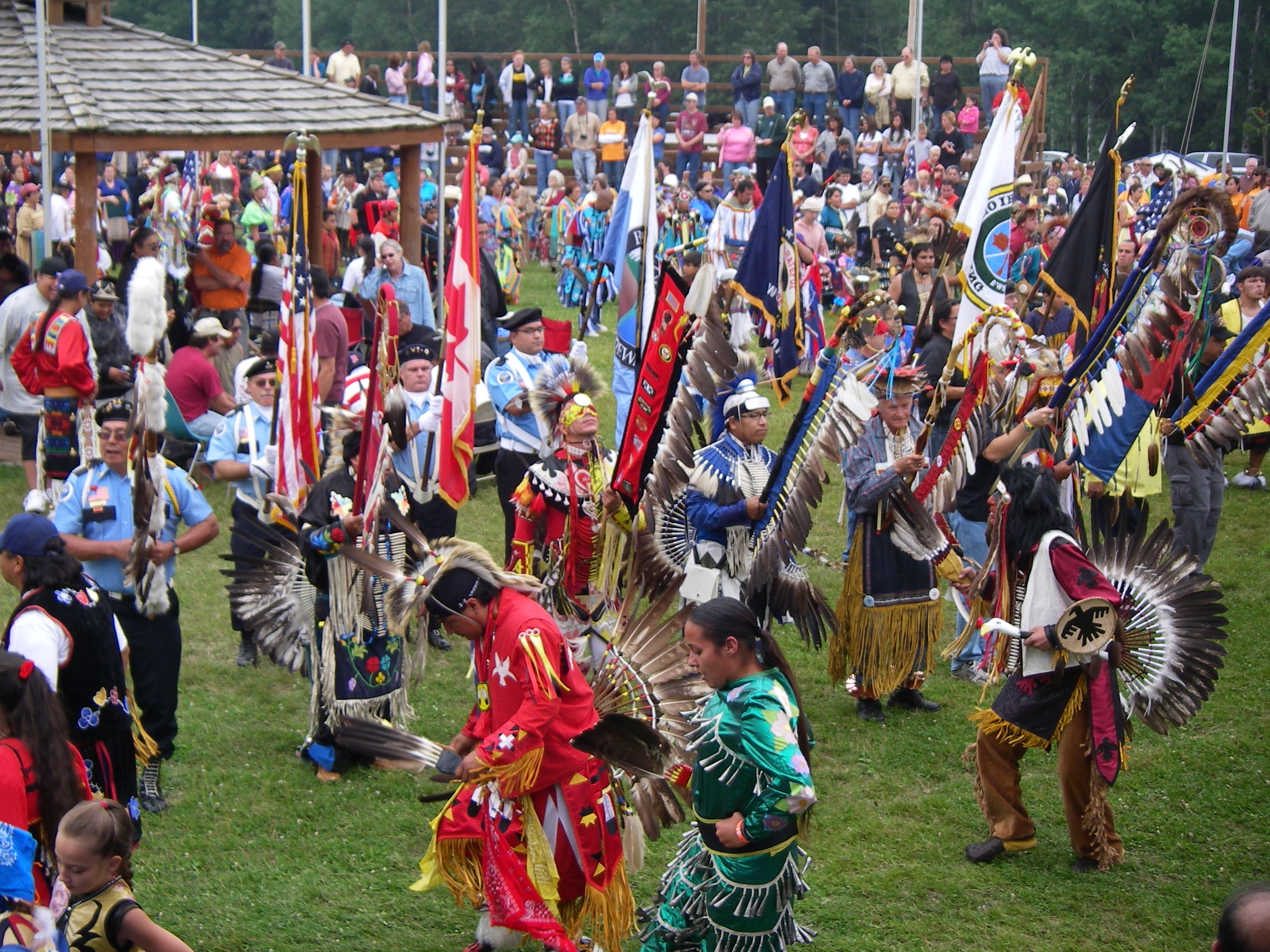
The reconstructed depot brings the fur trade era back to life. Volunteers and park staff in period attire occupy the Kitchen, Great Hall, Canoe Warehouse, Ojibwe Village, and Voyageur Encampment, interpreting daily life at the turn of the 18th century. The four corner rooms of the Great Hall each represent a different chapter of the fur trade story: a shareholder's bedroom, a trading post stocked with furs and goods, a London streetscape showing the finished products made from Grand Portage pelts, and a hatter's shop demonstrating how beaver fur became fine felt hats. Every August, the monument hosts a rendezvous reenactment, while the Grand Portage Indian Reservation holds its annual pow wow. The two events coincide with the Perseid meteor shower -- fur trade history, Ojibwe culture, and streaking meteors over the same lake that voyageur canoes once crossed. The Heritage Center, opened in 2007, houses exhibit galleries, archives, and educational programs, built through collaboration between the Park Service and the Grand Portage Band.
From the Air
Located at 48.00°N, 89.73°W on the north shore of Lake Superior in northeastern Minnesota. The reconstructed stockade and depot buildings are visible on Grand Portage Bay, a sheltered inlet along the shoreline. The portage trail extends inland to the west-northwest through the Sawtooth Mountain range toward the Pigeon River and Fort Charlotte. The Pigeon River, which forms the international border with Canada, is visible flowing east into Lake Superior. Look for the Heritage Center near the waterfront compound. Grand Marais/Cook County Airport (CKGM) is approximately 35 miles southwest. Thunder Bay International Airport (CYQT) is about 40 miles north across the border. Best viewed at 2,000-3,000 feet AGL to see the stockade, the bay, and the portage trail cutting through the forest. On clear days, Isle Royale is visible across Lake Superior to the southeast.