Graveyard of the Pacific
On the morning of October 25, 1906, the four-masted steel barque Peter Iredale was waiting for a pilot to guide her into the Columbia River when a southeast gale and a fierce current seized the ship. Before her crew could come about, she was in the breakers. The Iredale hit Clatsop Beach so hard that three of her masts snapped from the impact. Her rusting skeleton is still there, half-buried in the sand near Fort Stevens, Oregon -- one of the most photographed shipwrecks in the world and one of more than 2,000 vessels lost along a stretch of coastline that mariners have called the Graveyard of the Pacific since the earliest days of the fur trade.
A Geography Built for Disaster
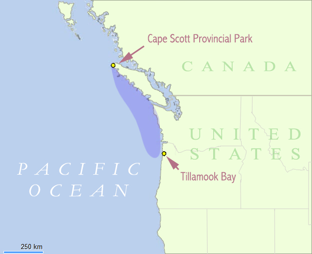
The Graveyard stretches from Tillamook Bay on the Oregon Coast northward past the Columbia Bar and the Strait of Juan de Fuca, then up the rocky western shore of Vancouver Island to Cape Scott -- hundreds of miles of coast where nearly everything conspires against ships. The Columbia Bar is the anchor of this reputation: a massive sandbar at the mouth of the Columbia River where the outflow of the largest river on the Pacific coast collides with incoming ocean swells and unpredictable currents. The bar shifts constantly, and what was navigable water one season can be a breaking shoal the next. North of the Columbia, Cape Flattery guards the entrance to the Strait of Juan de Fuca, where tidal rips can spin a vessel sideways. The west coast of Vancouver Island offers no shelter -- just rocky reefs, submerged pinnacles, and fog that can descend without warning and hold for days.
The Night the Valencia Broke Apart
No wreck haunts the Graveyard more than the SS Valencia. On January 22, 1906, the steamer was running from San Francisco to Seattle when strong winds and currents pushed her past the entrance to the Strait of Juan de Fuca in heavy fog. She struck a reef near Pachena Point on Vancouver Island's southwest coast. Trapped between sheer cliffs and pounding breakers, with uncharted rocks making rescue from seaward impossible, the Valencia broke apart over two terrible days. Of the 173 people aboard -- including 17 women and 11 children -- 136 died. The disaster so shocked the Canadian government that it triggered a wholesale reformulation of maritime safety policy on the Pacific coast. New lighthouses went up, including the Pachena Point light. Communications and mapping were upgraded. And along the rocky shore where survivors had stumbled through trackless forest, the government carved a footpath that would become known as the Life Saving Trail. Declared a public highway in 1911, it survives today as the West Coast Trail, one of the world's great long-distance hikes, within Pacific Rim National Park Reserve.
Empires, Fur, and Open Warfare
The name Graveyard of the Pacific is believed to date from the earliest years of the maritime fur trade, when European and Russian ships began probing these waters in the late 18th century. The dangers were not only natural. Russia, Spain, and Great Britain all pressed competing claims to the coast, and their rivalries sometimes spilled into open confrontation. Indigenous nations controlled the shoreline and were formidable trading partners and, when provoked, adversaries. Ships that survived the bar, the reefs, and the fog still had to navigate the politics of a contested frontier. By the time the California Gold Rush sent a flood of sailing ships and steamers hauling lumber south in the 1850s, the coast's reputation was firmly established. Each decade added to the toll -- schooners driven onto rocks, steamers burned to the waterline, barques that simply vanished in winter storms and were never heard from again.
What the Sea Leaves Behind
Salvage in the Graveyard is rarely successful. The same storms and currents that destroy ships make recovery nearly impossible, and the coast's violent surf grinds wooden hulls into driftwood within a season or two. Most wrecks survive only as names in maritime registries or as faint anomalies on sonar surveys. The Peter Iredale endures because she was made of steel and because Clatsop Beach is gentle enough to preserve her bones. Visitors walk across the sand at low tide to stand inside her ribs, the iron stained orange by more than a century of salt air. Near the Columbia Bar alone, more than 700 lives have been lost. One catalog lists 484 wrecks on the south and west sides of Vancouver Island. Although major wrecks have declined since the 1920s -- thanks to modern navigation, radar, and the bar pilots who guide ships across the Columbia -- the Graveyard still claims lives every year. The sea does not care about technology. It keeps its own schedule.
Flying Over the Edge
From the air, the Graveyard reveals what sailors never see: the full shape of the trap. The Columbia Bar appears as a pale crescent of turbulent water where brown river meets blue ocean, the breaking waves visible even from cruising altitude on rough days. North along the Washington coast, the shoreline is a saw blade of headlands and coves. Cape Flattery marks the corner where the Pacific swings east into the Strait of Juan de Fuca, and on a clear day you can trace the dark western wall of Vancouver Island stretching north to nothing. The beaches where ships came to grief look serene from above -- smooth arcs of sand backed by dense forest. Only the Peter Iredale's skeleton, a faint rust-colored pattern on Clatsop Spit, hints at what lies beneath. The beauty is genuine, and so is the danger. The two have always been the same thing here.
From the Air
The Graveyard of the Pacific stretches from approximately 45.5N to 50.8N along the Pacific coast, centered roughly at 48.75N, 128.90W. The Columbia Bar (46.25N, 124.05W) is visible as turbulent water at the mouth of the Columbia River -- look for the color change where brown river water meets the Pacific. Cape Flattery (48.38N, 124.72W) marks the northwest tip of the contiguous U.S. The Peter Iredale wreck is at Clatsop Spit near Fort Stevens, Oregon (46.18N, 123.99W). Best viewed at 3,000-5,000 feet AGL for coastline detail. Nearest airports: Astoria Regional (KAST) near the Columbia Bar, Port Angeles William R. Fairchild International (KCLM) near Cape Flattery, Tofino/Long Beach (CYAZ) on Vancouver Island's west coast. Weather is frequently overcast with fog; clear days offer dramatic coastal visibility.