Grays Harbor
Captain Robert Gray sailed into this bay in 1792, and the estuary that bears his name still opens to the Pacific the same way it did then -- through a two-mile gap between two low peninsulas, Point Brown to the north and Point Chehalis to the south. But Grays Harbor is older than any European name. It is a ria, formed when rising seas at the end of the last ice age flooded the lower Chehalis River valley, creating a bay 17 miles long and 12 miles wide. The Chehalis pours in from the east, joined by the Hoquiam and Humptulips rivers, and the whole system pulses with tides that reshape its islands and sandbars twice a day.
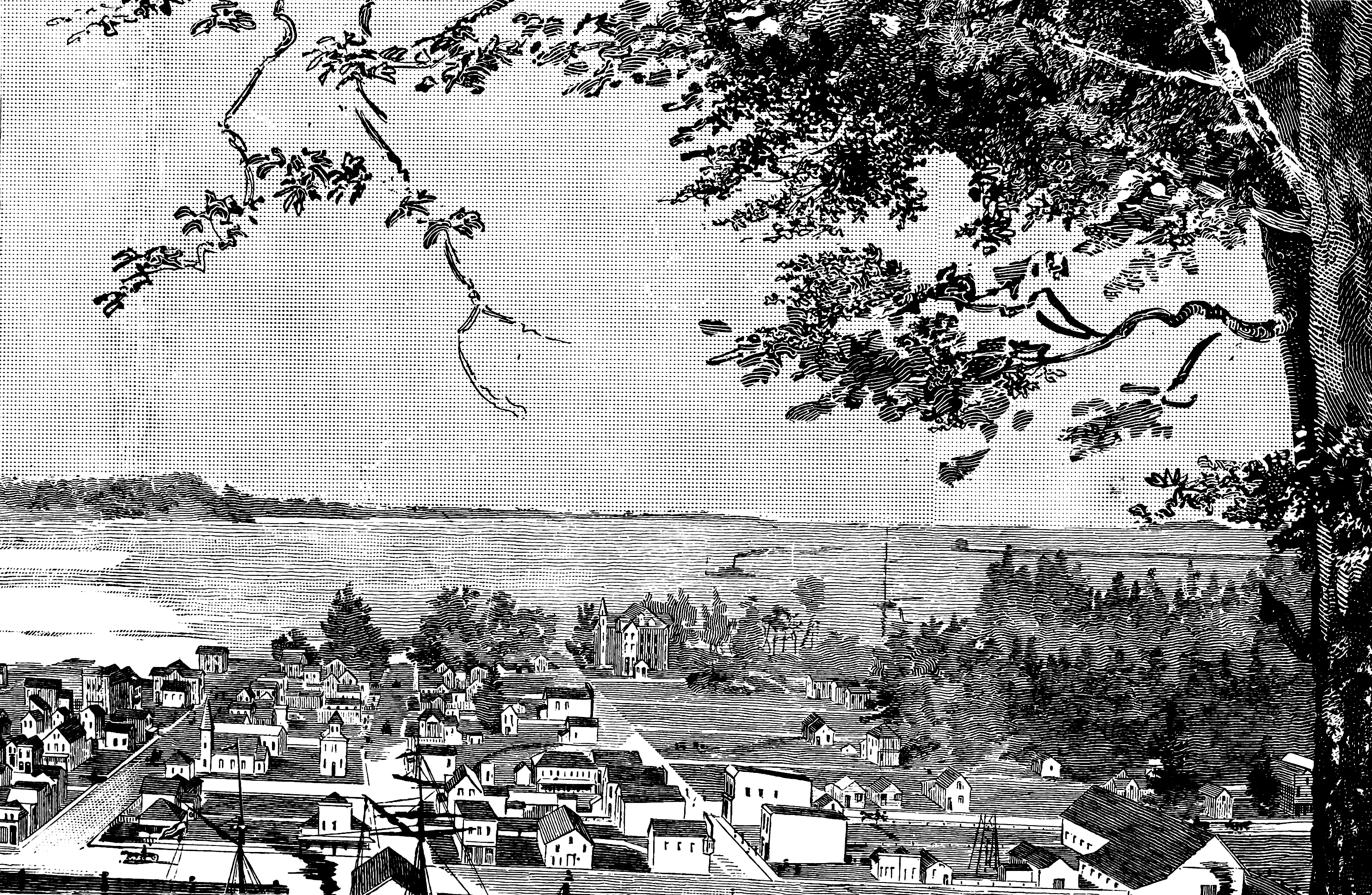
Timber, Strikes, and the Smell of Sawdust
Settlement came to Grays Harbor in the 1870s, and it came for wood. As the forests of the eastern United States dwindled, loggers from the East Coast and the Midwest migrated west, joined by waves of Scandinavians and Finns who knew timber country in their bones. By the early 20th century, Grays Harbor had become the largest lumber-shipping port in the world, its waterfront stacked with raw logs and milled boards bound for markets across the Pacific and down the coast. That concentration of labor and capital made the harbor a flashpoint for the era's fiercest labor battles. The Industrial Workers of the World organized strikes in 1912, 1917, and 1923, and the conflict could turn violent -- in 1906, an armed union ship opened fire on the Fearless, a vessel crewed by strikebreakers. Aberdeen and Hoquiam, the twin cities at the harbor's eastern end, were rough places where the line between work and war sometimes blurred.
The Schooner and the Spy Trial
On June 29, 1915, US customs officials seized the schooner Annie Larsen at Grays Harbor, setting off a chain of events that would lead to the most expensive trial in American legal history at the time. The Annie Larsen was loaded with arms destined for Indian revolutionaries plotting to overthrow British rule during World War I -- part of what became known as the Hindu-German Conspiracy. The seizure at this remote Washington harbor pulled Grays Harbor into a web of international espionage and geopolitics that stretched from Berlin to Bengal. The subsequent San Francisco trial exposed a covert German campaign to foment revolution in British India, and the little schooner from Grays Harbor became Exhibit A in one of the war's strangest intelligence operations.
Islands That Come and Go
The geography of Grays Harbor resists permanence. Sand Island, near the center of the north bay, is seasonally submerged -- a sandbar that appears and disappears with the tides and storms. Goose Island sits just adjacent. Rennie Island, the largest at 225 acres near Aberdeen, provides more stable ground, while Grass Island hugs the shore near Westport. What USGS maps call Protection Island, the city of Ocean Shores knows as Damon Point -- a 61-acre park formed by accretion at the tip of Point Brown. Whitcomb Flats, a named bar near Westport, and an unnamed island off Markham at the mouth of Johns River complete the archipelago. Sand Island, Goose Island, and Whitcomb Flats are protected under the Washington Natural Areas Program, while the Johns River Wildlife Area manages the Markham island. These are landscapes in motion, shaped by the same forces that carved the bay itself.
Guns on the Harbor, Wings Overhead
World War II turned Grays Harbor into a fortress. Western Defense Command emplaced searchlights, 12-inch coast defense mortars, and 155mm howitzers around the bay, guarding the Pacific approaches against a Japanese invasion that felt entirely plausible in the nervous months after Pearl Harbor. The gun emplacements are gone now, but the harbor's strategic geography -- that narrow two-mile entrance flanked by low peninsulas -- remains obvious from the air. Today, Grays Harbor's most consequential defense is ecological. The 1,500 acres of intertidal mudflats, salt marsh, and uplands that make up the Grays Harbor National Wildlife Refuge host up to one million shorebirds during spring and fall migration, making it one of four critical staging areas on the Pacific Flyway. Where artillery once pointed seaward, western sandpipers and dunlin now descend in clouds so thick they darken the sky.
From the Air
Located at 46.941N, 124.046W on Washington's southwest Pacific coast, approximately 45 miles north of the Columbia River mouth. The bay is 17 miles long and 12 miles wide, making it unmistakable from altitude. The twin cities of Aberdeen and Hoquiam are visible at the eastern end where the Chehalis River enters. Ocean Shores occupies the northern peninsula (Point Brown) and Westport sits on the southern peninsula (Point Chehalis). Bowerman Airport (KHQM) sits on the north shore near Hoquiam. At 3,000-5,000 feet AGL, the full shape of the ria is visible, along with the two-mile gap to the Pacific. The islands and sandbars -- particularly Sand Island in the center of the north bay -- are best seen at low tide.