Great Nicobar Island
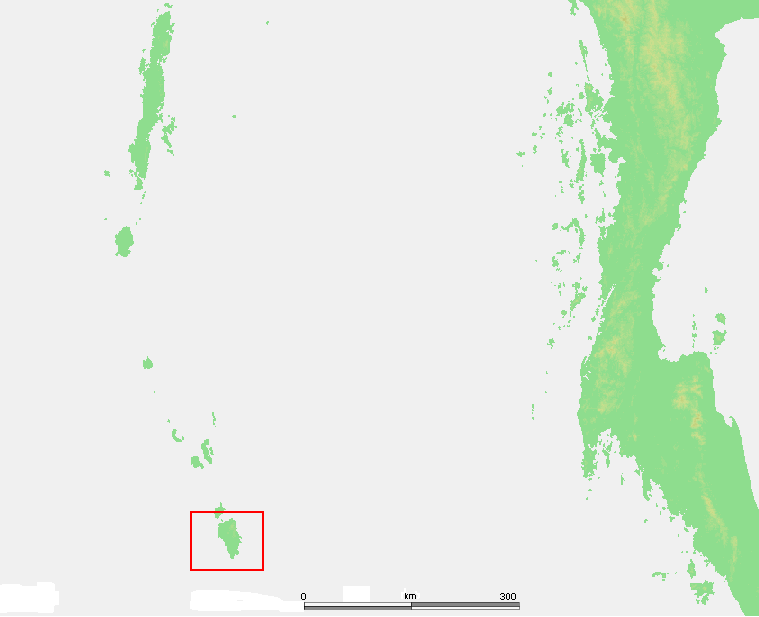
Only 163 kilometers of open sea separate Great Nicobar from Sumatra, yet the island belongs to India -- a geographic oddity that places Indian sovereign territory closer to Indonesia than to any Indian city. To reach it from Port Blair, the capital of the Andaman and Nicobar Islands, takes more than a day by sea across 540 kilometers of water. That remoteness has shaped everything about the place: its dense rainforest canopy, its singular wildlife, and the precarious survival of the Shompen people who still live as hunter-gatherers in its interior.
Names Written in Rivers
Great Nicobar's rivers read like a guest register of colonial ambition. The Alexandra River honors a Danish queen who became the wife of Britain's King Edward VII. The Galathea River takes its name from a Danish survey vessel that prospected for minerals here between 1845 and 1847. The Amrit Kaur River commemorates an Indian princess from Kapurthala who became independent India's first health minister. Denmark claimed the island in 1755, calling it New Denmark and renaming the entire archipelago Frederikøerne. Administered from Tranquebar, the headquarters of the Danish East India Company, the colony was repeatedly abandoned when malaria devastated the settlers. In 1868, Denmark sold its Indian holdings to the British, and the island passed quietly into the expanding orbit of the Raj.
A Biosphere on the Brink
The majority of Great Nicobar's 921 square kilometers falls within the Great Nicobar Biosphere Reserve, a designation that reflects what lives here. Nicobar scrubfowl build their incubation mounds in the forest floor. Saltwater crocodiles patrol the mangrove estuaries, while giant leatherback sea turtles haul themselves onto Galathea Bay's beaches to nest -- one of the species' critical breeding grounds in the Indian Ocean. Coconut crabs, among the largest terrestrial arthropods on Earth, climb the palms. Nicobar long-tailed macaques, found nowhere else, forage through the canopy. From mangroves at the coast to evergreen forest in the interior, the island compresses a remarkable range of tropical ecosystems into a space smaller than many national parks. Mount Thullier, the highest point in the Nicobars at 642 meters, anchors the central ridge, and nearly every river on the island flows south or southwest, tracing the general slope of the terrain toward the sea.
The Day the Ground Sank
On December 26, 2004, the Indian Ocean earthquake sent a tsunami crashing over Great Nicobar with devastating force. The island was cut off from all outside contact for over a day. At Indira Point, the southernmost tip of India itself, the ground subsided 4.25 meters. A lighthouse that had stood with its base five meters above sea level since 1972 found itself nearly awash -- less than a meter of clearance remained. The coast retreated as the sea moved permanently inland. Indira Point, once called Pygmalion Point and renamed in 1985 to honor Indira Gandhi, was largely submerged. The lighthouse has since been repaired and the ocean floor has slowly rebounded, but the event left a permanent mark on the island's geography. That red-and-white-banded cast iron tower, 35 meters tall with a beam visible for 16 nautical miles, still serves as a critical landmark on the Colombo-to-Singapore shipping lane via the Malacca Strait.
The Shompen and the Megaproject
Perhaps 400 Shompen people live in the hilly interior, though no census has been conducted. They are hunter-gatherers whose small villages -- clusters of a few huts, documented by researchers in the 1970s along the Dogmar River and near the western coast -- represent one of the world's most isolated communities. In 2021, the Indian government's NITI Aayog think tank proposed the Great Nicobar Development Plan: a mega transshipment port at Galathea Bay, a new airport, and military infrastructure that would transform the island's southern tip. The plan envisions 650,000 people living on an island whose current population is roughly 8,500. In February 2024, thirty-nine genocide scholars from thirteen countries warned that this population surge would constitute a death sentence for the Shompen, who have little to no immunity to common infectious diseases. Survival International has called the project a threat to the tribe's existence. Environmental groups argue it would also destroy the leatherback turtle nesting beaches at Galathea Bay. The tension between India's strategic ambitions and the survival of its most vulnerable citizens plays out here, at the country's farthest edge.
Sentinel at the Strait
Great Nicobar's strategic value explains the pressure. INS Baaz, India's southernmost naval air station, already operates near Campbell Bay on the eastern coast. The island sits at the northwestern entrance to the Strait of Malacca, one of the busiest shipping lanes on the planet. India and Indonesia have discussed collaborating on port facilities at nearby Sabang to secure the channel between Great Nicobar and Indonesia's Rondo Island. For now, the island remains largely what it has been for centuries -- rainforest, rivers, and reef -- but the forces converging on it suggest that condition will not hold indefinitely.
From the Air
Located at approximately 7.0°N, 93.83°E in the eastern Indian Ocean. The island is visible as a large, heavily forested landmass 180 km north of Sumatra. Indira Point at the southern tip (6°45'N, 93°49'E) marks India's southernmost territory. INS Baaz naval air station near Campbell Bay has a 915 m airstrip (no public ICAO code widely published). Nearest major airport is Port Blair/Veer Savarkar International (VOPB), over 500 km to the north. Approach from the east for views of the mountainous spine and coastal mangroves. Best viewed at 3,000-5,000 ft for island overview.