Great Rift Valley, Kenya
Three tectonic plates are tearing East Africa apart. The Arabian, Nubian, and Somali plates meet beneath Kenya, and their slow divergence has created a system of topographic depressions that runs the length of the country from north to south. This is the Great Rift Valley of Kenya, the eastern branch of the East African Rift known as the Gregory Rift. It is not one valley but many: a chain of escarpments, volcanic peaks, soda lakes, freshwater lakes, geysers, and fossil beds stretching from the Tanzanian border to Ethiopia. The fossils preserved in its lava flows span 14 to 4 million years, recording the evolution of the hominids who became us. The valley that is splitting a continent apart is also the place where our species came together.
A Chain of Fire
Volcanoes stud the rift floor like a line of exclamation marks. In the north, the shield volcano Emuruangogolak straddles the valley south of the Suguta Mud Flats. Mount Silali and Paka rise further south, with Paka still displaying widespread geothermal activity. Menengai, a massive shield volcano overlooking Lake Nakuru, collapsed into a caldera roughly 8,000 years ago. Mount Longonot, a dormant stratovolcano southeast of Lake Naivasha, erupted in the early 1900s, and ash can still be found around Hell's Gate National Park to its south. Mount Suswa, between Narok and Nairobi, has lava flows so recent they remain bare of vegetation, perhaps no more than a century old. The volcanic soils, classified as Andisols, are among the most fertile in Kenya, which is why people farm the slopes of mountains that could, in geological terms, wake up at any time.
The Ladder of Lakes
Eight major lakes mark the Kenyan rift from north to south: Turkana, Logipi, Baringo, Bogoria, Nakuru, Elmenteita, Naivasha, and Magadi. Only Baringo and Naivasha hold fresh water. The rest are alkaline, their shallow, poorly drained basins concentrating minerals into caustic brines that support blue-green algae, which in turn feed insect larvae, crustaceans, and the lesser flamingos that gather in numbers reaching into the millions. Lake Turkana at the northern end stretches 250 kilometers long, reaching a maximum depth of 109 meters. Lake Magadi at the southern end produces roughly 350,000 metric tonnes of soda ash per year, mined for sodium carbonate for nearly a century. Rubies and pink sapphires have been found around Lake Baringo. The Kenya lake system comprising Bogoria, Nakuru, and Elmenteita is a UNESCO World Heritage Site, home to thirteen globally threatened bird species and the most important feeding area for lesser flamingos in the world.
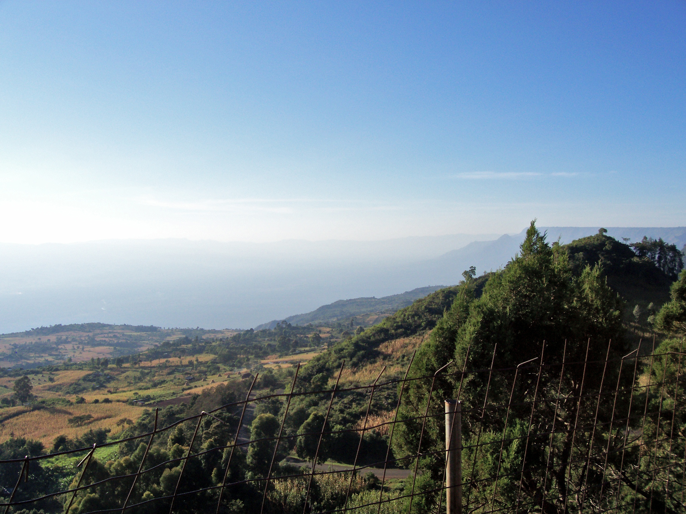
Walls of Stone
The valley is bounded by escarpments that rise like fortress walls on either side. To the west, the Elgeyo Escarpment climbs more than 1,000 meters above the Kerio Valley, which lies at its foot at roughly 1,000 meters elevation between the Tugen Hills and the escarpment face. Further south, the Mau Escarpment runs approximately 1,000 meters high along the western edge near Lake Naivasha. The Nguruman Escarpment extends about 50 kilometers along the southwestern margin near the Tanzanian border. On the eastern rim, the Aberdare Range rises north of Nairobi, with Mount Satima at its northern end and Mount Kinangop to the south. The Ngong Hills form a ridge along the eastern edge southwest of Nairobi, their profiles familiar to anyone who has read Karen Blixen's account of her farm at the foot of those hills. The Laikipia Escarpment bounds the rift to the northeast. Together these walls frame one of the most visually dramatic landscapes on Earth.
Where Humans Were Made
The Tugen Hills west of Lake Baringo contain fossils preserved in lava flows spanning 14 to 4 million years, a record that includes hominid ancestors. The rift valley is not just where early humans evolved; it is where that evolution can be read in the rock. Today the valley is home to a mosaic of ethnic groups, including the Maasai, Kalenjin, Elgeyo, Luhya, and Ogiek, along with the pastoralist Il Chamus, Rendille, and Turkana in the drier north. The colonial era brought the Happy Valley set, the group of aristocratic British settlers whose excesses in the Kenya highlands became a scandal. Beryl Markham flew from these landscapes. Kuki Gallmann wrote about them. The rift has appeared in films from Mogambo to Out of Africa. Kenya now taps the valley's geothermal energy, and tourism brings hundreds of thousands of visitors to the lakes and escarpments each year. The three plates beneath continue their slow work of separation, widening the rift by a few millimeters annually, indifferent to everything happening on the surface above.
From the Air
Located at approximately 0.44°N, 36.24°E, but the rift extends the full length of Kenya north to south. From cruising altitude, the chain of lakes is clearly visible: Turkana (250 km long) in the north, the cluster of Baringo-Bogoria-Nakuru-Naivasha in the center, and Magadi near the Tanzanian border. Volcanic peaks including Longonot and Suswa are prominent landmarks. The escarpments on both sides create dramatic terrain. Major airports along the rift include Eldoret International (HKEL), Nakuru (HKNK), and Nairobi's Jomo Kenyatta International (HKJK) on the eastern rim. Best viewed from 15,000-25,000 ft for the full geological panorama.