Greenbank Farm
Stand at Greenbank Farm on a clear day and you can see Puget Sound on both sides of Whidbey Island. The farm sits on one of the island's narrowest stretches, a geographic waist where the landmass pinches so thin that the water seems close enough to reach in either direction. For islanders, this is the dividing line: everything north is North Whidbey, everything south is South Whidbey, and the farm in between belongs to everyone. It has been a dairy, a loganberry empire, a failing winery venture, and finally a community-owned gathering place. Each reinvention left its mark on the land.
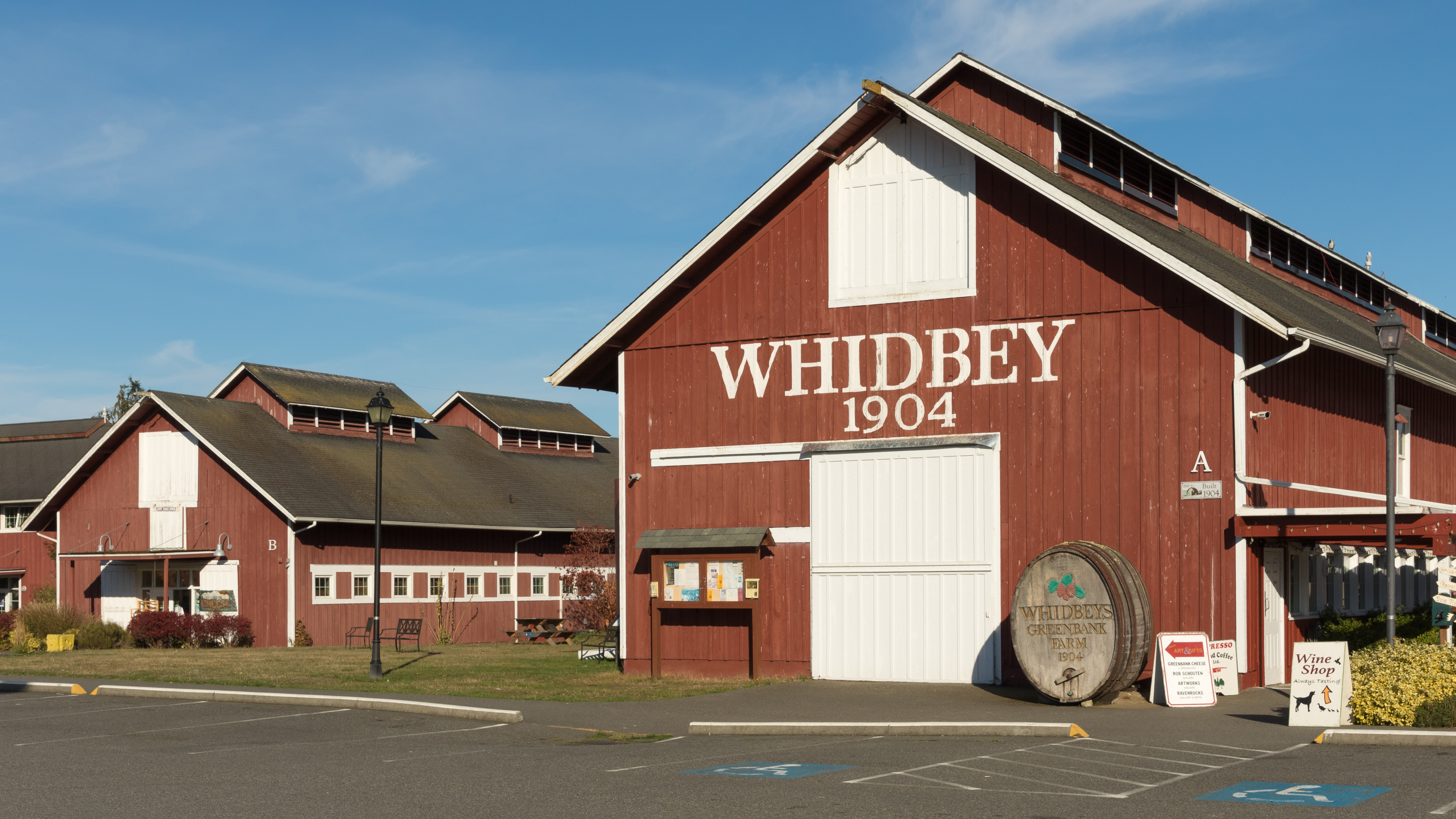
Cattle, Then Catastrophe
Calvin Philips founded Greenbank Farm in 1904 as a model dairy operation, building the iconic barn that still anchors the property. His goal was to bring commerce to Whidbey Island, and for a time the farm delivered. By 1906, 125 acres along what is now Highway 525 had been cleared for an expanding cattle herd. The Philips family ran the operation for three decades, but the early 1930s brought disaster: tuberculosis swept through the herd, and every animal had to be destroyed. The farm struggled on without its economic engine until the 1940s, when the Philips family sold the entire 522-acre property, its barns, outbuildings, and cleared fields included.
The Loganberry Kingdom
The new owner, John Molz, saw a different future in the soil. He planted loganberries, a hybrid cross between blackberries and raspberries, and within years Greenbank Farm had become the largest loganberry producer in the United States, with 125 acres of berry bushes rolling across the fields. Molz pressed the berries into wine, selling it under the label of Pommerelle, a winery he co-founded in Seattle. For decades the farm hummed with agricultural productivity that seemed perfectly suited to the island's mild maritime climate and rich soil. Molz ran the operation until 1984, when the parent company was sold. The new corporate owners, operating as Chateau Ste. Michelle, attempted a revitalization in 1987, adding a visitor center and ramping up production. But by 1995 the effort had collapsed, and the company announced plans to sell the entire property for residential development.
Saving the Farm
The prospect of losing Greenbank Farm to housing tracts galvanized the community. Whidbey Island residents rallied against the development proposal, and in 1997, a joint effort between Island County, the Port of Coupeville, and The Nature Conservancy purchased the property. The Port of Coupeville took ownership of 151 acres of farmland, while the county and Conservancy acquired the surrounding woodlands. The 2009 Master Site Plan declared Greenbank Farm a place that should be preserved for generations to come, envisioning it as a model for community-supported agriculture and a gathering space that reflects island values of conservation and connection. The plan worked. Today the farm leases land to local growers, and the historic 1904 barn hosts weddings, the Tour de Whidbey, the Harvest Faire, and a popular Holiday Market.
Cheese, Wine, and Solar Panels
The Shops at Greenbank Farm have turned the property into an unlikely commercial village. Old Spots Bistro, the Greenbank Farm Wine Shop, and the Greenbank Cheese Shop share space with an art gallery, an antiques store, and the offices of the Whidbey Camano Land Trust. Walking trails loop through open fields and along the property's edges, offering views of the water on both sides of the island. In 2011, with a green power grant from Puget Sound Energy and investment from local citizens, the farm installed a solar array. The infrastructure was built with expansion in mind, and by 2019 the solar farm had grown to produce a maximum of 152 kilowatt hours, owned by 36 investors across four community groups. It is a fitting addition to a place that has always been about making something productive from the land, even as the definition of productive keeps changing.
From the Air
Located at 48.11°N, 122.57°W at one of the narrowest points of Whidbey Island. The farm's open fields and the 1904 barn are visible from altitude, distinct against the surrounding forest. The island's pinch-point geography is dramatically apparent from the air, with Puget Sound visible on both sides. Best viewed from 2,000-4,000 ft AGL. Nearest airports: W10 (Whidbey Airpark, 5 nm NW), KNUW (NAS Whidbey Island, 10 nm N), KPAE (Paine Field, 25 nm SE).