Greenstone and Caples Tracks
In August 2023, eighteen takahē walked into the Greenstone Valley and disappeared into the tussock. The flightless birds, once declared extinct in 1898 before a remnant population was rediscovered in the Murchison Mountains in 1948, were being released onto Ngāi Tahu tribal land as part of a recovery program run by the Department of Conservation and the local iwi. That these particular valleys - the Greenstone and the Caples, which together form a 61 km tramping circuit on the South Island - were chosen for the release says something about the quality of the habitat. It also says something about the unusual ownership arrangement that makes this track unlike any other in Fiordland: much of the land belongs not to the Crown but to Ngāi Tahu, the principal Maori tribe of the South Island.
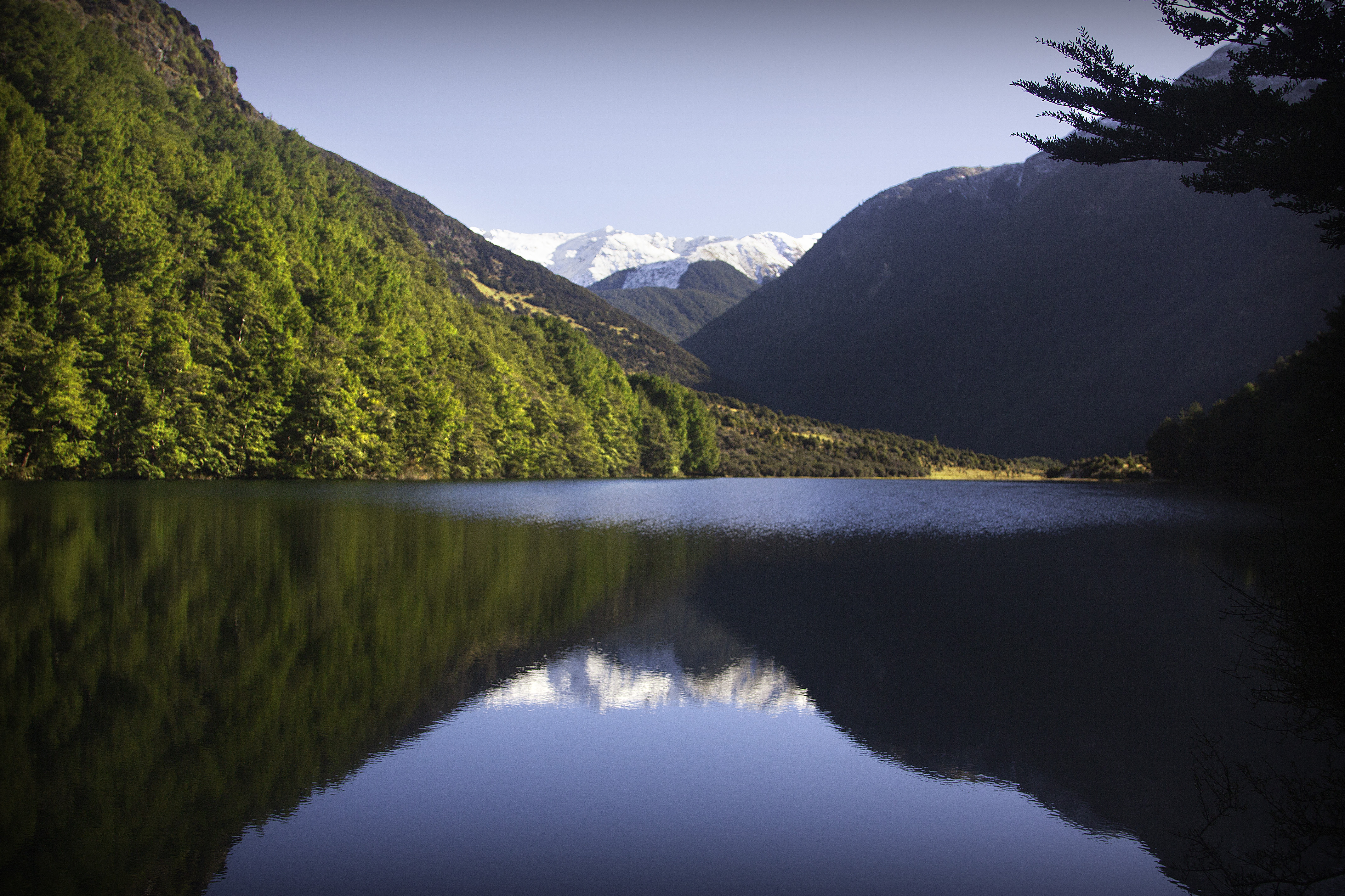
Two Valleys, One Loop
The Greenstone and Caples are two separate tracks that together form a circuit, linked at their upper ends by the McKellar Saddle. Most trampers walk the loop in four to five days, following the Caples River up its valley, crossing the saddle, and descending the Greenstone River back to the starting point - or vice versa. Each valley has its own character. The Caples is narrower and more intimate, with the river winding through beech forest beneath steep valley walls. The Greenstone is broader and more open, the river braiding across wide gravel flats with long views to the surrounding mountains. Both valleys are privately owned - the Caples by various landholders, the Greenstone by Ngāi Tahu - but public access is guaranteed as long as livestock is not disturbed. The tracks sit within the Greenstone and Caples Conservation Areas, with portions near Lake McKellar falling inside Fiordland National Park.
The Quiet Alternative
The circuit's position next to the Routeburn Track is both its greatest asset and the reason most international visitors overlook it. The McKellar Hut, near the saddle connecting the two valleys, also provides access to the Routeburn - meaning trampers can combine the two tracks into a longer journey. Many do exactly that, starting at Glenorchy, walking the Routeburn to the McKellar junction, then looping through the Greenstone and Caples back to their starting point. But the circuit stands on its own. Without the Routeburn's Great Walk status and mandatory booking system, the Greenstone and Caples tracks see fewer walkers, and the huts operate on a first-come, first-served basis. The experience is quieter, less regulated, and in some ways more authentically what New Zealand tramping used to be before the Great Walks became internationally famous.
World Heritage Country
The entire area falls within Te Wahipounamu, the South-West New Zealand World Heritage Area, a UNESCO designation that recognizes the region's outstanding natural values. The beech forests that cloak both valleys are ancient - southern beech species that have grown here since New Zealand separated from Gondwana. Birdlife is abundant, including the newly released takahē, which had been reduced to fewer than 300 individuals before conservation breeding programs began reversing the decline. The Greenstone Valley in particular offers the kind of open, tussock-covered river flats that takahē once inhabited across much of the South Island before introduced predators devastated their numbers. DOC and Ngāi Tahu's 2023 release was a deliberate act of restoration - returning a species to land it had been driven from, on terms negotiated between the Crown and the tribe that holds title to the valley.
Connections and Crossings
What makes the Greenstone and Caples circuit compelling for longer-distance trampers is how it connects to everything around it. From the Greenstone Hut at the circuit's southeastern corner, a track leads south to the Mavora Lakes Conservation Park, opening up days of additional walking through remote backcountry. From the McKellar Hut, the Routeburn Track leads northwest toward Milford Sound. The circuit itself begins at the northern end of Lake Wakatipu, accessible from Glenorchy, which sits at the lake's head about 45 minutes by road from Queenstown. This web of connecting trails means a tramper with enough time and food could spend weeks in these mountains, crossing from valley to valley, saddle to saddle, through landscapes that shift from river flat to alpine ridge to dense forest and back again. The Greenstone and Caples circuit is often the first step into that larger network.
From the Air
The Greenstone and Caples Tracks form a loop circuit centered approximately on 44.93S, 168.34E, in the mountains northwest of Lake Wakatipu. The two valleys run roughly parallel, with the Greenstone to the east and the Caples to the west, connected by the McKellar Saddle at their northern ends. From altitude, the valleys are visible as twin cuts in the mountain ranges, with braided river beds on their floors. The circuit connects to the Routeburn Track at its northern extent. Access is from Glenorchy at the head of Lake Wakatipu. Nearby airports include Queenstown (NZQN, approximately 45 minutes by road from Glenorchy) and Te Anau (NZTZ). The surrounding peaks in the Ailsa and Humboldt Mountains reach above 2,000 m. The area falls within the Te Wahipounamu World Heritage Area.