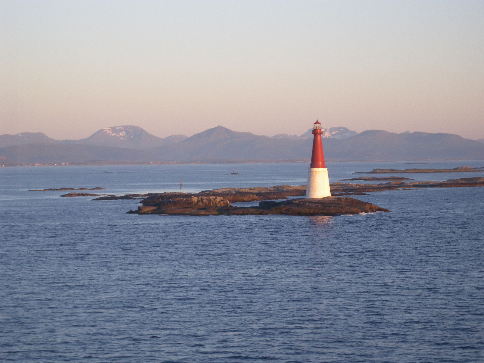
Grip Lighthouse
The islet of Bratthaarskollen offers nothing but bare rock. No trees, no soil, no shelter from the North Atlantic gales that rake across the Grip archipelago. Yet on this seven-meter-high slab of stone, Norwegian engineers spent three years, from 1885 to 1888, erecting what would become the second tallest lighthouse tower in the country: a 44-meter column of red cast iron planted on a white granite base, visible for 19 nautical miles in every direction. Everything about Grip Lighthouse speaks to the stubbornness required to keep a light burning at the edge of the Norwegian Sea.
Iron and Granite Against the Open Sea
The tower's design is both elegant and brutally practical. A 16-meter base of white granite stonemasonry absorbs the punishment of winter storms and the constant salt spray, while the red cast-iron tower above it reaches high enough to throw its light across a vast stretch of open water. The light itself shifts between white, red, and green depending on the bearing of approaching vessels, occulting every eight seconds to create a distinctive rhythm that mariners could identify even in rough conditions. For nearly a century, this light was the primary navigational aid for ships transiting the waters northwest of Kristiansund, marking the scattering of skerries and islets that make the Grip archipelago so treacherous.
Living Inside the Light
Most lighthouses provided separate dwellings for their keepers. At Grip, there was no room for such luxury. The keepers lived inside the lighthouse tower itself, their quarters stacked within the narrow column along with the machinery that kept the light operating. The islet's only other structures were a concrete boathouse and two wharves, the bare minimum needed to receive supplies and maintain contact with the mainland. Imagine the winters: the wind howling against iron walls, the entire islet disappearing under spray during storms, the nearest neighbors the fishermen of Gripholmen, themselves perched on an island barely ten meters above sea level. A radio beacon was added in 1947, giving the keepers additional equipment to maintain until it was replaced by a radar beacon in 1986.
The Lights Go Automatic
Electrification came to Grip Lighthouse in 1932, decades before the fishing village on nearby Gripholmen received its own diesel generator in 1950. The pilot station that had operated alongside the lighthouse was shut down in 1969, and in 1977 the lighthouse itself was automated, ending the era of human keepers on Bratthaarskollen. The islet returned to a silence broken only by wind and waves, the light continuing its eight-second rhythm without anyone to watch it sweep across the water. In 2000, the Norwegian government recognized the lighthouse as a protected cultural heritage site, acknowledging that this isolated tower represents something worth preserving beyond its navigational function: a record of the lengths to which coastal communities went to make their waters safe.
A Beacon at the Edge
From the air, Grip Lighthouse is unmistakable. The red-and-white tower stands alone on its tiny rock platform, surrounded by nothing but ocean and the scattered low islets of the archipelago. It marks the outermost reach of human infrastructure in this part of the Norwegian coast, a point where the impulse to build and maintain meets the indifference of the sea. The fishing village that once justified the lighthouse's existence has been empty of permanent residents since 1974. The ships that once relied on its light now navigate by GPS and electronic charts. But the tower still stands, still flashes, a monument to the century when keeping a flame alive on a rock in the North Atlantic was considered not just worthwhile but essential.
From the Air
Grip Lighthouse is located at 63.234N, 7.609E on the islet of Bratthaarskollen in the Grip archipelago, approximately 14 km northwest of Kristiansund in the Norwegian Sea. The 44-meter red-and-white tower is highly visible from the air against the dark sea and bare rock. Nearest airport is Kristiansund Airport, Kvernberget (ENKB), about 20 km southeast. Best viewed at 1,000-3,000 ft AGL. The surrounding archipelago of 82 islets and skerries is an excellent visual landmark. Caution: exposed offshore location with frequent fog and strong winds.