Grip, Norway
Just before Christmas in 1974, Hildur and Kasper Larsen packed their belongings and left the island of Gripholmen for the last time. With their departure, a fishing community that had clung to existence for over a thousand years finally let go of the Norwegian Sea. The Grip archipelago, 82 islets and skerries scattered 14 kilometers northwest of Kristiansund, had supported human settlement since the ninth century. At its peak, during the great cod runs, as many as 2,000 fishermen crowded onto rocks where the highest point barely reaches ten meters above sea level. Today, Grip has no permanent residents, no fresh water, and electricity only sixteen hours a day in summer. It also has the world's smallest fire truck.
The Cod That Built a Village
Settlement at Grip may date to the ninth century, which would make it the oldest in the Nordmore district. The reason was simple: the fishing grounds offshore were exceptionally productive. For centuries, fishermen rowed and sailed to these exposed rocks from all over the coast, drying their catch on the bare cliffs of Gripholmen, where every scrap of turf and vegetation had been stripped away to create clean drying surfaces for cod. The Hanseatic League's monopoly on fish exports made the village economically significant, and around 1470 the community built Grip Stave Church, still standing today at the island's highest point. But the fishermen's relationship with land-based power was never comfortable. When merchant Hans Horneman of Trondheim purchased the islet from King Frederick IV in 1728, the residents became vassals, forced to sell their catch at prices the merchant set after the fact. This arrangement persisted until it was outlawed in 1893.
Storm, Wreckage, and Starting Over
Living on a rock ten meters above the Norwegian Sea meant living at the mercy of the weather. Storm surges destroyed most of the village in 1796 and again in 1804, leaving only the stave church and a handful of houses standing. The community rebuilt each time, but protection came slowly. The first breakwaters were not constructed until 1882, and a proper harbor capable of receiving small ships was not completed until 1950. The surplus stone from that harbor construction was put to characteristically practical use: the islanders built a small football pitch. Population fluctuated between 100 and 400 people over the centuries, rising and falling with the profitability of fishing. After World War II, centralization drew families to the mainland, and the decline that had been gradual became irreversible.
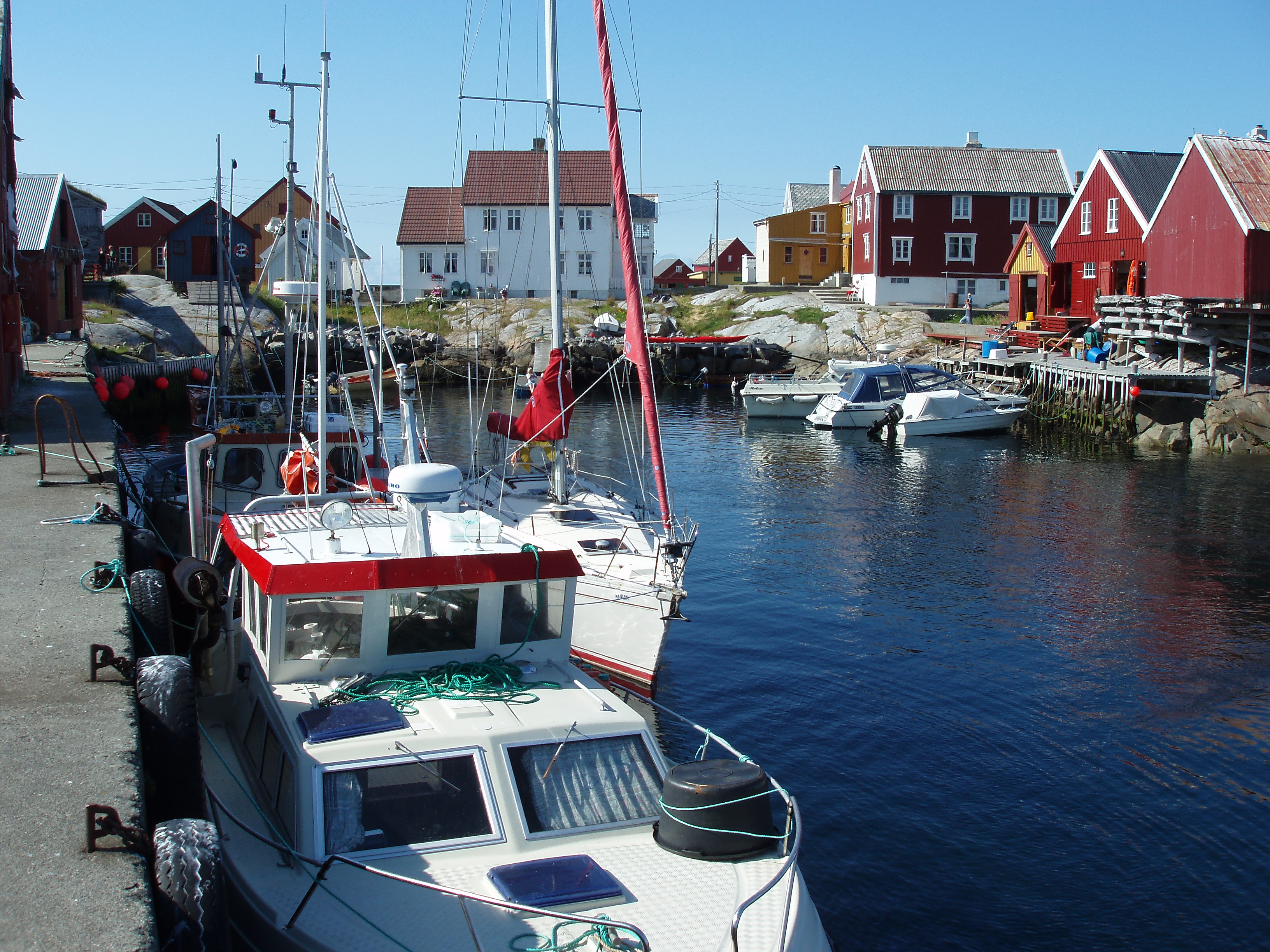
The Ghost Village That Wakes in Summer
Abandonment did not mean the end of Grip. After the last permanent residents left, the old fishing cottages found new purpose as summer houses, claimed primarily by descendants of the original families now living in Kristiansund. Between June and August, 150 to 250 people inhabit the village's 44 housing units, arriving by a passenger ferry that makes one or two thirty-minute crossings from Kristiansund each day. The living conditions remain deliberately austere. There is no natural source of fresh water, so residents collect rainwater, flush toilets with seawater, and travel to town to do laundry. Two diesel generators provide electricity from seven in the morning until eleven at night. The old schoolhouse has been converted into an inn and post office, and the temperance movement's lodge serves as a community house. Infrared cameras monitored from the fire station in Kristiansund provide fire protection, supplemented since 2011 by a fire truck so small it has earned the unofficial title of the world's tiniest.
The Name That Caught
The name Grip appears in written records as early as 1338, rendered as "Gripar," a plural form appropriate for an archipelago. Its etymology likely traces to the Old Norse verb gripa, meaning to catch or seize, almost certainly a reference to the fishing that defined the place for a millennium. From the air, the archipelago is a remarkable sight: a constellation of low rock outcrops barely breaking the surface of the Norwegian Sea, the red tower of Grip Lighthouse rising from one islet, the white stave church perched on another, and the tight cluster of painted wooden houses on Gripholmen looking impossibly fragile against the vastness of open water surrounding them. The islands are slowly revegetating now that the cod-drying cliffs are no longer being scraped bare, nature reclaiming what a thousand years of fishing industry had kept stripped.
From the Air
Grip archipelago is located at 63.217N, 7.600E, approximately 14 km northwest of Kristiansund in the Norwegian Sea. The 82 islets and skerries are visible from altitude as a scattering of low rock outcrops; the 44-meter Grip Lighthouse on Bratthaarskollen and the cluster of painted houses on Gripholmen are the most identifiable features. Nearest airport is Kristiansund Airport, Kvernberget (ENKB), about 20 km southeast. Best viewed at 2,000-5,000 ft AGL for the full archipelago panorama. The islands barely rise above sea level, so look for the lighthouse and building cluster rather than terrain features.