Griqualand West
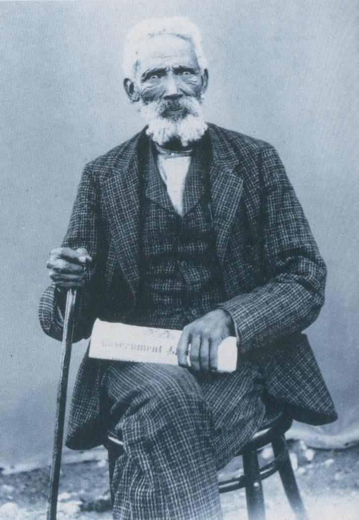
Adam Kok I, the first recognized leader of the Griqua nation, was born a slave. He bought his own freedom, gathered his people, and led them north out of the Cape Colony into the arid plains along the Orange River. There, in a territory they called Griqualand West, centered on the settlement of Klaarwater (later renamed Griquatown), the Griqua built something rare in colonial Africa: a self-governing state run by people of mixed-race descent who wrote their own constitutions and elected their own leaders. Then, in 1870, someone found diamonds. Within a year, ten thousand fortune-seekers had arrived, and the Griqua's world began to collapse.
Children of the Frontier
The Griqua originated in the marriages and liaisons between Dutch colonists at the Cape and Khoikhoi women already living there. Colonial law recognized only Christian marriages, so the children of these unions -- called Basters, or bastards -- could not claim their fathers' legal status. The Dutch East India Company conscripted them into commandos fighting the San and Khoi resistance, which gave them military training but not social acceptance. Equipped with guns, horses, and grievances, many Basters abandoned the colony entirely, striking out beyond the frontier as semi-nomadic horsemen. They were compared to the Cossack states of imperial Russia: armed, mobile, answering to their own captains. By the early nineteenth century, the most powerful of these groups had adopted the name Griqua and settled along the Orange River, where they governed a territory of some 40,000 square kilometers through a system of elected kapteins and written law.
The Waterboer Dynasty
After Adam Kok I's death, the Griqua nation split. One branch migrated southeast under Adam Kok II, eventually founding Griqualand East. In the original territory, Andries Waterboer took control around 1820 and established a dynasty that would rule Griqualand West for decades. In 1834, the Cape Colony formally recognized Waterboer's authority, signing a treaty that acknowledged his rights to the land and its people. The Waterboer kapteins maintained political control even as they were demographically outnumbered by both the pre-existing Tswana population and incoming European settlers. It was a precarious balance sustained by the Griqua's military skill, their diplomatic connections to the British, and the relative poverty of the semi-arid territory they governed. No one paid much attention to Griqualand West until the earth beneath it turned out to be studded with diamonds.
The Diggers' Republic
In 1870-71, prospectors flooded into the area near the junction of the Vaal and Orange rivers. The diamond fields sat on land claimed by the Griqua chief Nicolaas Waterboer, the Boer Republic of the Orange Free State, and the Transvaal. When the Transvaal's president declared the fields Boer property, a former British sailor named Stafford Parker organized the diggers to expel all Transvaal officials. On 30 July 1870, Parker declared an independent republic at Klipdrift -- promptly renamed Parkerton after himself -- and began collecting taxes, sometimes at gunpoint. The so-called Diggers' Republic lasted less than a year. By December, 10,000 British settlers had arrived. British Governor Henry Barkly mediated the rival claims through the Keate Committee, which ruled in Waterboer's favor. Waterboer then offered to place his territory under Queen Victoria's administration. On 27 October 1871, Griqualand West became British territory.
A Sovereignty That Could Not Settle
The annexation resolved nothing. The Orange Free State nearly went to war over the lost diamond fields. A Land Court established in 1875 under Justice Andries Stockenstrom heard competing claims and delivered a finding that cut to the heart of Griqua identity: because the Griqua were nomadic, their captains ruled over a people, not over a fixed territory. They could claim title only to lands they had permanently settled, not to every acre through which their herds had wandered. Much of Waterboer's claim was denied. The ruling effectively favored the Orange Free State, provoking accusations that Stockenstrom was biased. Resolution came only in 1876, when the Colonial Secretary, Lord Carnarvon, paid off the Free State's claims in full. Meanwhile, the Cape Colony's prime minister, John Molteno, refused to annex the indebted territory until he traveled to London in 1876 to negotiate terms, finally passing the Griqualand West Annexation Act on 27 July 1877.
What the Diamonds Left Behind
Griqualand West was formally united with the Cape Colony on 18 October 1880. The Cape imposed its non-racial qualified franchise, which allowed all men -- regardless of race -- to vote provided they met property-ownership requirements. The Griqua welcomed this; the recently arrived diamond diggers did not. Kimberley, the diamond capital that had erupted from the veld, sent four representatives to the Cape parliament. The diamond wealth that had destroyed Griqua political autonomy simultaneously rescued the bankrupt Orange Free State, whose farmers found a ready market for their produce among the mining settlements. Capital flowed from Kimberley and London. The Boer "bluebacks" -- a paper currency that had dropped to half its face value -- recovered and were redeemed. Under apartheid, many Griqua people adopted the classification "Coloured," fearing that acknowledging their distinct heritage might place them at a lower rung in the racial hierarchy. Today, the Griqua population is of uncertain size, scattered across the Northern Cape, Western Cape, and Namibia -- descendants of a frontier people who once governed their own state.
From the Air
Griqualand West is centered at approximately 28.75S, 24.77E in what is now the Northern Cape Province of South Africa. From the air, the flat, semi-arid landscape is dominated by the Big Hole at Kimberley -- the massive open-pit diamond mine visible even from high altitude as a dark void in the city grid. The Vaal and Orange rivers, whose junction defined the diamond fields, are visible as green ribbons through the brown terrain. Griquatown (Griekwastad), the historic Griqua capital, lies to the northwest. The nearest major airport is Kimberley Airport (FAKM). The landscape is flat grassland with scattered kopjes, and the mining infrastructure around Kimberley is clearly visible from 5,000-8,000 ft AGL.