Großes Moor (Vechta-Diepholz)
Walk out onto a raised bog in northern Germany on a still autumn morning and the first thing you notice is the sound: there isn't any. No traffic, no farm machinery, no cattle. Just the squelch of waterlogged peat under your boots and the occasional thin call of a curlew from somewhere out in the heather. The Großes Moor - the Great Bog - is one of the larger surviving examples of this landscape, a contiguous spread of raised peat bog stitched together across the boundary between the counties of Vechta and Diepholz in southern Lower Saxony. People have been cutting it, draining it, planting it, and arguing over it for the better part of two centuries. Recently they have begun to try to put some of it back.
What a Raised Bog Is
A raised bog is a peculiar thing. It forms when sphagnum moss accumulates faster than it can decompose, gradually building up a dome of peat that rises above the surrounding water table and feeds itself entirely from rain. The whole structure is acidic, oxygen-poor, and nutrient-starved. Only specialist plants live there: cotton grass, cranberry, sundew, bog rosemary. In northwestern Germany, where ice age meltwaters left wide flat depressions across the Ems-Hunte Geest and the Dümmer Geest Lowland, these bogs once covered enormous areas. The Großes Moor is what is left of one such complex. The whole name actually applies to two smaller bogs - one south of Damme, the other east of Vechta - linked by a chain of intermediate bogs east of Steinfeld and Lohne. Together they are sometimes called the Great Bogs, in the plural, and the entire region is one of the most extensive bog landscapes still recognisable in Lower Saxony.
Two Hundred Years of Cutting
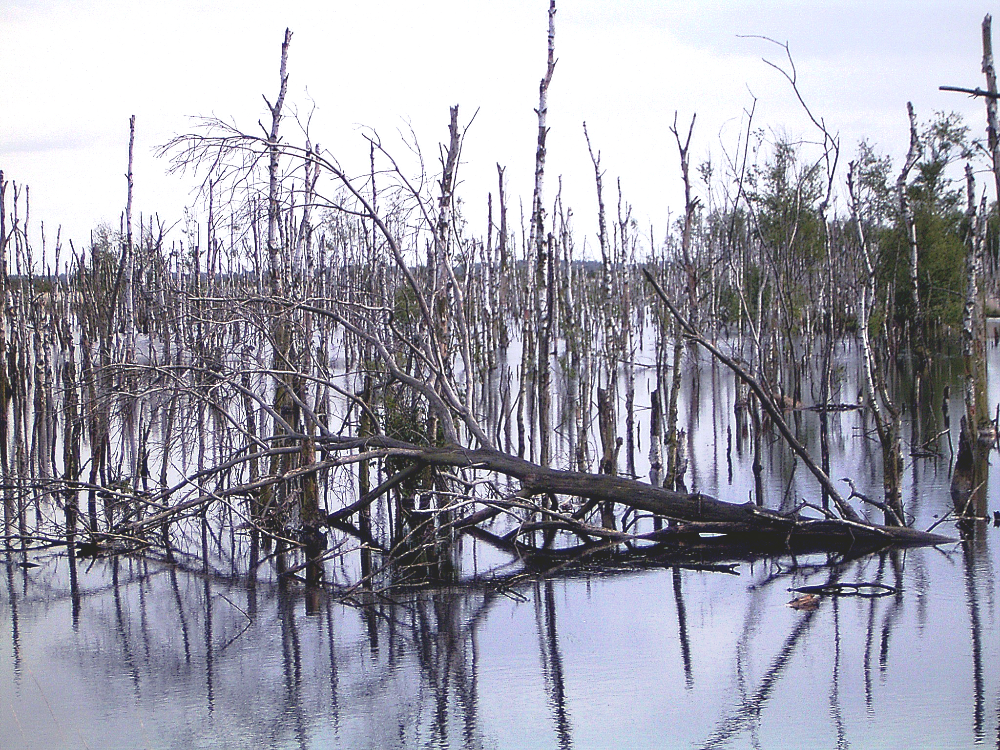
From the eighteenth century onward, peat was a fuel and a fertiliser, and the Großes Moor was a resource. Generations of small farmers cut hand-spades of peat from family plots, dried it on raised berms beside the cuts, and burned it through the long northern winters. Beginning in the early twentieth century, industrial peat extraction took over: drainage ditches were dug, fields were squared off, conveyor systems carried away the dark cubes by the millions. The cleared land was either turned into peat-rich grassland or sold to horticulture. By the late twentieth century, only fragments of the original near-natural bog remained, scattered across a working landscape of former cuttings and reclaimed pasture. What now exists is a mosaic of states - some places still being worked, some places set aside, and some places being patiently re-flooded to see whether the sphagnum will come back.
The Geography Around the Bog
The Großes Moor lies along the boundary between Vechta and Diepholz counties, on the southern edge of the North German Plain. The Damme Hills wrap around it to the north and west - their wooded spurs reaching down to the bog edge near Damme and the borough of Vechta. The southern half of the bog extends into the Dümmer Nature Park, with the lake of the Dümmer just beyond it. Further south the foothills of the Wiehen Hills rise into view, and along their northern flank the Mittelland Canal carries barges east to west. The northern part of the bog runs into the Wildeshausen Geest Nature Park. To the east the Rehden Geest Moor takes over; to the southeast the Kellenberg rises. Two rivers drain the region - the Hase to the west, the Hunte to the east - and the streams that flow off the bog into them carry brown, peat-stained water that smells faintly of tea.
Coming Back
Bog restoration is slow, patient, unphotogenic work. You dig in dams, close drainage ditches, let the water table rise, and wait years to see whether the sphagnum mat re-establishes. In places across the Großes Moor it has begun to. Cranes - the tall grey birds, not the construction kind - return each spring to feed and roost on the wetter sections. Cotton grass spreads back across former cuttings, lifting white tufts above the reflective water in May. Hikers come here precisely because the landscape is empty in a way that almost no other corner of densely populated Germany is empty. The light is enormous. The horizon is unbroken. The ground beneath you stores carbon that has been accumulating since the last ice age - and, with time and care, may go on accumulating it for the next one.
From the Air
The Großes Moor (Vechta-Diepholz) lies at 52.45 degrees N, 8.19 degrees E in southern Lower Saxony, on the boundary between the counties of Vechta and Diepholz. From altitude the bog complex reads as a wide, near-treeless brown-to-green expanse, distinct from the surrounding patchwork of farmland and pine plantation. The Damme Hills form a dark wooded ridge immediately to the north and west, and the Dümmer lies a few kilometres to the east. Nearest airport is Münster Osnabrück International (EDDG), about 45 km southwest. Best viewing altitude 3,000-5,000 feet; the bog is one of the more distinctive empty spaces in this otherwise heavily cultivated region.