Groesbeek
The hills around Groesbeek should not exist. The Netherlands is famously flat, but here, eight kilometers southeast of Nijmegen, the land rolls in a way that feels almost out of place, with thick forests on the heights and wineyards on the slopes. The hills are the wreckage of an Ice Age. About 150,000 years ago, during the Saale glaciation, a sheet of ice pushed south until it stopped near here, then retreated and left its terminal moraines behind. Groesbeek's valley was carved out by that ice. Today the same hills are still rising, gently but measurably, by half a millimeter a year. The streams that gave the village its name (beek is Dutch for brook) have mostly vanished, but the geology has not.
The Valley the Glaciers Forgot to Flatten
Because the moraine hills around Groesbeek are still being pushed upward by tectonic forces, the topography here is sharper and more varied than the geologically similar landscapes elsewhere in the central and eastern Netherlands. During the cold pulse known as the Younger Dryas, thick layers of loess settled into the valley floor. That loess is why farmers have been able to make a living here for centuries while the hills above remained too sandy to plow. The hilltops stayed forested because nothing else would grow well on them, and the forests, in turn, kept the valley isolated. The first major road to Nijmegen did not arrive until the railway came in 1865, and even then the area kept a distinct dialect and a tightly-knit community deep into the twentieth century. The interbellum brought a high-capacity paved road, and the isolation finally lifted.
September 1944: The 82nd Comes Down
On 17 September 1944 the sky above Groesbeek filled with parachutes. The 82nd Airborne Division, jumping as part of Operation Market Garden, had been given the high ground southeast of Nijmegen as its objective: hold the ridge above the city, deny it to the Germans, and capture the bridges over the Waal. The drop zones were the open fields around Groesbeek itself. What followed was nine days of brutal fighting, much of it back and forth across the village's edge. By the time the front stabilized, Groesbeek had been almost completely destroyed. Its people had been evacuated, the streets reduced to rubble, the church towers fallen. The Liberation Museum that now sits on one of the original drop zones tells the story not just of the soldiers who landed but of the villagers who came home to find their homes gone. Two kilometers north of the town lies the Groesbeek Canadian War Cemetery, where 2,338 Canadians who died in the subsequent Rhineland campaign now rest.
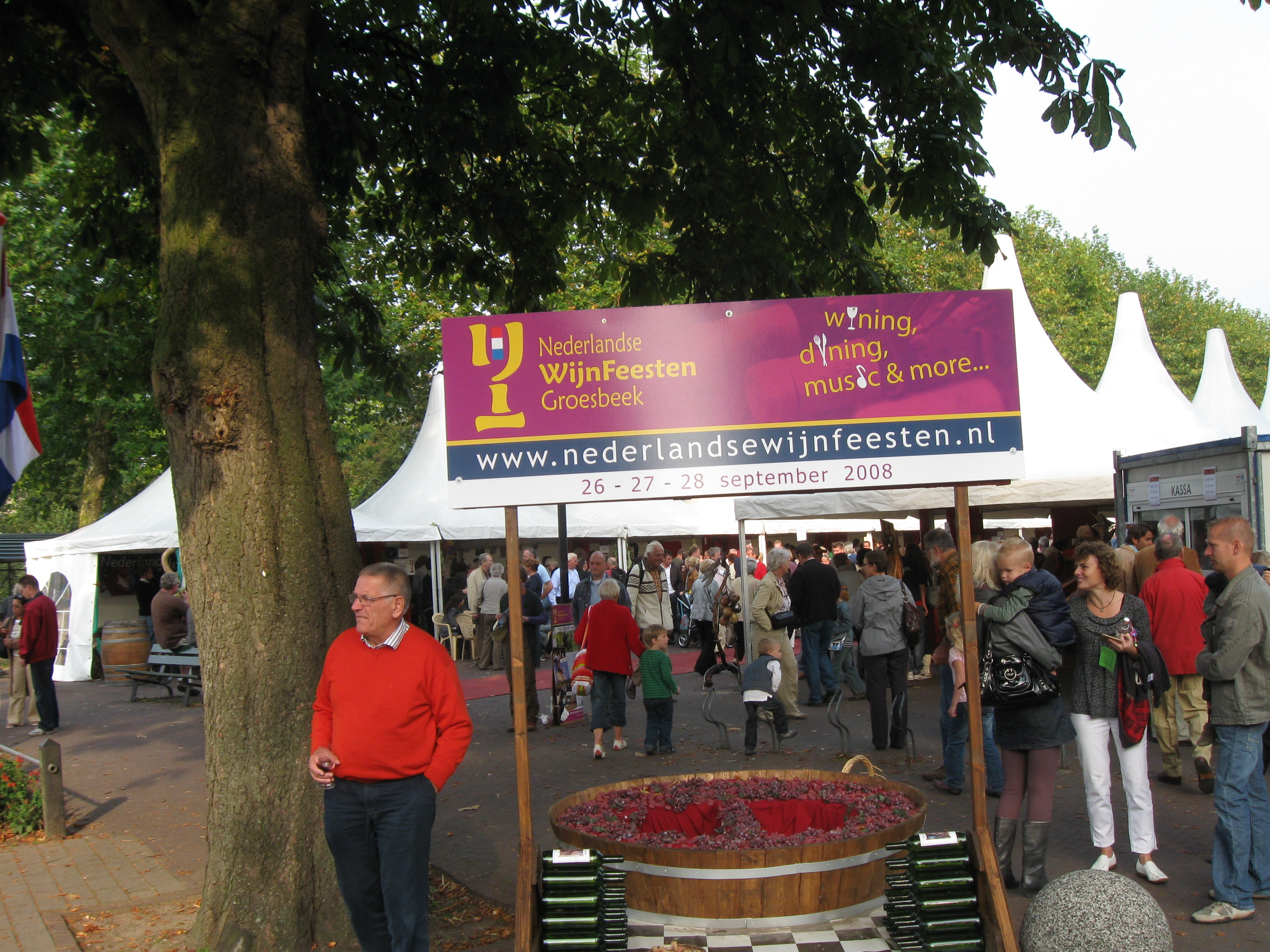
From Loess to Wine
After the war Groesbeek was rebuilt, and the better roads that came with reconstruction tied it firmly into the orbit of Nijmegen. What had been an isolated farming village became a commuter town. A three-kilometer band of woodland called the Dekkerswald still separates Groesbeek from Nijmegen proper, giving the place a green moat of its own. Then, in the last decade or so, something unusual began happening on the south-facing slopes. New grape varieties bred for cooler, damper climates turned out to thrive in the loess soil, and a viniculture industry sprang up here. Groesbeek now claims to be the northernmost wine-producing center in Europe and the only one in the Netherlands. Every September a wine harvest festival draws crowds onto the same hills that, eighty years before, had been parachute drop zones.
Carnival, Football, and the Third Day
For a town of fewer than 20,000 people, Groesbeek punches well above its weight in two distinctly Dutch traditions. Its Catholic carnival parade on Sunday is one of the largest in the country, so popular that participation spots have to be limited. Its amateur football clubs are unusually serious: De Treffers plays in the Tweede Divisie, the country's highest amateur level, and Achilles '29 made an even more remarkable choice in 2013, accepting promotion to the national second division (the Eerste Divisie) and becoming the first amateur club willing to take that step into professional football. And once a year, on the third day of the International Four Days Marches Nijmegen, tens of thousands of walkers wind through the town and over its hills. They come up out of the valley breathing hard, because the hills are real, and then they descend toward Nijmegen with the cemetery on their left and the wineyards on their right.
From the Air
Coordinates 51.78°N, 5.93°E, about eight kilometers southeast of Nijmegen and right against the German border. The terminal moraine landscape stands out clearly from the air: forested ridges with the broader Groesbeek valley pinched between them and the Reichswald forest on the German side. The Waal river is unmistakable to the north, with Nijmegen on its south bank. Nearest controlled airspace is around Eindhoven (EHEH) about 50 km southwest; Maastricht Aachen (EHBK) lies roughly 60 km south. Low-altitude passes work well in early autumn when the wineyards are heavy with grapes.