Guadeloupe National Park
Clouds form inside Guadeloupe National Park. Not above it - inside it. At elevations above 1,000 meters on Basse-Terre's volcanic massif, the forest lives in near-permanent cloud cover, its trees stunted and draped in moss, the air so saturated that the boundary between rain and atmosphere dissolves. Drop a few hundred meters and the world transforms: dense montane rainforest where tabonuco trees tower above 30 meters, giant philodendrons cling to trunks, and orchids bloom in the perpetual twilight of the canopy. Drop further still and you reach mangrove swamps where saltwater meets fresh, where frigatebirds patrol overhead and crabs pick through the roots. All of this exists within 173 square kilometers of protected core area - a vertical journey from sea level to 1,467 meters that compresses more ecological diversity into a smaller space than almost anywhere in the Caribbean.
The Volcano at the Center
La Soufriere is the park's highest point and its defining presence - an active volcano whose summit, at 1,467 meters, is the tallest peak in the Lesser Antilles. It last erupted in 1976, forcing the evacuation of 72,000 people from southern Basse-Terre, though the eruption produced more ash and gas than lava. The volcano remains monitored and fumaroles still vent sulfurous steam near the summit, a reminder that the lush forest below grows on unstable ground. Other peaks within the park include Echelle at 1,397 meters and Grand-Sans-Toucher at 1,354 meters, while the twin summits of the Mamelles at 768 meters mark the midpoint of the Route de la Traversee, the road that crosses Basse-Terre through the heart of the park. The Carbet Falls, among the most visited sites in Guadeloupe, cascade down the volcano's flanks in three separate drops fed by the extraordinary rainfall that the mountains wring from Caribbean trade winds.
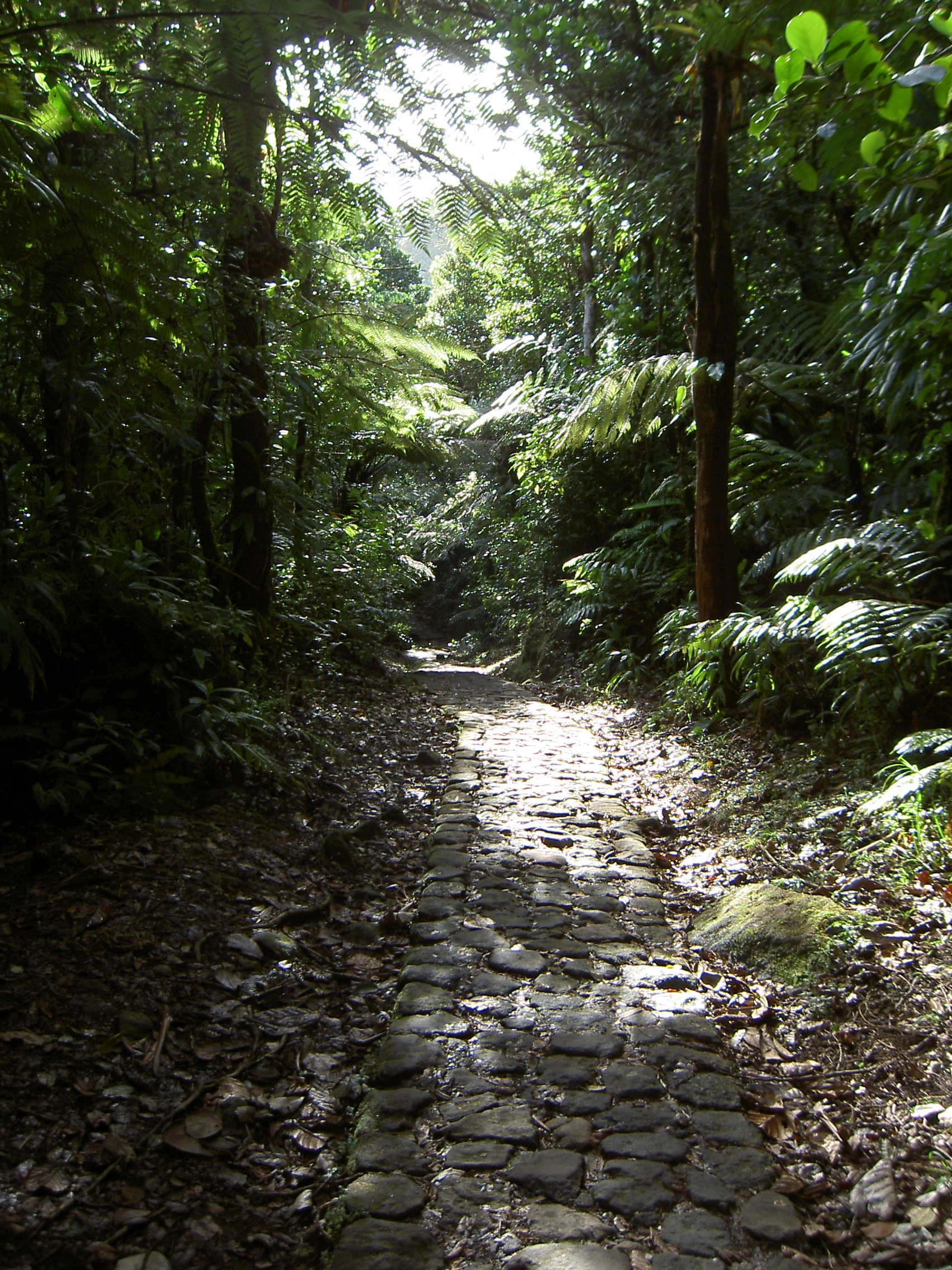
Three Forests Stacked
Elevation dictates everything in the park. Below 500 meters, a mesophilic forest of white and red mahogany, rosewood, and jatoba shares space with banana plantations and food crops in the buffer zone - a working landscape where agriculture and conservation overlap. Between 300 and 1,000 meters, the montane moist forest takes over, covering 80% of the park's core area. This is the dense, luxuriant jungle visitors picture when they imagine Caribbean rainforest: multiple canopy layers from towering tabonuco and acomat boucan down through mid-level oleander to ferns, heliconias, and mountain palms at ground level, with epiphytic orchids and giant philodendrons colonizing every available surface. Above 1,000 meters, the cloud forest is a different world entirely - sparse, wind-battered, more savanna than jungle, where trees grow low and the constant moisture breeds mosses and lichens rather than the flamboyant blooms of lower elevations.
Where the Mangroves Meet the Reef
The park extends beyond the mountains. The Grand Cul-de-Sac Marin Nature Reserve, established in 1987 and administered jointly with the national park, protects 21 square kilometers of marine area and 16 square kilometers of terrestrial coast along Guadeloupe's inner lagoon. Nearly half of the island's mangrove swamps - 37 of 80 square kilometers - fall within this reserve, a network of coastal wetland forest flooded by fresh and salt water where the root systems create nurseries for marine life. Together, the national park and the marine reserve earned UNESCO biosphere reserve designation in 1992, the first such recognition for a French national park outside metropolitan France. For most of its history, Guadeloupe National Park held the distinction of being France's only overseas national park, a status it lost only in 2007 when Reunion National Park and Guiana Amazonian Park were created.
What Survives and What Was Lost
The park's wildlife tells a complicated story. Intensive hunting during earlier centuries stripped Guadeloupe of several species - parrots and parakeets were eradicated entirely. What remains is diminished but still remarkable: 17 mammalian species including the Guadeloupe raccoon, two bat species found nowhere else on Earth, mongooses introduced from India that now roam the forest floor, and the endangered agouti. Thirty-three bird species inhabit the park, from hummingbirds and Guadeloupe woodpeckers - endemic to the island - to pelicans and frigatebirds along the coast. Hercules beetles lumber through the understory, black witch moths with wingspans as wide as a hand hunt at night, and walking-stick insects mimic the branches they rest on. Park authorities have discussed reintroducing the manatee, which once swam Guadeloupe's coastal waters before being hunted to local extinction. Whether such restoration succeeds or not, the park's existence since its official founding on February 20, 1989, has drawn a line: what survives here will be given a chance to remain.
From the Air
Located at 16.08°N, 61.68°W on the western (Basse-Terre) half of Guadeloupe. The park covers the volcanic mountain massif that forms the spine of Basse-Terre island, with La Soufriere's summit at 1,467 m (4,813 ft) the highest point in the Lesser Antilles - often obscured by cloud. From altitude, the park boundary roughly corresponds to the forested mountain terrain, with cultivated lowlands below. The Route de la Traversee crosses the park east-west. The Grand Cul-de-Sac Marin lagoon on the north coast is visible as a shallow turquoise area contrasting with deeper ocean. Nearest airports: Pointe-a-Pitre Le Raizet (TFFR) approximately 20 nm northeast on Grande-Terre; Basse-Terre has no commercial airport. Best viewed from 8,000-15,000 ft for full mountain perspective. Expect cloud cover over the summits year-round; clearest conditions typically early morning. Trade winds from the east produce orographic rainfall on Basse-Terre's windward slopes.