Guánica State Forest
Most people imagine Puerto Rico as lush rainforest, all dripping ferns and cascading water. The island's southwest corner tells a different story. Here, where rain shadows starve the coast and limestone karst crumbles underfoot, the Guánica State Forest spreads across nearly 10,000 acres of something rarer and more fragile than any jungle: subtropical dry forest. Designated a forest reserve in 1919 and recognized as a UNESCO Biosphere Reserve in 1981, Guánica is considered the best-preserved dry forest in the Caribbean. It is a landscape of spiny cacti, wind-twisted trees, and hidden lagoons, a place where life has learned to thrive on almost nothing.
Where the Rain Refuses to Fall
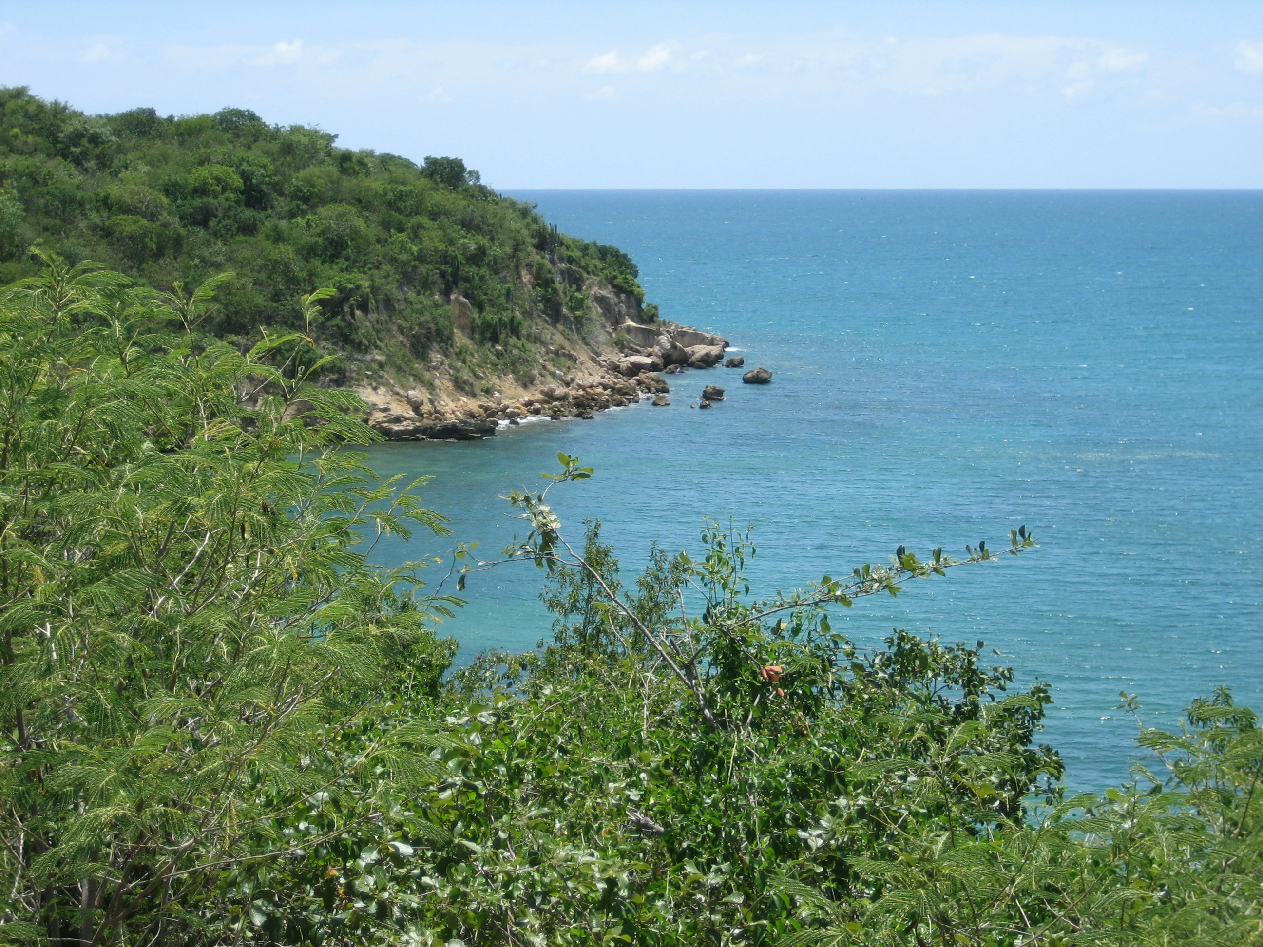
The dry forest occupies Puerto Rico's southern karst region, a terrain sculpted by millennia of water dissolving limestone into jagged ridges, sinkholes, and caverns. The soils are thin and unforgiving. In the deciduous zones, trees shed their leaves during the driest months, standing skeletal against a bleached sky. In the evergreen pockets, where clay and sand hold just enough moisture, the canopy stays green year-round. Between 30 and 50 tree species occupy each hectare, a modest number compared to rainforests but remarkable for soil this poor. The forest stretches across five municipalities: Guánica, Guayanilla, Peñuelas, Ponce, and Yauco, though in Peñuelas and Ponce it exists only as offshore keys and small islands. From above, the contrast is stark: green coastal Puerto Rico gives way to something tawny and austere, a landscape that belongs more to the arid Antilles than to the tropical imaginary.
The Nightjar's Last Stand
Roughly half of Puerto Rico's bird species have been recorded in Guánica, including nine of the island's sixteen endemic species. The Puerto Rican nightjar, once thought extinct until its rediscovery in 1961, nests in the dry forest's leaf litter. Its call, a repeated whip-like note, is one of the rarest sounds in Caribbean ornithology. The Puerto Rican vireo forages in the understory. The Puerto Rican crested toad, an animal that resembles a stone until it moves, breeds in the forest's ephemeral pools after rare heavy rains. Offshore, West Indian manatees graze on seagrass in underwater prairies within the reserve's protected waters, while coral reefs ring the coastline. More than 700 plant species have been documented here, 48 of them endangered and 16 found nowhere outside this forest. Among the rarest is the bariaco, a tree classified as critically endangered, clinging to existence in one of the most threatened ecosystems on the planet.
Limestone, Salt, and Mangrove
What makes Guánica extraordinary is not any single habitat but the sheer variety compressed into a narrow coastal strip. Sandy beaches give way to rocky shores. Mangrove forests line the estuaries where freshwater meets the sea. Saltwater lagoons and salt flats shimmer inland, their crusted surfaces a stark white against the surrounding scrub. Limestone caverns riddle the karst below, some of them home to the Mona basket shrimp, a cave-dwelling crustacean adapted to permanent darkness. Seagrass prairies sway in the nearshore waters, and coral reefs extend along the coast. Each ecosystem supports its own community of specialists: the Cook's pallid anole, a lizard found in only a few dry forest fragments; the red land crab, which migrates from forest to sea to spawn; the sebucan cactus, with its ribbed columns rising from the rocky substrate. Walking the forest's twelve hiking trails, visitors pass through several of these zones in a single morning.
The View from Space
One of the most striking photographs of Guánica was taken not from its trails but from the International Space Station. In the image, the dry forest appears as a brown-green wedge between Guánica Bay and Guayanilla Bay, visibly different from the surrounding agricultural and urban land. The perspective underscores both the forest's significance and its vulnerability. At 10,000 acres, Guánica is the largest of Puerto Rico's twenty state forests, yet it is still small enough to see its boundaries from orbit. What the astronaut's lens captured is a fragment, a remnant of the dry forests that once covered much of the Caribbean's leeward coasts before centuries of agriculture, development, and fire reduced them to scattered patches. Guánica survives because it was protected early, because its soils were too poor to farm profitably, and because the species that live here adapted to hardship long before humans complicated their world.
From the Air
Located at 17.97°N, 66.88°W on Puerto Rico's southwest coast. The dry forest is visible as a distinctly brown-green patch between Guánica Bay and Guayanilla Bay, contrasting sharply with surrounding development. Nearest airport is Mercedita Airport (TJPS/PSE) in Ponce, approximately 20 nm east. From 3,000-5,000 feet, the limestone karst terrain and coastal lagoons are clearly visible. The forest's twelve hiking trails, salt flats, and mangrove areas can be distinguished at lower altitudes. Offshore keys belonging to the reserve are visible to the south. Weather is typically dry and clear on this coast, with better visibility than Puerto Rico's rainier north side.