Gyda National Park
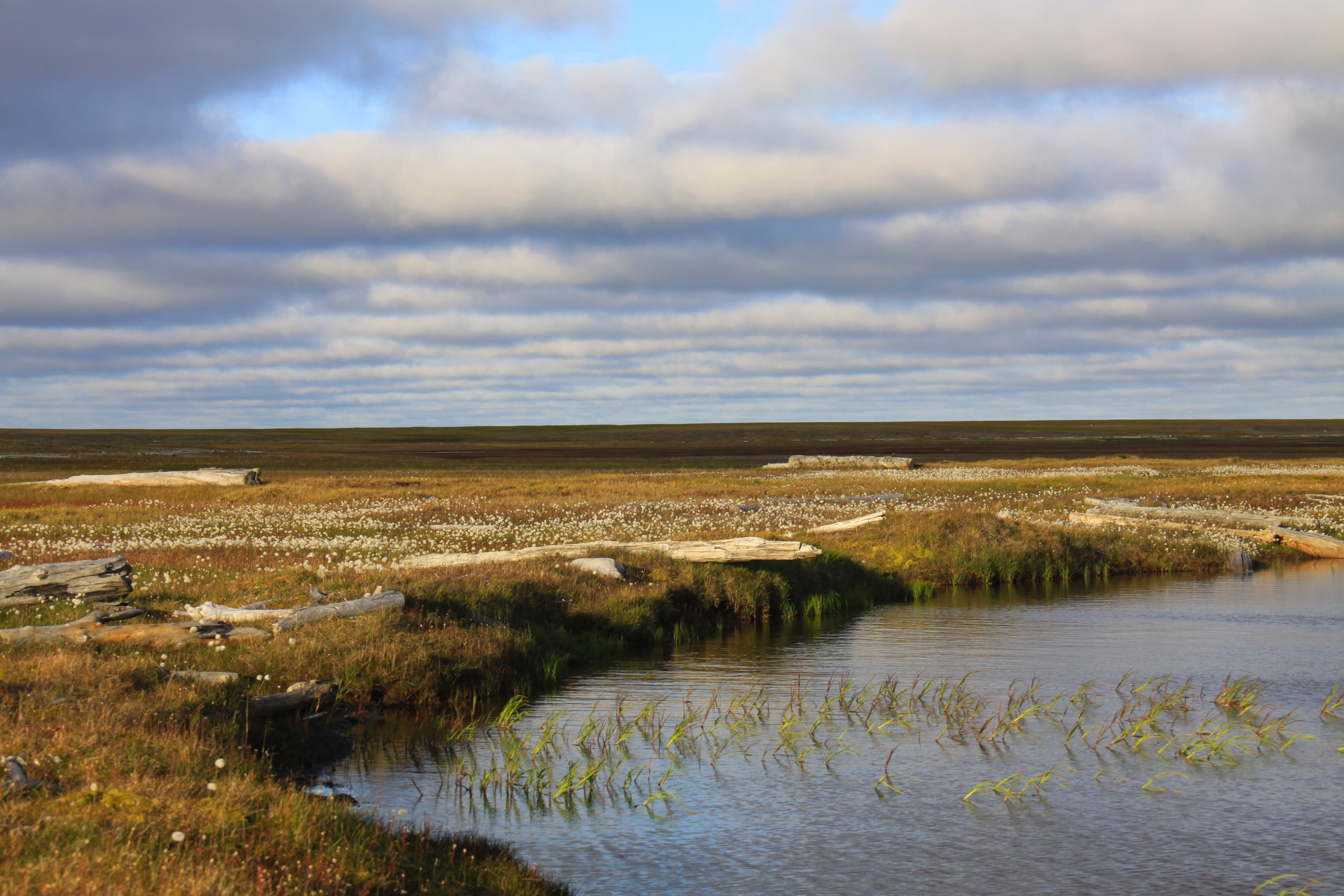
Snow falls on Gyda in October and does not melt until June. For 240 days each year, the northernmost national park in Western Siberia lies buried under white, its average annual temperature hovering at minus 10 degrees Celsius. The frost-free window lasts 55 to 70 days -- barely two months in which the tundra briefly greens, birds arrive to nest, and the permafrost's top layer softens to a depth of less than 1.2 meters before freezing solid again. This is Gydansky National Park, an 878,200-hectare expanse of arctic terrain covering the northern tip of the Gyda Peninsula and a scattering of islands in the Kara Sea. Until 2019 it was a zapovednik, a strict nature reserve with a near-total ban on human access. Its conversion to national park status has not made it noticeably more accessible. There are no roads, no facilities, and no easy way in.
Geography at the Edge
The park occupies the Gyda Peninsula's northernmost reach, where the Ob River delta meets the Kara Sea. Its boundaries extend beyond the mainland to include the Yapay Peninsula, the northern portion of the Mamonta Peninsula (named, appropriately, for mammoths), Deer Island, Shokalsky Island, Pestsovoye Island, and several smaller outcrops. Roughly one-sixth of the total protected area -- 159,800 hectares -- is island territory. An additional 150,000-hectare buffer zone surrounds the core reserve. The terrain is flat in the most absolute sense: a permafrost plain stretching to the horizon without a single significant rise. Where the ground is not bare, it is covered in hummocky lichen-moss tundra. In the southern sectors, wetlands and sedge marshes take over, particularly where spring snowmelt floods the lowlands before it can drain through the frozen substrate beneath.
Survivors of the Cold
Life at Gyda is a study in adaptation. Scientists have recorded 180 species of vascular plants, most of them low-growing mosses, lichens, polar willows, and dwarf birch that hug the ground to escape the wind. In the southernmost reaches, a few larch trees mark the treeline's absolute northern limit in this part of Siberia. The animal roster is more surprising. Eighteen mammal species inhabit the park, including polar bears, walruses, and narwhals along the coast -- the narwhal population having declined significantly in recent decades. Siberian lemmings scurry through the tundra, driving the boom-and-bust population cycles that ripple through the food web. Reindeer herds within the park boundaries can number in the thousands, and biologists consider them genetically distinct from the similar Taimyr reindeer population to the east. Wolves follow the herds. Scientists have recorded 76 bird species, 40 of them nesting, including white-tailed sea eagles, tundra swans, and the near-threatened yellow-billed loon.
Closed to the World
As a zapovednik from 1996 to 2019, Gyda operated under Russia's strictest conservation framework: no tourism, no development, no traffic. Only scientists and visitors with approved environmental education purposes could arrange access through the park's administration, headquartered in the village of Tazovsky, the regional capital. The conversion to national park status in December 2019 theoretically opened the door to regulated visitation, but the practical barriers remain immense. There are no roads leading to the park. No trails exist within it. No accommodations or services of any kind await visitors. Access requires helicopter or boat transport, both subject to weather that can shut down operations for days. The park's remoteness has been its most effective protector -- but remoteness offers diminishing returns when the threat comes from below ground rather than from visitors.
Pressure from Beneath
The Gyda Peninsula sits atop oil and gas reserves that have attracted the attention of Russian energy companies, particularly Novatek, which has pursued natural gas extraction across much of the peninsula since 2019. The Arctic LNG 2 project, an enormous gas extraction and liquefaction facility, is under construction on the Gulf of Ob coast just south of the park's buffer zone. The tension between conservation and extraction is not abstract here; it is visible in the landscape. The park's permafrost -- the foundation of its entire ecosystem -- is warming. The same cryovolcanic methane blowouts that have opened craters on the neighboring Yamal Peninsula have raised concerns about similar processes on the Gyda side. For a park where the growing season lasts two months and the ecosystem takes decades to recover from any disturbance, the pace of industrial development in the surrounding region represents an existential challenge that no administrative designation alone can resolve.
From the Air
Coordinates: 72.14°N, 77.85°E. Gyda National Park covers the northern tip of the Gyda Peninsula, with several islands visible in the Kara Sea to the north. The flat tundra terrain is nearly featureless from altitude -- look for the peninsular shape and island clusters. No airports exist within the park; nearest facility is at Tazovsky far to the south. The Arctic LNG 2 construction site on the Gulf of Ob coast south of the park provides a visual reference point. Best viewed at 10,000-20,000 ft. The park is snow-covered from October through June. Summer months reveal the wetland and lake patterns across the tundra.