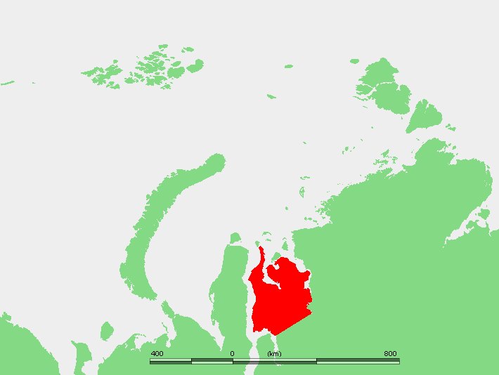
Gyda Peninsula
One of the peninsula's sub-arms is named Mamonta -- Mammoth Peninsula -- and the name is not decorative. A mammoth skeleton excavated from the Gyda Peninsula's permafrost now stands in a zoological museum in Saint Petersburg, one more specimen pulled from the frozen archive that underlies this entire landscape. The Gyda Peninsula is a 400-kilometer-long, 360-kilometer-wide expanse of flat, frozen ground jutting into the Kara Sea between two of Siberia's greatest river systems: the Ob to the west and the Yenisei to the east. Its southwestern corner is bounded by the Taz Estuary, and across that water lies its better-known neighbor, the Yamal Peninsula. In the language of geopolitics and energy markets, the Gyda is increasingly where the action is moving next.
A Landscape Built by Water and Ice
The Gyda Peninsula is flat to an extraordinary degree. Its surface is permafrost covered by tundra, laced with rivers and studded with lakes that have no outlet through the frozen ground beneath. The Tanama River has its sources here, threading across the plain toward the coast. Several sub-peninsulas extend northward into the Kara Sea like reaching fingers: the Yapay Peninsula in the northwest, the Mamonta Peninsula between Khalmyer Bay and Yuratski Bay, and various lesser arms. Offshore, the islands of Oleniy, Shokalsky, and Vilkitsky rise from the shallow sea. The two main bays cut deep into the northern coast -- Khalmyer Bay is narrow and fjord-like, while Yuratski Bay is smaller and more enclosed. In the administrative geography of the Russian Federation, this is the Yamalo-Nenets Autonomous Okrug, though on English maps the peninsula appears variously as Gydansky or Gydanskiy, an artifact of transliteration from Cyrillic.
The Ground Gives Way
Since 2014, the Gyda Peninsula has joined its neighbor Yamal in producing a phenomenon that has no comfortable explanation: massive holes, nearly 100 feet wide, appearing suddenly in the tundra. The craters are believed to result from methane gas blowouts -- pockets of gas trapped beneath the permafrost that build pressure as the ground warms, then rupture explosively. The local research station had been closed since 1991, leaving a 25-year gap in monitoring data. Scientists were not allowed back until 2016 to resume geo-cryological studies and track permafrost changes. What they found was accelerating. In 2020, following the warmest summer recorded in the region since 1881, heavy masses of mud and permafrost began sliding into the sea at Gydan Bay. These mudslides have been attributed both to rising temperatures and to the construction of the Arctic LNG 2 project nearby. The permafrost that has preserved mammoth bones for tens of thousands of years is losing structural integrity in real time.
Conservation on a Deadline
In 1996, Russia designated the northernmost 8,782 square kilometers of the Gyda Peninsula as a strict nature reserve -- a zapovednik -- with a general ban on all human traffic. Administered from the regional capital of Tazovsky, the Gyda Nature Reserve was among the most isolated protected areas in Russia, accessible only by helicopter or boat and offering no facilities for visitors. In December 2019, the reserve was reclassified as a national park, a status that theoretically allows more regulated access while maintaining conservation protections. The timing of the conversion coincided with expanding energy development across the peninsula, a juxtaposition that environmental observers noted was not coincidental. The park now exists as an island of formal protection in a landscape increasingly shaped by industrial ambition.
Russia's Next Arctic Port
The Gyda Peninsula's frozen surface sits above gas reserves that Novatek, Russia's independent gas giant, has held extraction rights for since 2019. The company's plans go beyond drilling: in 2020, Novatek announced construction of a major new port on the Gulf of Ob for gas shipment. Named Utrenneye, the port serves the Arctic LNG 2 project, a facility designed to rival the Yamal LNG complex across the estuary at Sabetta. The project represents a second front in Russia's Arctic energy strategy, expanding gas extraction eastward from the Yamal to the Gyda coast. For the peninsula itself, the implications are profound. Roads, pipelines, and port infrastructure are being imposed on terrain where the nearest settlement of any size is Tazovsky, far to the south, and where the only previous human footprint was the seasonal passage of Nenets reindeer herders. The mammoth bones continue to emerge from the thawing ground, relics of an earlier world that is now changing faster than at any point since the ice retreated.
From the Air
Coordinates: 70.00°N, 79.00°E. The Gyda Peninsula extends northward between the Gulf of Ob (west) and the Yenisei Gulf (east), visible from altitude as a broad, flat landmass with numerous sub-peninsulas and offshore islands. The Arctic LNG 2 construction site on the Gulf of Ob coast provides a visual reference. Shokalsky and Vilkitsky islands are visible to the north. No airports serve the peninsula directly; nearest facilities are at Tazovsky to the south and Sabetta (USDA) across the Ob estuary. Best viewed at 15,000-25,000 ft for the full peninsular shape. The terrain is snow-covered October through June; summer reveals the tundra lake patterns and coastal features.