
Hadrian's Wall Path
Eighty-four miles is what it took the Romans to seal off Britain. Eighty-four miles is also what it takes a walker, six or seven days of steady tramping, to follow the same line from coast to coast. The Hadrian's Wall Path begins at Wallsend, on the muddy estuary of the Tyne where shipyards once built half the world's freighters. It ends at Bowness-on-Solway, a tiny village on a marsh facing Scotland across an arm of tidal sand. In between, you walk along what was, for three centuries, the most heavily militarised frontier in Europe. Most of the wall is gone. Farmers quarried it for centuries to build their barns. But the line of it remains, and the path follows it as faithfully as the modern Right of Way allows.
From Tyne to Solway
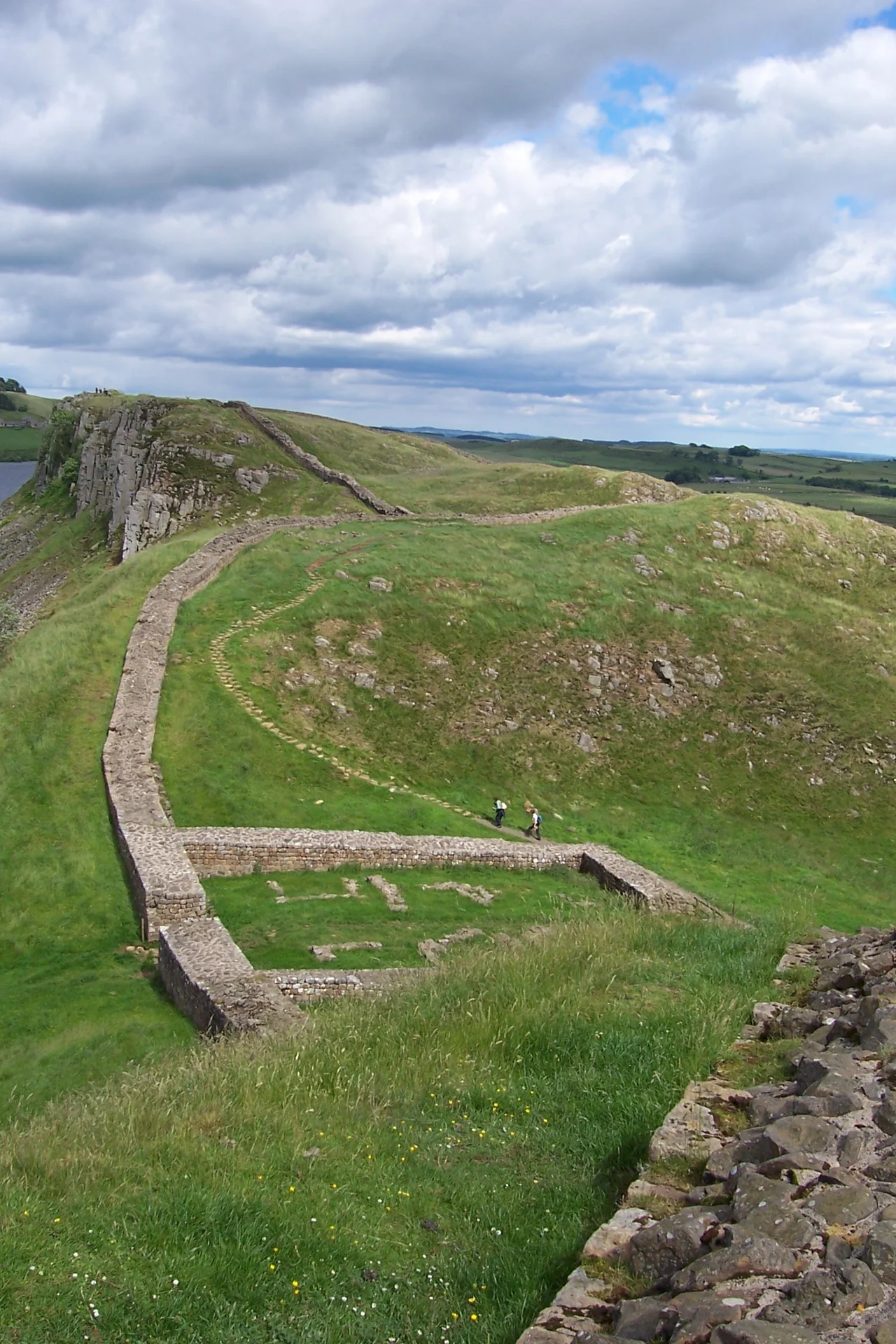
The path was designated Britain's fifteenth National Trail in 2003. It is part of the UNESCO Frontiers of the Roman Empire World Heritage Site, which links Hadrian's Wall with the Antonine Wall further north and the German limes. From Wallsend on the east coast to Bowness-on-Solway on the west, the trail crosses three modern counties: Tyne and Wear, Northumberland, and Cumbria. The eastern third runs through Newcastle and the urban Tyne valley, where the wall mostly survives as a buried foundation under streets and parks. The middle third climbs onto the Whin Sill, the dramatic basalt ridge where the wall and the cliff are sometimes the same thing. The western third descends through the Cumbrian hills to the salt marshes of the Solway Firth, ending at a small wooden shelter where walkers stamp their passport books and look across the water at Scotland.
The Highest Point
The summit of the trail is only 345 metres above sea level, at Winshield Crags above Once Brewed. By the standards of British long-distance paths, this is gentle terrain. The Pennine Way crosses the Hadrian's Wall Path here and climbs much higher, deeper into the wild moors. But the modest altitude of the Hadrian's Wall trail belies its character. The middle section, between Greenhead and Chollerford, is one of the most dramatic stretches of walking in England. The path runs along the very lip of the Whin Sill, with the cliff falling away to the north and farmland rolling south, and the Roman stones underfoot or to one side for most of the way. Walkers often describe it as a kind of horizontal pilgrimage, the same view that Roman sentries had two thousand years ago.
Mud and Memory
The walking is relatively easy by long-distance standards, but the wall path is famously muddy. Northumbrian peat does not forgive boots. The National Trails authority introduced a 'Walkers' Passport' system encouraging hikers to stamp their progress at participating cafés and pubs, partly as a souvenir and partly as a polite nudge to spread footfall and support local businesses along the route. The AD122 bus service, named for the year construction of the wall is believed to have begun, runs between Hexham and Haltwhistle and connects most of the major Roman sites, allowing walkers to drop in for a day or use it for emergency extraction when the weather turns. Most people walk west to east, putting the prevailing wind at their backs; others swear by east to west, finishing with the more dramatic scenery. There is no wrong direction.
Companions in Stone
The trail does not walk alone. Hadrian's Cycleway, a 170-mile route on the National Cycle Network, runs from Ravenglass on the Cumbrian coast to South Shields on the Tyne, partly parallel to the foot trail. The Coast to Coast Walk, another classic British long-distance route, lies somewhat to the south, running from St Bees to Robin Hood's Bay. For purists, the Antonine Wall further north in Scotland marked a brief Roman attempt to push the frontier even further. None of these companions match the Hadrian's Wall Path for the simple proposition it offers: a walk along a line drawn 1,900 years ago by an emperor who never wanted Britain to extend any further. To finish at Bowness-on-Solway and look across the firth at the hills the Romans decided not to conquer is to feel, briefly, the weight of that decision.
From the Air
Coordinates: 55.031°N, 2.128°W (mid-route, near Carrawburgh). The full trail runs east-west between Wallsend (54.985°N, 1.531°W, near Newcastle) and Bowness-on-Solway (54.957°N, 3.213°W). Recommended viewing altitude 2,000-4,000 ft AGL for the dramatic central Whin Sill section between Once Brewed and Housesteads. The B6318 Military Road parallels the trail through Northumberland. Nearest airports: Newcastle (EGNT) at the eastern end, Carlisle Lake District (EGNC) at the western end.
Nearby Stories
- Battle of Alnwick (1174) 5.7 km away
- Allenheads 5.8 km away
- Mitford Castle 6.4 km away
- Battle of Nesbit Moor (1355) 11 km away
- Battle of Arfderydd 12 km away
- Battle of Neville's Cross 13 km away
- Battle of Philiphaugh 19 km away
- Caldbeck 20 km away