Hakusan National Park
So many alpine flowers grow on Mount Haku that botanists started naming them after the mountain itself. Hakusan Kozakura, Hakusan Ichige, Hakusan Shakunage -- the list reads like a love letter from the plant kingdom to a single peak. At 2,702 meters, this dormant stratovolcano straddles the borders of four prefectures in central Honshu, and it has drawn pilgrims, monks, and naturalists upward for over thirteen centuries. The national park that surrounds it protects 480 square kilometers of terrain that shifts from warm temperate forest at its base to stark alpine meadows at its crown, a vertical journey through nearly every ecosystem Japan has to offer.
The Third Holy Mountain
Mount Haku stands alongside Mount Fuji and Mount Tate as one of Japan's Three Holy Mountains, a distinction rooted in Shugendo mountain worship. In 717, the monk Taicho became the first recorded person to reach its summit, opening the mountain to centuries of spiritual pilgrimage. Today, approximately 2,000 Hakusan shrines across Japan trace their lineage to the Shirayama Hime Shrine at the mountain's base in Ishikawa Prefecture, with a branch shrine perched near the summit itself. The name Hakusan means "White Mountain," earned from the heavy snowpack that lingers on its slopes well into summer, giving the peak a gleaming pale silhouette visible from cities across the Hokuriku coast.
Where Four Prefectures Converge
The park occupies a rare geographic position, spanning the borders of Fukui, Gifu, Ishikawa, and Toyama prefectures. This four-way meeting point reflects the mountain's role as a natural barrier and watershed in the Chubu region. Rivers born on its flanks flow in every direction -- north to the Sea of Japan, south toward the Pacific slope. The area first received quasi-national park designation in 1955, then full national park status in 1962. In 1980, UNESCO recognized the entire 480-square-kilometer park as a Man and the Biosphere Reserve, acknowledging the ecological importance of its intact forest-to-alpine gradient.
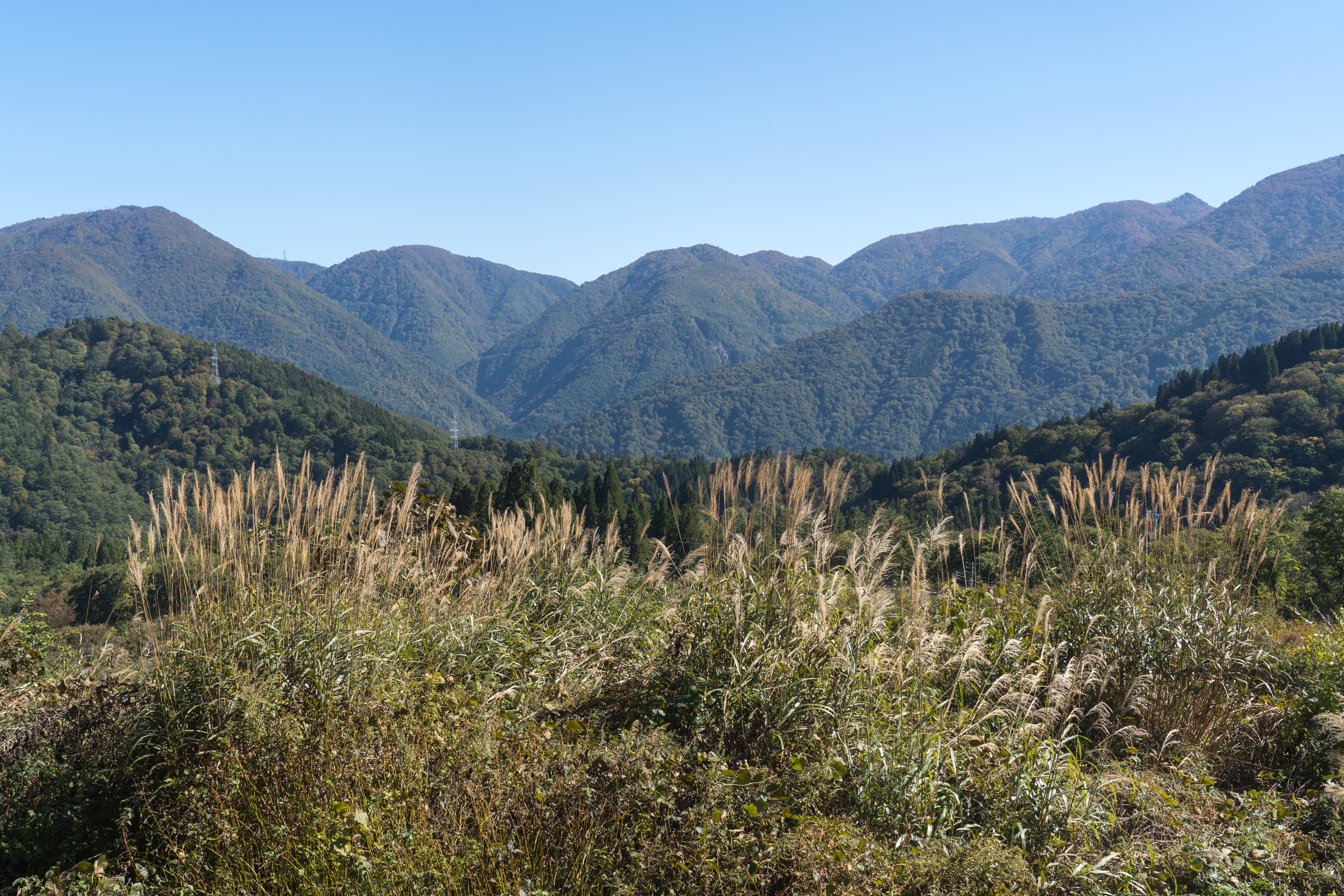
A Living Vertical Garden
From the lowland valleys upward, the park's vegetation tells a story of altitude. Coniferous forests of Maries fir, pine, and Japanese cedar blanket the mountain's base. Higher up, deciduous woodlands of Mongolian oak and Japanese beech take over, their canopies turning brilliant gold each autumn. Above the treeline, open alpine meadows explode with wildflowers during the brief summer season. Golden eagles and mountain hawk-eagles patrol the thermals, while the forests below shelter Japanese macaques, Asiatic black bears, Japanese serow, and sika deer. The biodiversity here is so concentrated that Hakusan serves as a living laboratory for Japanese alpine ecology.
Pilgrims and Hikers on Ancient Paths
The mountain's trails have been worn smooth by thirteen centuries of footsteps. What began as routes for Shugendo ascetics evolved into paths for Edo-period pilgrims, and today they carry hikers seeking views that stretch from the Japan Alps to the distant shimmer of the Sea of Japan. The peak climbing season runs from July through early October, with mountain huts offering overnight stays near the summit. Many hikers time their ascent for a dawn arrival at Gozenga-mine, the highest point, where sunrise illuminates the snowfields and volcanic ridgeline. Despite its spiritual prestige, Hakusan sees far fewer visitors than Mount Fuji, giving it a quieter, more contemplative atmosphere that its monk founders might still recognize.
From the Air
Located at 36.155N, 136.788E in the Chubu region of central Honshu. Mount Haku's summit reaches 2,702 meters (8,865 feet). The snowcapped peak is a prominent landmark visible from altitude, particularly its white summit contrasting against surrounding green forests. The park spans the intersection of Fukui, Gifu, Ishikawa, and Toyama prefectures. Nearest major airports include Komatsu Airport (RJNK) to the northwest and Chubu Centrair International Airport (RJGG) to the south. Weather conditions often include cloud cover on the peak; clear days offer exceptional visibility of the surrounding Japanese Alps.