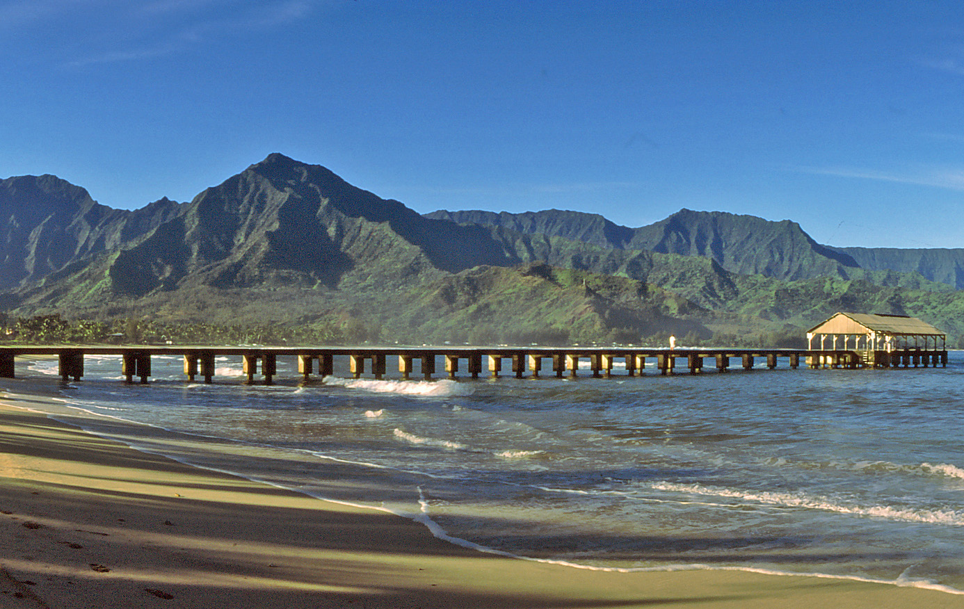
Hanalei Pier
Nobody ships rice from Hanalei Pier anymore. The last commercial cargo left in 1933, and the pier has spent the nine decades since becoming something more valuable than a loading dock. It juts into Hanalei Bay on Kauai's north shore, backed by emerald mountains that plunge toward the water in pleated ridges, and it draws people the way piers always do -- not for arrival or departure, but for the simple pleasure of standing over water at the edge of land.
From Taro to Rice
Ancient Hawaiians cultivated taro in the wetlands surrounding Hanalei Bay, using the rich alluvial flats where the Hanalei River meets the ocean. By the 1860s, as the Native Hawaiian population declined, ethnic Chinese workers whose contracts had expired on nearby sugarcane plantations -- including the one at Princeville, just north of the bay -- began farming the same land for a different crop. Rice flourished in the wet conditions, and Hanalei became a significant producer. The grain was shipped to Honolulu, where it ranked as the second-largest export crop in the Hawaiian Islands. The pier served as the essential link in this chain, the point where sacks of rice moved from shore to ship. But after Hawaii's annexation by the United States in 1898, island-grown rice could not compete with California's vast production, and shipments from Hanalei dwindled year by year until commercial use of the pier ended entirely.
The Gathering Place
What replaced commerce was community. Since 1933, when the last shipment departed, Hanalei Pier has served as a gathering place for the small town behind it. Fishermen cast from its planks. Swimmers jump from its end. Families watch the sun set over the bay's crescent of sand. A shed roof was added at the far end of the pier in the 1940s, providing shade and shelter that made it an even more natural place to linger. The pier's appeal is inseparable from its setting. Hanalei Bay curves in a wide half-moon between two headlands, with waterfalls visible on the mountain walls after a rain. The bay is protected enough for calm swimming in summer and exposed enough to receive substantial surf in winter. At the end of Weke Road, north of Route 560, the pier sits adjacent to the mouth of the Hanalei River, where a public boat landing provides access for both recreational and commercial vessels.
Lights, Camera, Hanalei
Hollywood discovered the pier and its bay early. In 1954, it served as the main filming location for Beachhead, and three years later, the surrounding landscape became the backdrop for the 1957 film South Pacific, one of the most successful movie musicals of its era. The mountain behind the bay, Mount Makana, became famous as the inspiration for the fictional island of Bali Ha'i. These connections cemented Hanalei's reputation as the archetype of tropical paradise in the American imagination, a place that looked exactly the way a South Pacific island was supposed to look. The pier itself, weathered and unpretentious, provided the kind of authentic texture that Hollywood set builders cannot replicate. On September 13, 1979, the pier was added to the National Register of Historic Places, recognized not for architectural distinction but for its role in the agricultural, commercial, and cultural history of Kauai's north shore.
Still Standing
The pier has been maintained and repaired over the decades, surviving the same storms and salt corrosion that have claimed less resilient structures along Hawaii's coastlines. It remains a working piece of infrastructure in the sense that it is used daily, though its work is now entirely social. The adjacent Hanalei River mouth provides the only navigable waterway access on the north shore, making the area a hub for kayakers, stand-up paddleboarders, and small boat operators. The transition from shipping dock to community landmark happened organically, without any preservation campaign or adaptive reuse plan. The pier simply outlasted its original purpose and found a new one, the way the best public spaces always do. It endures because people keep showing up, the way Hanalei Bay endures because the mountains keep sending water down to meet the sea.
From the Air
Located at 22.21°N, 159.50°W on Kauai's north shore, extending into Hanalei Bay. The pier is visible from low altitude as a thin line extending from the shoreline into the crescent-shaped bay. Best viewed at 1,000-1,500 feet AGL approaching from the east along the north shore. Hanalei Bay's distinctive half-moon shape is an excellent visual landmark. Nearby airport: Lihue Airport (PHLI), approximately 15 nm southeast. The mouth of the Hanalei River is immediately adjacent. Terrain rises sharply to the south and west toward the Na Pali cliffs.