Hanna Lake
The lake vanished in 1999. For six years, the bed of Hanna Lake sat exposed to the Balochistan sun -- cracked earth where turquoise water had been, silence where migratory birds once gathered by the hundreds. Then the rains returned, and by 2011 the reservoir filled again, its surface reflecting the sandy brown ridgelines of the Zarghoon Ghar and Koh-i-Murdaar mountains as though nothing had happened. This cycle of death and resurrection defines Hanna Lake more than any single moment in its history. Seventeen kilometers east of Quetta, where the Urak Valley opens into the hills, the lake exists in a state of permanent negotiation between snowmelt, infrastructure, and neglect.
The Red Bridge and the British Design
In 1894, British engineers built a small diversion dam called Surrpull -- the Red Bridge -- on the main Urak road. Its purpose was straightforward: catch the catastrophic snowmelt and rainwater pouring down from the Zarghoon Ghar and Murdaar mountains, and channel it through a main canal into Hanna Lake. At the time, the reservoir spread over 818 acres and held more than 220 million gallons of water, reaching depths of 49 feet. A supplementary channel was constructed simultaneously to capture surplus flow from near Spin Kaarez, on the Murdaar Mountain side. The system worked as designed for decades, turning seasonal violence into stored abundance. But infrastructure built for colonial purposes requires maintenance that outlasts colonial interest, and that is precisely the story of everything that followed.
The Floods That Took the Canals
A heavy flood in 1973 destroyed the Murdaar Mountains recharge canal that fed water to Surrpull from the Spin Kaarez road. It was never reconstructed. Three years later, in 1976, another flood wrecked the supplementary channel on the Murdaar Mount side -- the one the British had built to capture surplus snow and rain. That channel was not rebuilt either. Without these two arterial connections, snowmelt and rainwater that had sustained the lake for nearly a century simply flowed off into the desert. The consequences arrived slowly and then all at once. By 1999, Hanna Lake was completely dry. It stayed that way until January 2005. In 2010, it dried up again. Then in May 2016, a flood filled the Surrpull dam itself with mud and stones, choking off the last functioning connection. Thousands of fish died. Hundreds of migratory birds lost their stopover. The ecosystem that had taken a century to develop around the reservoir collapsed.
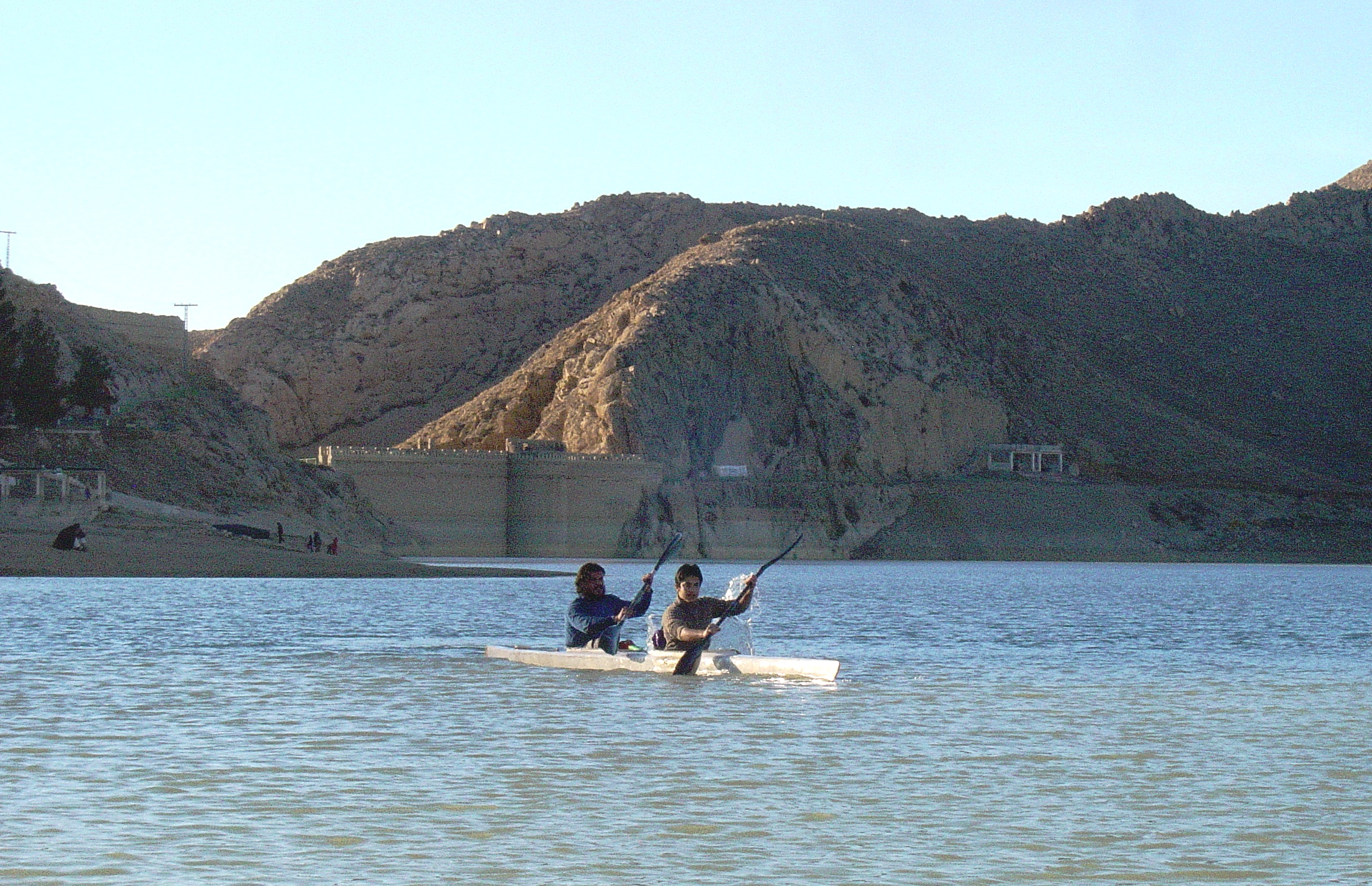
Kayaks on a Disappearing Lake
In 1986, while the canals were still damaged but the lake still held water, a mountaineer and caver named Hayatullah Khan Durrani established the Hayat Durrani Water Sports Academy on his ranch near the lake's northwestern edge. Inaugurated on 14 August -- Pakistan's Independence Day -- HDWSA became Balochistan's first and only academy for rowing, canoeing, kayaking, and sailing. Durrani offered training and equipment free of cost to young athletes. National kayak champions trained on these waters. But the academy's story is inseparable from the lake's decline: when Hanna dried between 1999 and 2005, and again in 2010, there was nothing to paddle on. The national and international canoe, kayak, and rowing teams lost their practice venue entirely.
A Boat Capsized on a Holiday
On 6 July 1990, an overcrowded tourist boat capsized on Hanna Lake, killing 40 people and injuring 8. Most of the victims were on holiday -- families who had come to the water to escape the heat. Another boat was used to pull survivors from the lake. The disaster exposed what the region's geography already suggested: Hanna Lake was a place people needed, a rare body of water in an arid province where summer temperatures make indoor life feel punitive. The lake served not just as a reservoir but as a public commons, a place where Quetta's residents could promenade on terraces, hire a boat, and paddle around the small island at the lake's center.
The Custodians Hold the Line
The government of Balochistan, by most accounts, did little to restore the water infrastructure. It was Durrani's HDWSA and the Hanna Lake Development Authority who took on the role of custodians, restoring water flow through the surplus canal to keep the reservoir alive. In February 2019, the Surrpull dam was locally desilted with the assistance of Hashim Khan Ghalzai and Durrani's team. Since then, floodwater from the Zarghoon mountains has once again reached Hanna Lake, and water levels have risen by roughly 50 percent. When the lake fills, its turquoise surface against the sandy hills creates a contrast so vivid it looks fabricated. When it empties, the contrast is equally stark -- a basin of cracked earth surrounded by mountains that have no intention of sending their water anywhere useful without human intervention. Hanna Lake persists not because the landscape guarantees it, but because people keep insisting it should.
From the Air
Located at 30.256N, 67.100E in the hills east of Quetta, Balochistan, Pakistan. The lake is visible as a turquoise water feature (when filled) or a dry basin (when empty) nestled in the foothills where the Urak Valley begins. Nearest airport is Quetta International Airport (OPQT), approximately 17 km to the west. Best viewed at 3,000-5,000 feet AGL. The Zarghoon Ghar mountains rise to the north and the Koh-i-Murdaar range to the south, framing the lake basin.