Harajuku
Before the teenagers with rainbow hair and platform boots, before the Gothic Lolitas posing on Jingu Bridge and the takenoko-zoku dance crews shaking Takeshita Street, this neighborhood belonged to ninja. In 1590, after helping Tokugawa Ieyasu escape safely from Sakai to Mikawa during the Honno-ji Incident of 1582, Iga ninja received the villages of Harajuku-mura and Onden-mura as a reward. They established a residence here to defend the southern approach to Edo along the Koshu Road. Four centuries later, Harajuku defends nothing except its reputation as the epicenter of Japanese street fashion -- a reputation earned not through any single designer or brand, but through the sheer creative energy of young people who have been reinventing this district in their own image since the 1970s.
Watermill Village to Warzone
For most of its history, Harajuku was unremarkable. In the pre-Edo period, it was a small post town on the Kamakura Highway. The artist Hokusai painted the watermill at Onden, a tributary of the Shibuya River, as part of his famous Thirty-six Views of Mount Fuji series -- a beautiful image of a place that, in reality, struggled to feed itself. The soil was poor, rice harvests meager, and local farmers resorted to rain-making invocations at shrines to improve their fortunes. The Meiji period brought transformation: Harajuku Station opened in 1906 as part of the Yamanote Line expansion, and in 1919, the construction of Meiji Shrine turned the boulevard of Omotesando into a formal approach road, widened and lined with zelkova trees. In 1943, Togo Shrine was consecrated in honor of Admiral Togo Heihachiro. Two years later, American firebombing reduced much of the area to ash.
Washington Heights and the American Imprint
The postwar American occupation reshaped Harajuku as thoroughly as the firebombing had. On the land that would later become Yoyogi Park and the Yoyogi National Gymnasium, the U.S. military built Washington Heights, a residential complex for soldiers and their families. American consumer culture seeped into the surrounding streets. Shops catering to GIs opened along Omotesando -- Kiddyland, Oriental Bazaar, and the Fuji Tori among them. When the 1964 Tokyo Olympics arrived, Kenzo Tange's sweeping concrete Yoyogi National Gymnasium hosted the swimming, diving, and basketball events just steps from where the military housing had stood. Washington Heights was demolished, and Yoyogi Park rose in its place. But the Western commercial sensibility planted during the occupation had already taken root in the neighborhood's DNA.
The Sunday Kingdoms
Starting in 1977, local authorities closed Harajuku's roads to traffic every Sunday, creating a pedestrian precinct that became a stage for Tokyo's youth subcultures. Rock and roll bands played impromptu sets near the entrances to Yoyogi Park, drawing crowds that swelled to 10,000 people at their peak. In the 1980s, Takeshita Street became the territory of the takenoko-zoku, teenage dance troupes in wildly colorful outfits who performed choreographed routines to boombox music. Laforet Harajuku, the fashion building that opened in 1978 on Meiji Street, anchored the neighborhood's identity as a retail destination. Jingu Bashi, the pedestrian bridge between Harajuku Station and Meiji Shrine, evolved into a weekly showcase where Gothic Lolitas, visual kei fans, and cosplayers posed for photographers. The Sunday pedestrian zone was abolished in 1998, but by then the subcultures had already made Harajuku world-famous.
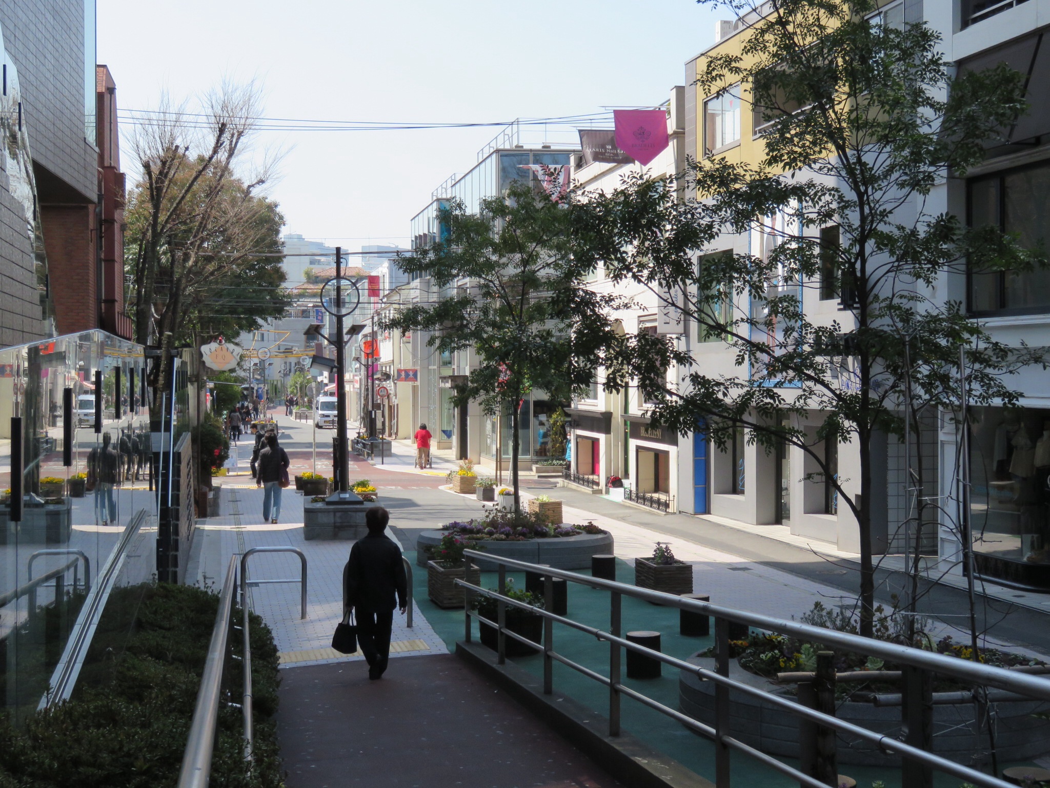
Fast Fashion and the Backstreets
The 1990s and 2000s brought a wave of international retailers. Gap, Forever 21, Uniqlo, Topshop, and H&M opened flagship stores along Omotesando, transforming the tree-lined boulevard into one of Tokyo's most prestigious shopping addresses. In 2006, Omotesando Hills replaced the beloved 1927 Dojunkai Apartments with a sleek complex designed by Tadao Ando. Meanwhile, independent boutiques and trend shops pushed into the residential backstreets of Jingumae 3 and 4 chome, creating the district known as Ura-Harajuku -- literally the "Harajuku Backstreets." Cat Street, a narrow lane following the path of a buried river, became a destination in its own right, lined with vintage shops, small-batch sneaker stores, and cafes. The official name Harajuku was actually changed to Jingumae in the Japanese address system back in 1965, but nobody uses it. The station kept the old name, and so did the world.
From the Air
Located at 35.669N, 139.705E in the Shibuya ward of central Tokyo. From the air, Harajuku is identifiable by its position between the enormous green rectangle of Yoyogi Park and Meiji Shrine's forested grounds to the west and the dense urban grid of Shibuya to the south. The tree-lined boulevard of Omotesando runs diagonally through the district. The distinctive swooping roof of Kenzo Tange's Yoyogi National Gymnasium is a landmark visible at medium altitudes. Nearest major airport: Tokyo Haneda (RJTT) approximately 10nm south-southwest. Tokyo Narita (RJAA) is approximately 37nm east. Recommended viewing altitude: 3,000-5,000 feet to see the contrast between the shrine forest and surrounding urban density.