Hardangervidda National Park
Somewhere around 7,000 BC, a hunter crouched beside a fire on the Hardangervidda plateau, gnawing roasted reindeer bone. We know this because archaeologists found that bone, charred and discarded, in a hearth that radiocarbon dating places among the oldest evidence of human presence on this vast highland. Nearly ten thousand years later, the reindeer still cross the same terrain, and the plateau still feels like a place that belongs more to wind and weather than to any human calendar. Hardangervidda is Norway's largest national park, covering 3,422 square kilometers of treeless moorland at an average elevation of 1,100 meters. It is also Europe's largest mountain plateau, a peneplain stretching roughly 6,500 square kilometers when measured beyond the park boundaries. The word vidde means 'wide plain, large mountain plateau,' and standing anywhere on the Hardangervidda, you understand why the name needed no embellishment.
A Land Shaped by Ice and Deep Time
The bedrock beneath your feet is Precambrian and Cambro-Silurian in origin, among the most ancient exposed geology in Scandinavia. What you see, though, is the work of glaciers. The rolling fells are remnants of mountains that ice ground down during successive ice ages, smoothing peaks into undulations and scooping out thousands of pools, lakes, rivers, and streams. The highest point is the Hardangerjokulen glacier, reaching 1,863 meters, its ice cap visible across the plateau like a white crown. To the west, the landscape is rocky and bare, battered by annual rainfall exceeding 1,000 millimeters. The eastern side is flatter and more vegetated, sheltered from the Atlantic moisture. The prominent peak of Harteigen, at 1,690 meters, stands like a lonely sentinel visible from much of the plateau, its flat summit a remnant of the ancient peneplain surface that glaciers failed to erase.
The Reindeer Roads
Hardangervidda's wild reindeer herds are among the largest in the world, fluctuating between 5,000 and 32,000 animals over the past half-century. The plateau hosts the southernmost populations of several arctic species, a biological outpost where arctic fox, snowy owl, and alpine plants survive at latitudes where they have vanished elsewhere. More than 250 Stone Age sites have been discovered here, along with Iron Age house foundations and medieval stone huts, all connected to one constant: the reindeer migration. Ancient trails crisscross the plateau linking western and eastern Norway, paths worn first by animals and then by the people who followed them. The Nordmannsslepa, one of the oldest documented routes in Norway, connects Eidfjord in Hardanger with the Numedal valley, a journey that has been walked for millennia. In August 2016, lightning killed more than 300 reindeer in a single strike on the plateau, a tragedy that made global headlines and underscored the raw, elemental power of this landscape.
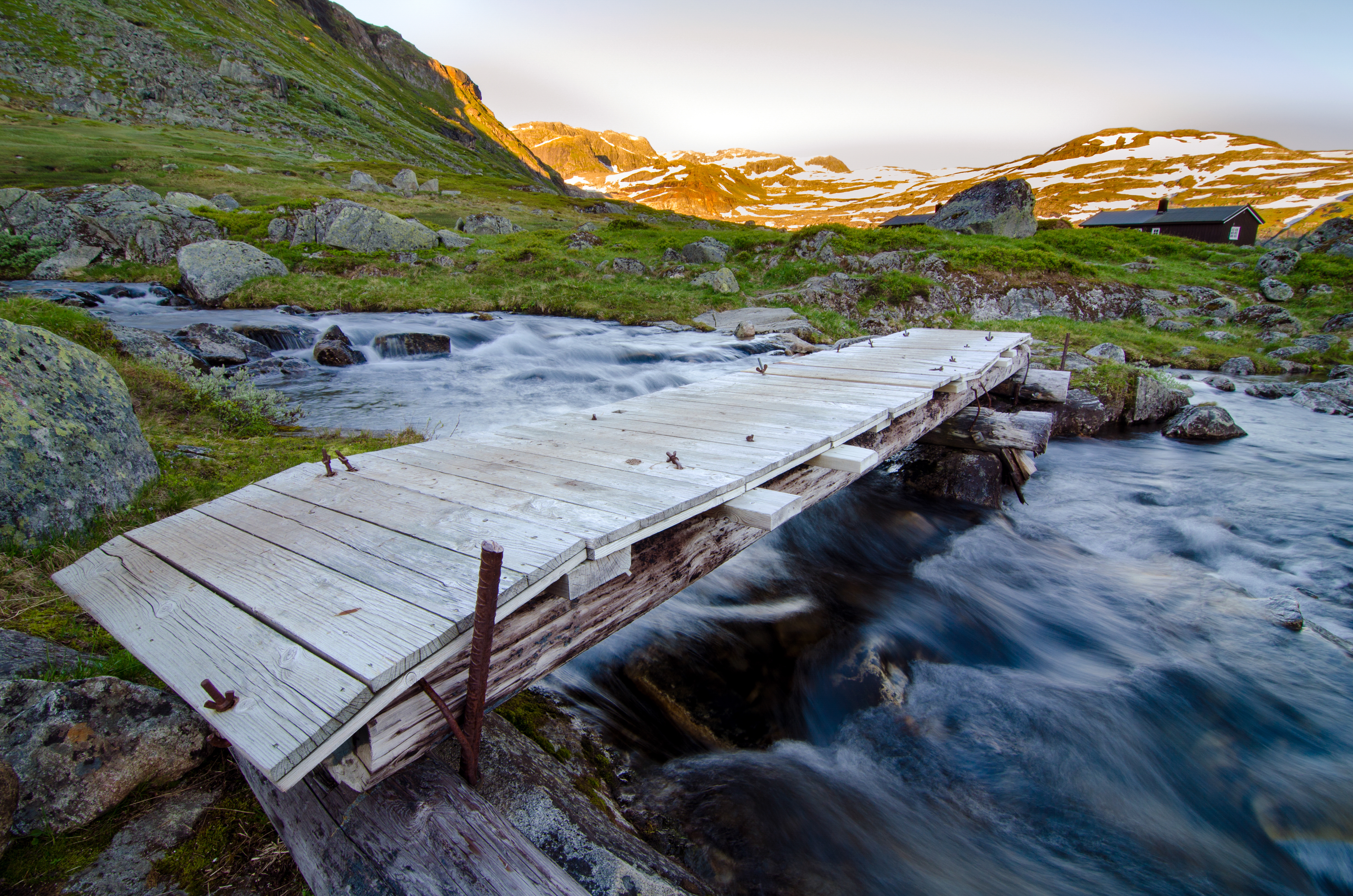
Crossing the Plateau
Two modern arteries cross the Hardangervidda in ways that would have astonished the Stone Age hunters. The Bergen Line railway, completed in 1909, runs across the northern edge of the plateau, connecting Oslo and Bergen through some of the highest and most exposed terrain on any European rail line. Norwegian National Road 7 follows a route across the central plateau, climbing through Eidfjord and descending toward the eastern valleys. Both routes close periodically in winter when storms reduce visibility to nothing. The Norwegian Mountain Touring Association, known by its initials DNT, maintains an extensive network of huts and marked paths across the Hardangervidda, making it one of Norway's most popular hiking and cross-country skiing destinations. The hut-to-hut system means trekkers can walk for days without carrying a tent, sleeping in staffed or self-service cabins spaced a day's walk apart. In summer, the plateau's endless daylight and open horizons draw thousands of hikers. In winter, it becomes a white expanse where the only movement is the wind reshaping snow into sculpted drifts.
A Park Designated, a Landscape Enduring
Hardangervidda was designated a national park in 1981, spanning territory across six municipalities in the counties of Buskerud, Vestland, and Telemark. The designation formalized protections for a landscape that had been shaped by millennia of light human touch. Unlike many national parks, the Hardangervidda's appeal is not in dramatic peaks or dense forests but in its sheer openness, a landscape where the sky is the dominant feature and the horizon seems to curve with the earth. Fishing in the plateau's countless lakes and streams remains a beloved tradition, the waters stocked with wild trout that thrive in the cold, clear runoff from snowfields. From the air, the plateau reads as a vast brown-and-green patchwork in summer, threaded with silver waterways, and a featureless white sheet in winter. It is a place that rewards patience and punishes the unprepared, much as it has for the past eight thousand years.
From the Air
Located at 60.13N, 7.50E in southern Norway. The plateau is visible as a vast, treeless highland between the fjords to the west and eastern valleys. Look for the white cap of Hardangerjokulen glacier at 1,863m and the distinctive flat-topped peak of Harteigen. The Bergen Line railway crosses the northern edge. Nearest airports include Bergen/Flesland (ENBR) to the west and Oslo/Gardermoen (ENGM) to the east. Recommended viewing altitude: 3,000-5,000 meters for plateau overview. Weather can change rapidly with low clouds and poor visibility common.