Harpers Ferry: Where the Civil War Began
John Brown was already famous as 'Bloody Kansas' before he arrived at Harpers Ferry with 21 men on October 16, 1859. His plan was audacious: seize the federal armory, arm enslaved people from surrounding plantations, and spark a rebellion that would destroy slavery. The plan failed within 36 hours; Brown was captured, tried, and hanged. But his raid electrified the nation - terrifying the South, inspiring the North, convincing both sides that war was coming. When it came, Harpers Ferry's position at the confluence of rivers and transportation routes made it a strategic prize. It changed hands eight times during the Civil War. The town where the war arguably began was nearly destroyed by it.
The Raid
Brown and his raiders - including three of his sons and five Black men - struck on Sunday night, seizing the armory and federal arsenal with minimal resistance. They took hostages, including George Washington's great-grandnephew. Then they waited for enslaved people to rise and join them. No uprising came. Local militia pinned the raiders in the armory engine house. By Tuesday morning, a company of U.S. Marines under Colonel Robert E. Lee stormed the building. Ten raiders died, including two of Brown's sons. Brown was wounded, captured, and eventually hanged at nearby Charles Town. The raid had lasted 36 hours and accomplished nothing military.
The Consequences
The military failure was political success. Brown's trial and execution made him a martyr to abolitionists and a terrorist to slaveholders. His willingness to die for the cause inspired Northerners; his willingness to arm enslaved people terrified the South. The raid deepened sectional distrust beyond repair. When Lincoln was elected in 1860, Southern states cited fears of Northern-supported rebellions by enslaved people in their secession declarations. Brown's raid didn't cause the Civil War - the conflict's roots ran deeper - but it accelerated the collision. His last words, written the morning of his hanging, proved prophetic: 'the crimes of this guilty land will never be purged away but with blood.'
The War
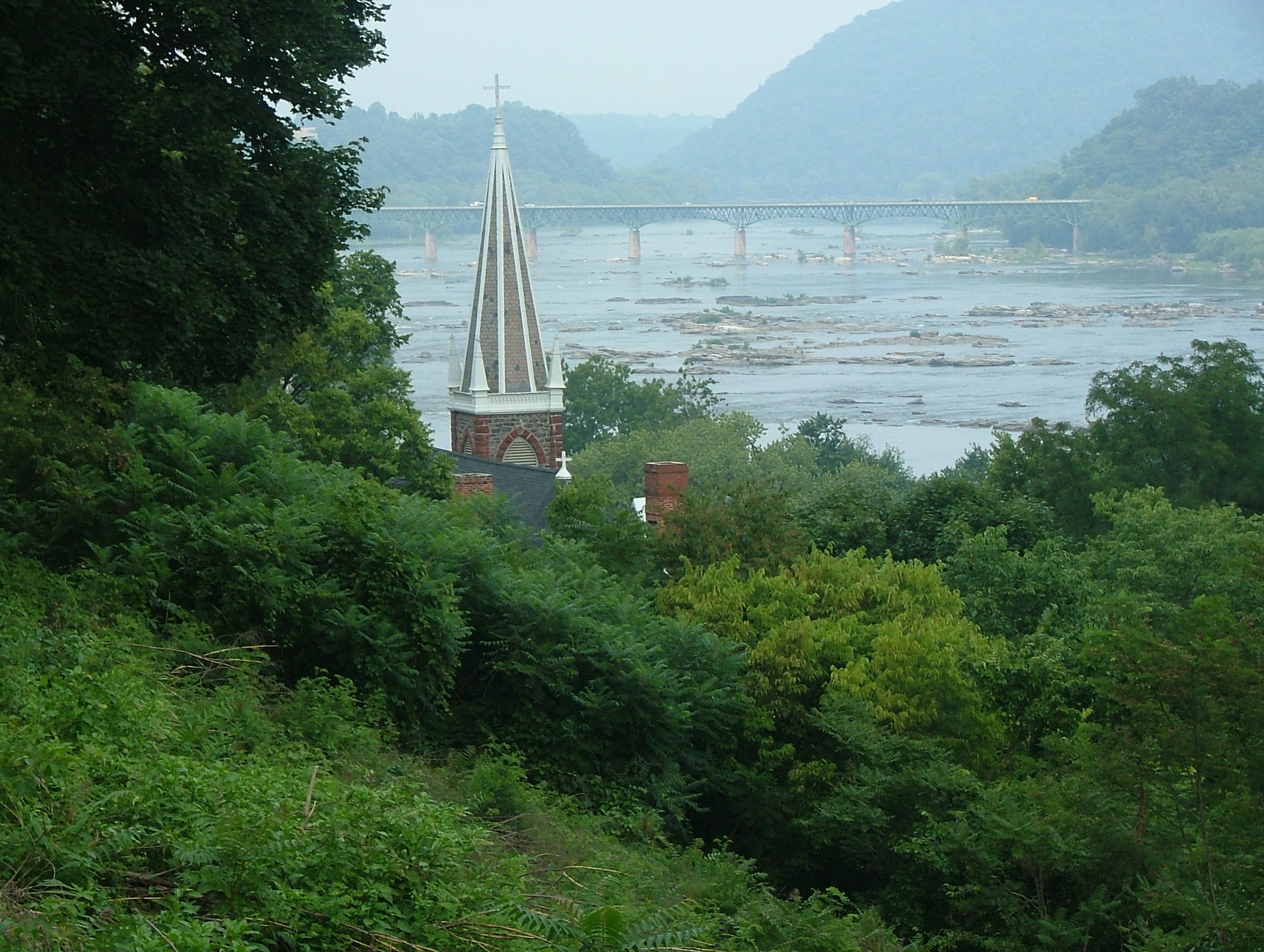
Harpers Ferry's geography made it indefensible and unavoidable. The town sits where the Potomac and Shenandoah rivers meet, surrounded by heights that command the valley. Whoever held those heights controlled the town; holding the heights required troops better used elsewhere. Control of the B&O Railroad and access to the Shenandoah Valley made the town strategically vital. It changed hands eight times during the Civil War. The largest surrender of Federal troops before the Civil War occurred here in 1862 when Stonewall Jackson captured 12,000 men. The town was wrecked by bombardment and occupation, then rebuilt, then wrecked again.
The Legacy
Harpers Ferry emerged from the war depopulated and damaged. Recovery was slow; floods compounded the destruction. The town became a backwater until the National Park Service began preservation in 1944. Today Harpers Ferry National Historical Park interprets multiple chapters: the armory that Brown seized, the Civil War battlefield, the freed people's education initiatives that followed emancipation. Storer College, established in 1867 to educate formerly enslaved people, operated here until 1955. W.E.B. Du Bois chose Harpers Ferry for the 1906 meeting that led to the NAACP's founding - deliberately honoring Brown's sacrifice. The town's layered history resists simple narrative.
Visiting Harpers Ferry
Harpers Ferry National Historical Park is located in West Virginia at the confluence of the Potomac and Shenandoah rivers, approximately 65 miles northwest of Washington, D.C. The park visitor center is outside town; shuttles transport visitors to the historic district. The lower town preserves antebellum and Civil War era buildings. John Brown's Fort (the engine house, relocated) is a key site. Heights above town offer battlefield perspectives. The Appalachian Trail crosses the rivers here; day hiking is excellent. Allow a full day for comprehensive exploration. The town's dramatic setting - rivers, mountains, layered history - makes it one of the most evocative historic sites in the eastern United States.
From the Air
Located at 39.32°N, 77.73°W at the confluence of the Potomac and Shenandoah rivers in West Virginia's eastern panhandle. From altitude, Harpers Ferry's geography is immediately apparent: two rivers meeting at the point of a peninsula, mountains rising on all sides. The town occupies the low ground between the waters. The railroad bridges crossing the rivers are visible. Maryland Heights rises to the north; Loudoun Heights to the south. The strategic significance is obvious from altitude - this is a chokepoint where water gaps pierce the mountains, a natural crossroads. Washington, D.C., is visible to the southeast. What John Brown saw as his fortress is visible as what it was: a trap, defensible only until surrounded.