Harvey Airfield: A Family Airport on the Floodplain
The first airplane to touch down on the Harvey family's farmland did so in 1911, when a barnstormer landed in what was then a field beside the Snohomish River. Thirty-three years later, Noble and Eldon Harvey looked at that same stretch of flat ground northeast of Seattle and saw something more permanent than a stunt. In 1944, with their partner Wesley Loback, they established Harvey Airfield - a grass strip carved from the family property in Snohomish, Washington. Eight decades on, the airport is still there, still family-owned, still tucked into the floodplain with 261 aircraft calling it home. It is the kind of place where the spirit of general aviation's golden age refuses to yield to the strip malls and subdivisions pressing in from every side.
Three Generations on the Runway
The Harvey family added a restaurant, an administration building, and a maintenance shop in 1947, turning their airstrip into a proper operation. Eldon and his wife Marjorie ran the field for decades before Richard and Kandace Harvey took over in the early 1970s, bringing the second generation into management. When Richard died of cancer in 1995, Kandace assumed ownership and continued running the airport with their four children - a family absorbing a loss and carrying forward anyway. That continuity matters. In an era when small airports across America are being sold off to developers, Harvey Field's survival as a family enterprise is itself a form of resistance. The asphalt runway was resurfaced in 2021, the first makeover in 40 years, a signal that the family intends to keep flying.
Living with the River
Harvey Airfield sits in the floodplain of the Snohomish River, and the river has opinions about that arrangement. A major flood in 1990 submerged the runway, a reminder that flat ground beside a river is flat for a reason. A levee constructed in 1995 offered some protection, but the airport's relationship with the water is ongoing and uneasy. In 2024, the Harveys proposed replacing the existing runway with a shorter 2,400-foot strip shifted south and west to improve visibility during approaches. The project would require rerouting Airport Way along the property's southern boundary - a proposal that drew pushback from neighbors already wary of the airport's presence in a growing community. The tension between an airport that predates the surrounding development and the development that now surrounds it is a familiar story at small fields across the country.
Under the Veil
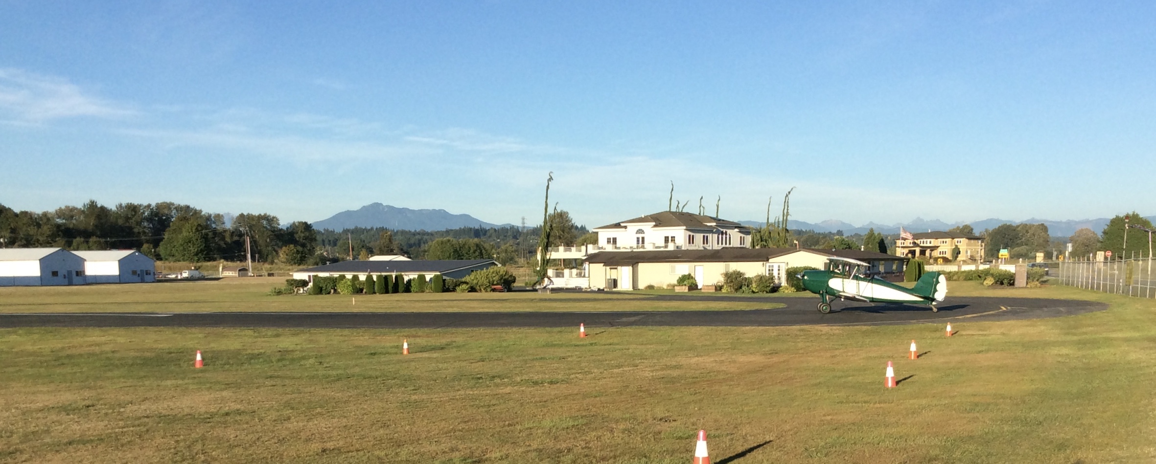
For pilots, Harvey Field occupies a particular niche in the Puget Sound airspace. Its identifier is S43 - a designation that marks it as a state or private facility rather than a federal one. The airport sits outside the Class B airspace surrounding Seattle-Tacoma International Airport but falls beneath the 30-nautical-mile "veil" that requires aircraft with electrical systems to carry altitude-encoding transponders. It is a subtle boundary, invisible from the ground, that shapes every departure and arrival. The field offers two runways: a 2,671-foot asphalt strip and a 2,430-foot turf runway, plus fourteen hangar bays housing those 261 based aircraft. Nine helicopters and nine multi-engine planes share the ramp with single-engine trainers and weekend flyers. Nineteen businesses operate on the property, including a hot-air balloon charter - a detail that captures the airport's eclectic, come-as-you-are character.
Where Aviators Are Made
Harvey Field is, at its heart, a place where people learn to fly. Flight training in small airplanes and helicopters has been the airport's bread and butter since the Harvey family first welcomed students onto the field. The Snohomish Flying Service and other operators based here introduce hundreds of student pilots to the rituals of preflight inspection, crosswind landings, and the particular challenge of operating from a short runway bordered by a river valley. As a fixed-base operator, the field also sells avgas and provides aircraft maintenance - the essential services that keep general aviation running at the local level. From the air, Harvey Field is easy to spot: a narrow strip of pavement in the Snohomish River valley, surrounded by green farmland giving way to suburban rooftops, with the Cascade foothills rising to the east. It looks small because it is small. That is precisely the point.
From the Air
Located at 47.908N, 122.105W in Snohomish, Washington. Airport identifier S43. One 2,671-foot asphalt runway and one 2,430-foot turf runway, oriented in the Snohomish River valley. Elevation approximately 22 feet MSL. The field is outside Seattle-Tacoma (KSEA) Class B airspace but under the 30nm Mode C veil - transponder with altitude encoding required for electrically equipped aircraft. Traffic pattern altitude typically 1,000 feet AGL. No control tower; use CTAF 123.0. The airport is visible as a narrow strip in the valley floor with the Snohomish River bending nearby. Nearest towered airport: Paine Field (KPAE), approximately 8 miles west. Arlington Municipal Airport (KAWO) is roughly 10 miles north. Best viewed from 2,000-3,000 feet to see the field's relationship to the river floodplain and surrounding valley.