Hatgyi Dam
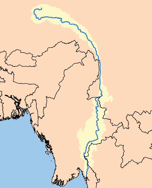
The Salween River has flowed through Karen State for millennia without a dam. At least thirteen indigenous groups live along its banks, fishing its waters, farming its floodplains, and navigating its currents between Myanmar and Thailand. The Hatgyi Dam project proposes to change that -- a massive gravity dam 33 kilometers downstream of where the Moei River meets the Salween, designed to generate up to 1,500 megawatts of electricity, the vast majority of which would be exported to Thailand. The dam does not yet exist. But the conflict around it has been reshaping the region for years.
Power for Export, Consequences for Home
The Hatgyi Dam is a joint venture funded by Thailand's Electricity Generating Authority (EGAT), China's Sinohydro Corporation, and Myanmar's Ministry of Electric Power alongside the International Group of Entrepreneurs (IGE). EGAT, a Thai government-owned company that has been building dams since 1964, would receive the bulk of the generated power. The arrangement follows a familiar pattern in the region: energy infrastructure built in one country to serve the grid of another, with the communities nearest the construction bearing the heaviest costs. The dam site sits in the Myaing Gyi Ngu area of Hlaing Bwe Township, an area that is both ethnically diverse and ecologically sensitive. For the Karen villagers who live there, the project represents the arrival of outside interests in a landscape they have managed, and fought over, for generations.
Nine Villages Under Water
In 2013, the Karen National Union informed local villagers that nine Karen villages would be flooded and damaged if the Hatgyi Dam were built. The prospect of displacement is not abstract here -- these are communities with homes, farms, and histories rooted in the Salween's floodplain. Paul Sein Twa, director of the Karen Environmental and Social Action Network (KESAN), stated plainly that local people do not want dams on the Salween without the free, prior, and informed consent of impacted communities. An open letter from the Karen Rivers Watch echoed the point: there had been little consultation with affected communities, and the majority of local populations opposed the project. The criticism is not merely about water levels. It is about who decides what happens to a landscape, and whether the people who live on it get any say.
Soldiers at the Dam Site
The Hatgyi Dam has become entangled with Myanmar's longest-running civil conflict. International Rivers has documented how the project has obstructed peace negotiations between the Karen National Union (KNU) and the Myanmar Army. A temporary ceasefire was signed between the two sides, but within months witnesses reported eight army battalions near the dam site -- a buildup that locals and Karen leaders interpreted as protection for the construction, not for the peace. The Democratic Karen Buddhist Army (DKBA) was forced to evacuate the dam area. Colonel Saw Maung Kyar, the DKBA's tactical operations commander, warned that problems would worsen if the government used the dam as an excuse to increase its military presence. Naw Paw Gay of the Karen Rivers Watch described what that presence means in practice: forced labor, villagers compelled to carry military rations and ammunition, and civilians ordered to lead soldiers through mined areas. The dam, in this telling, is not just infrastructure. It is a pretext for military control over contested territory.
A River on a Fault Line
The environmental stakes are as high as the political ones. The Salween is one of the longest free-flowing rivers in Southeast Asia, and the Hatgyi Dam site sits near an active geological fault line. Environmental researcher Steve Thompson of KESAN warned that the dam could wipe out many or most riverine fish species, with serious consequences for villagers who depend on the river for food and livelihood. The Karen Rivers Watch described the site as an ecologically sensitive area. Environmental assessments have flagged risks of flooding, biodiversity loss, soil degradation, pollution, and deforestation. The Salween's value is not only ecological. For the indigenous communities along its banks, the river is a transportation route, a food source, a cultural anchor, and a boundary that has defined territorial identity for centuries. Damming it would not merely alter a waterway. It would restructure the relationship between a people and the landscape they call home.
From the Air
Located at 17.53N, 97.75E in Karen State, southeastern Myanmar, at the proposed dam site on the Salween River roughly 33 km downstream of its confluence with the Moei River. The Salween gorge is visible from altitude as a deep river valley cutting through dense forest in the Dawna Range along the Thai-Myanmar border. Nearest airport is Mae Sot (VTPM) on the Thai side, approximately 80 km to the south. Yangon International Airport (VYYY) is roughly 300 km to the west. Terrain is rugged and mountainous. Best visibility in the dry season (November to March).