Heerenlogement
The oldest legible name on the cave wall belongs to Simon van der Stel, Commander of the Cape Colony, who scratched it into the rock in 1685. Beneath and beside it, roughly 130 other visitors left their marks over the next two centuries -- names, dates, initials, and occasionally nothing at all, just the evidence of a campfire and a night spent out of the wind. Heerenlogement, the "Gentlemen's Cave," sits about 30 kilometers north of Graafwater in the Cederberg municipality of the Western Cape, and it served for generations as what it still looks like: a convenient place to sleep on a long journey through difficult country.
Gold Seekers and the First Europeans
The first Europeans to find the cave were not looking for shelter. In November 1682, Olof Bergh led a Dutch East India Company expedition through this part of the Cederberg in search of the legendary gold fields of Monomotapa -- the fabled kingdom of Mutapa, whose mineral wealth had drawn European ambitions northward since the Portuguese first heard rumors of it. Bergh and his company came across the cave and used it, though Bergh himself did not carve his name as so many after him would. Three years later, Simon van der Stel passed through and left the inscription that survives as the oldest visible marking. Another early name belongs to Kaie Jesse Slotsbo, dated 1712. The cave became a known waypoint, a landmark passed from one traveler's account to the next.
A Guest Book in Stone
Over the following centuries, approximately 130 visitors inscribed their names on the cave walls, along with the dates of their passage. Thirty left only their names without dates; thirteen more carved just their initials. The result is an accidental guest book spanning the colonial and early modern periods of the Western Cape -- a record not of great events but of ordinary movement through a landscape that resisted easy travel. Each inscription represents a night spent in the cave: someone arriving on horseback or by wagon, building a fire against the cold Cederberg evenings, and deciding that the moment was worth recording. The University of Cape Town's Archive and Public Culture Research Initiative has documented these markings, treating the cave as both archaeological site and social archive.
Layers of Conflict
Near the cave stands an old iron British fort dating from the Second Boer War, a reminder that this remote corner of the Cederberg was touched by the broader conflicts that shaped South Africa. The Boer War reached even these mountains: guerrilla commandos from the Boer republics penetrated southward hoping to rally local Dutch-descended farmers, while the British fortified strategic points along travel routes. The fort near Heerenlogement is a small, utilitarian structure -- nothing like the grand blockhouse lines further north -- but its presence next to a cave full of 17th-century inscriptions compresses three centuries of colonial ambition into a single viewshed. The cave sheltered travelers seeking gold; the fort guarded a route contested by empires.
Still Standing, Still Legible
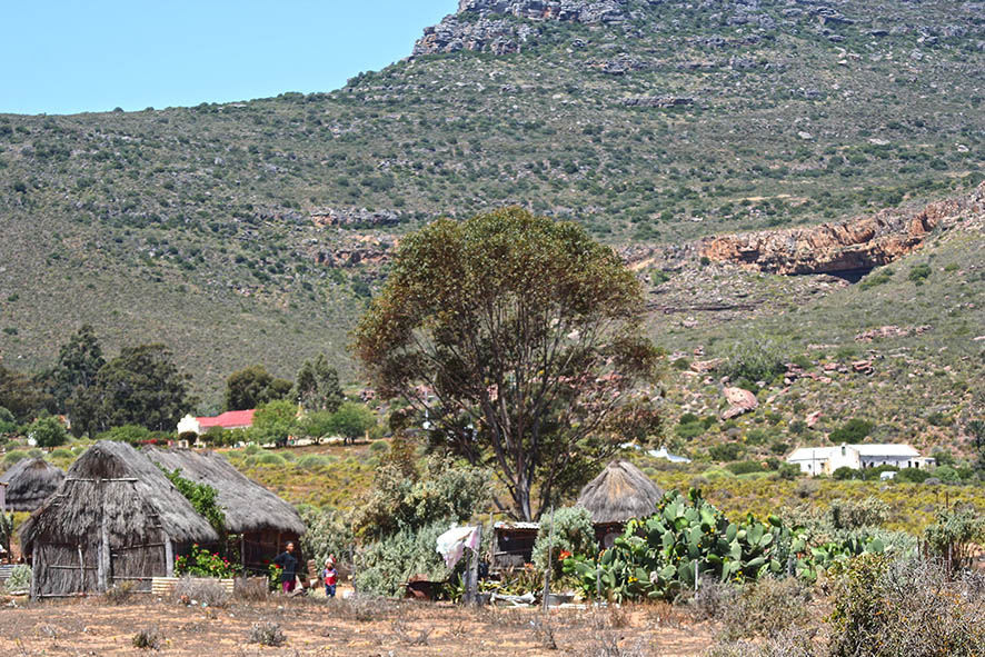
Heerenlogement endures because sandstone is both soft enough to carve and hard enough to last. The inscriptions have weathered three centuries of Cederberg winters and baking summers, yet the earliest remain legible. The cave itself is unchanged -- a shallow overhang in the rock face, large enough to shelter a party of travelers and their animals, surrounded today by a scattering of modern houses that have replaced the wilderness campsite with something more permanent. What makes the site remarkable is not its grandeur but its intimacy. This is not a fort or a monument. It is a place where people stopped for the night, carved their names by firelight, and moved on. The cave remembers them all, from the Commander of the Cape Colony to the anonymous travelers who left only their initials and the soot of their cooking fires.
From the Air
Heerenlogement is at approximately 31.96S, 18.55E in the northern Cederberg, about 30 km north of Graafwater. The terrain is mountainous sandstone with deep valleys. The cave is on a rock face and not prominent from the air, but the Cederberg range is a distinctive terrain feature. A small cluster of houses near the cave may be visible. Nearest town is Graafwater to the south. Clanwilliam is to the northeast. Cape Town International (FACT) is approximately 270 km to the south-southeast.