Helvetinjärvi National Park
The name translates to Hell's Lake, and standing at the lip of Helvetinkolu gorge, the label feels earned. The crack in the earth drops 38 meters straight down but measures only two to two and a half meters across -- narrow enough that the rock walls seem to press together, swallowing daylight before it reaches the bottom. Helvetinjarvi National Park, 49.8 square kilometers of old-growth forest and fault-line geology in Finland's Pirkanmaa region, takes its name from this otherworldly landscape. Founded in 1982 and managed by Metsahallitus, the park protects terrain that looks less like the gentle Finnish lakeland most visitors expect and more like something torn apart by forces operating on a geological timescale.
Cracks in Deep Time
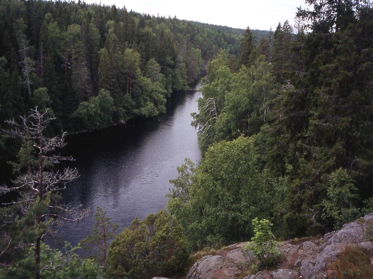
The gorges that define Helvetinjarvi were formed 150 to 200 million years ago when faults displaced the earth's crust, creating two rift valleys that cut through the ancient bedrock of the Tavastia region. Helvetinkolu, the most famous of these gorges, lies at the southeastern end of Lake Helvetinjarvi. Its 40-meter length and extreme narrowness give it the character of a slot canyon -- a rarity in Scandinavia, where glaciers typically ground landscapes into smooth curves rather than jagged clefts. A chain of narrow, steeply sided lakes -- Kovero, Luomajarvi, Iso Helvetinjarvi, Pikku Helvetinjarvi, and Pitka Helvetinjarvi -- fills the deepest fault line north of the gorge. At their highest points, the fault-line scarps rise 180 to 210 meters above sea level, modest by global standards but dramatic in the context of Finland's generally flat terrain.
Forest of Survivors
Beyond the gorges, Helvetinjarvi preserves some of the wildest forest remaining in the Pirkanmaa region. Old-growth stands shelter species that have largely vanished from Finland's heavily managed commercial forests: the Eurasian three-toed woodpecker drums on standing deadwood, red-breasted flycatchers nest in the canopy, and flying squirrels glide between the ancient spruces. Small forest ponds dot the landscape, their dark water stained by tannins from the surrounding peatland. The park sits within the municipality of Ruovesi, a quiet corner of inland Finland roughly 100 kilometers north of Tampere. This is not the tourist-friendly lakeland of central Finland but something wilder and more remote -- forest that has been left to its own devices long enough to develop the structural complexity that only time and neglect can produce.
Walking the Edge
The park's trail network includes the four-kilometer Helvetista Itaan nature trail, which loops down into the gorge and back, offering hikers a close encounter with the fault-line geology that defines the park. The descent into Helvetinkolu itself is the signature experience: the walls close in overhead, moss and lichen cling to surfaces that rarely see direct sun, and the air cools noticeably as the trail drops below the forest canopy into the crack. Longer routes connect to backcountry campsites for overnight trips through the surrounding wilderness. The terrain is rugged by Finnish standards -- less the gentle lakeside strolls of the southern national parks and more a genuine scramble through rocky, uneven ground. In winter, deep snow transforms the gorges into hushed corridors where the only sound is the creak of cold timber, and the narrow lakes freeze into ribbons of ice threading through the forest.
From the Air
Located at 62.03°N, 23.85°E in the Pirkanmaa region of central Finland. The park covers 49.8 km² of forested terrain within the municipality of Ruovesi. Nearest major airport is Tampere-Pirkkala Airport (EFTP), approximately 100 km to the south. From the air, look for the distinctive chain of narrow, dark lakes filling the rift valleys -- they appear as thin dark lines cutting through dense forest cover, in contrast to the rounder lakes typical of the Finnish landscape. The gorges themselves are not visible from cruising altitude but the linear lake chain is a clear signature. Recommended viewing altitude: 3,000-6,000 ft to trace the fault-line lake chain.