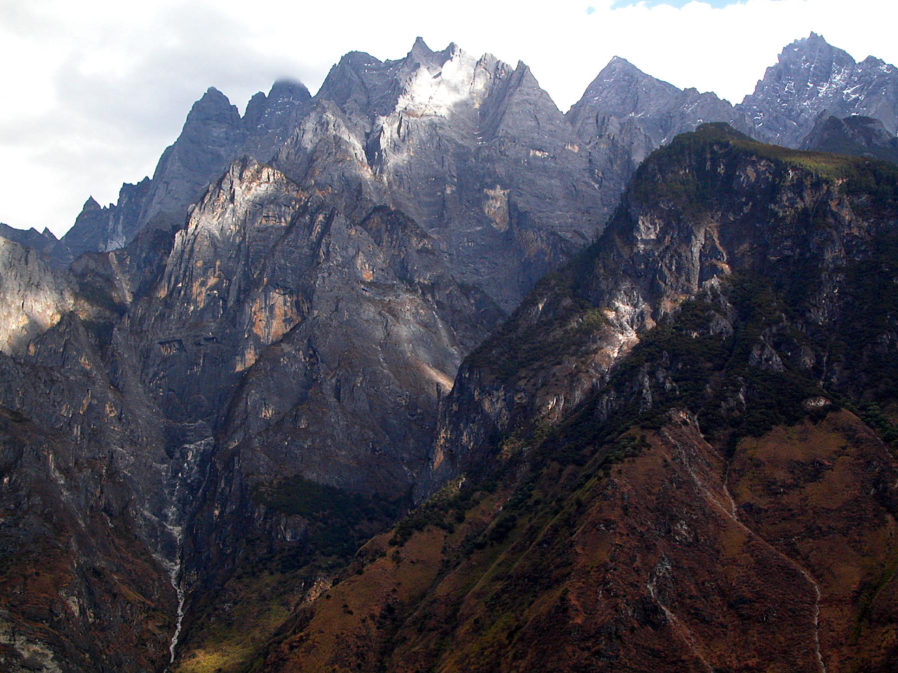
Hengduan Mountains
Most mountain ranges run east-west, following the grain of the tectonic forces that built them. The Hengduan Mountains do not. These ranges run north to south through southwest China, a geological anomaly created by the Indian subcontinent's collision with the Eurasian Plate, their ridges and gorges carved by the Yangtze, Mekong, and Salween as these rivers drain the eastern Tibetan Plateau. Stretching approximately 900 kilometers from 33 degrees north to 25 degrees north, the Hengduan connect the southeast Tibetan Plateau with the Yunnan-Guizhou Plateau, forming a wall that separates the lowlands of northern Myanmar from the Sichuan Basin. Their highest point, Mount Gongga, rises to 7,556 meters, the tallest peak east of the Himalayas.
Four Ranges, Four Rivers
The core of the Hengduan system divides into four primary ranges, each defined by the rivers that flank it. The westernmost runs between the Salween and the Mekong, called the Taniantaweng Mountains in Tibet and the Nu Mountains in Yunnan. The Meili Snow Mountains form a subrange here, crowned by Kawagebo. The next range east separates the Mekong from the Yangtze, with the Mangkam Mountains to the north, the Ninchin Mountains in the middle, and the Yun Range to the south. The Jade Dragon Snow Mountain, visible from the city of Lijiang, belongs to this system. Between the Yangtze and the Yalong River rise the Shaluli Mountains and the Chola Mountains, culminating in the Ge'nyen Massif. Farthest east, the Daxue Mountains stand between the Yalong and Dadu Rivers, dominated by Mount Gongga. Additional ranges sometimes included in the group are the Gaoligong Mountains to the west and the Qionglai and Min Mountains to the east.
The Ice Age Refuge
What makes the Hengduan Mountains biologically extraordinary is not just their size but their history. During the ice ages, most of this terrain remained free from glaciation, providing a refuge for species that were driven to extinction elsewhere. The dense forests, dramatic elevation changes, and relative isolation created a patchwork of habitats ranging from tropical savanna in the deepest southern gorges to alpine meadows and subalpine conifer forests at higher elevations. The result is one of the most biologically diverse temperate mountain systems on earth. Six distinct ecoregions coincide with the Hengduan, from the Southeast Tibet shrub and meadows at the highest elevations to the Northern Indochina subtropical forests on the southwestern slopes. The mountains are home to the endangered giant panda in their easternmost ranges, along with the Chinese yew and numerous rare plants, deer, and primates.
Rivers That Built Nations
The rivers that carved the Hengduan gorges do not merely define the mountains. They define civilizations. The Yangtze, known here as the Jinsha, flows east to become the lifeline of China, the longest river in Asia. The Mekong, called the Lancang in its upper reaches, travels south through six countries before reaching its delta in Vietnam. The Salween, or Nujiang, runs through Myanmar to the Indian Ocean. Together with the N'Mai River feeding the Irrawaddy and the Lohit River feeding the Brahmaputra, this narrow mountainous region contains the headwaters of five of Asia's most consequential rivers. The gorges themselves are staggering in scale. The Nujiang, famous for its "72 turns" road in Tibet, cuts through valleys thousands of meters deep, where the vertical distance from river to ridge exceeds that of the Grand Canyon.
Kham: Land of the Horsemen
The area covered by the Hengduan ranges corresponds roughly with Kham, the eastern Tibetan cultural region. The mountains span western Sichuan, northwestern Yunnan, the easternmost Tibet Autonomous Region, and parts of southern Qinghai, with extensions into eastern Kachin State in Myanmar. Despite this vast reach, only one major city sits within the Hengduan: Lijiang, in Yunnan, a UNESCO World Heritage Site where the Naxi people have maintained their culture beneath the snow-capped Jade Dragon Snow Mountain. Under the narrowest definition, the Hengduan Mountains stretch about 400 kilometers wide between 98 and 102 degrees east, but the broader system's influence extends much further, shaping climate, ecology, and human settlement across a swath of Asia that few outsiders have ever seen up close.
From the Air
Centered at approximately 27.50N, 99.00E in southwest China. The Hengduan Mountains stretch 900 km north-south from about 33N to 25N. Mount Gongga (7,556 m) is the highest peak, located at approximately 29.60N, 101.88E. Jade Dragon Snow Mountain (5,596 m) near Lijiang is a prominent visual landmark. The three parallel river gorges (Yangtze/Jinsha, Mekong/Lancang, Salween/Nujiang) are visible from cruising altitude as deep north-south valleys. Nearest major airports: Chengdu Shuangliu (CTU) to the northeast, Lijiang Sanyi (LJG) to the south, Shangri-La Diqing (DIG). Extreme terrain with peaks above 7,000 meters demands careful altitude planning. Mountain weather is highly variable with monsoon conditions from June to September.