Hengelo
On 6 and 7 October 1944, Allied bombers struck Hengelo. They were aiming at the railway junction and the factories that the German occupation had turned to war production - Stork, Hazemeyer, Heemaf, the names of Hengelo's industrial pride now also the names of legitimate military targets. The bombs missed. They hit the heart of the town instead. Several hundred Hengelo residents died. The historic center, what little of it had survived the centuries of growth, was largely destroyed in one autumn weekend. The town that exists today is, in many ways, a long answer to that mistake - a postwar reconstruction so deliberate, so committed to modern planning principles, that Dutch architectural historians now treat it as a national reference point.
Where the Streams Converge
Hengelo sits in one of the lower parts of the Twente landscape, where several small streams meet, and that geography is the whole story. Mesolithic hunter-gatherers camped here. The Romans left pottery in the Weser-Rhine Germanic tradition. A 13th-century estate called Huys Hengelo stood at the heart of a village that grew up around its church and cemetery, and the estate itself was the center of several uprisings during the Spanish occupation of the Netherlands before it was finally demolished in 1826. The municipality was founded in 1802, just a few hundred farms and workers' houses scattered across the wet ground. Hengelo never received city rights - it was simply a village that became enormous when the 19th century happened to it.
Metaalstad
What changed everything was the railway, which arrived in 1866, and the water, which Hengelo had in abundance. The 19th-century industry needed water to bleach textile and to cool steam engines, and Hengelo could supply it. Stork B.V., Hazemeyer, N.V. Heemaf, KHZ, Hollandse Signaal Apparaten - the founding names of Dutch industrial engineering all set up here. The city earned the nickname metaalstad, metal city. Salt mining grew alongside, and with it a chemical industry. Stork especially shaped the place. In the 1910s the company built Tuindorp 't Lansink as a garden village for its workers, a deliberate piece of social engineering inspired by the same garden-city movement that had reshaped English industrial towns. Today the descendants of those firms live on inside Alstom, Eaton, Vattenfall, Wabtec, AkzoNobel, and Thales Group - a roll call of multinational corporations whose roots trace back to small workshops along these streams.
Rebuilt as Manifesto
The Allied bombs of October 1944 took the historic core. After the war Hengelo's planners did not try to recreate what was lost. Instead they treated the destruction as an opening for an idea: that a Dutch town could be redesigned on modern principles - rational street grids, generous public space, careful integration of housing and infrastructure. The new town hall (1958-1963) by J.F. Berghoef became the centerpiece, and it is still considered an exemplar of postwar Dutch civic architecture. Innovative housing projects followed - Klein Driene I and II (1945-1965), the Hengelose Es housing by Van den Broek and Bakema (1962-1968), and Piet Blom's startling, geometric De Kasbah (1969-1973). Architecture students still visit. The cost of all this modernity was high in heritage terms: the surviving synagogue, an entire historic block called De Telgen, a 17th-century farmhouse, and the 19th-century town hall were all torn down to make room. Hengelo gained a coherent new city and lost most of its old one in the same act.
Crossroads of Europe
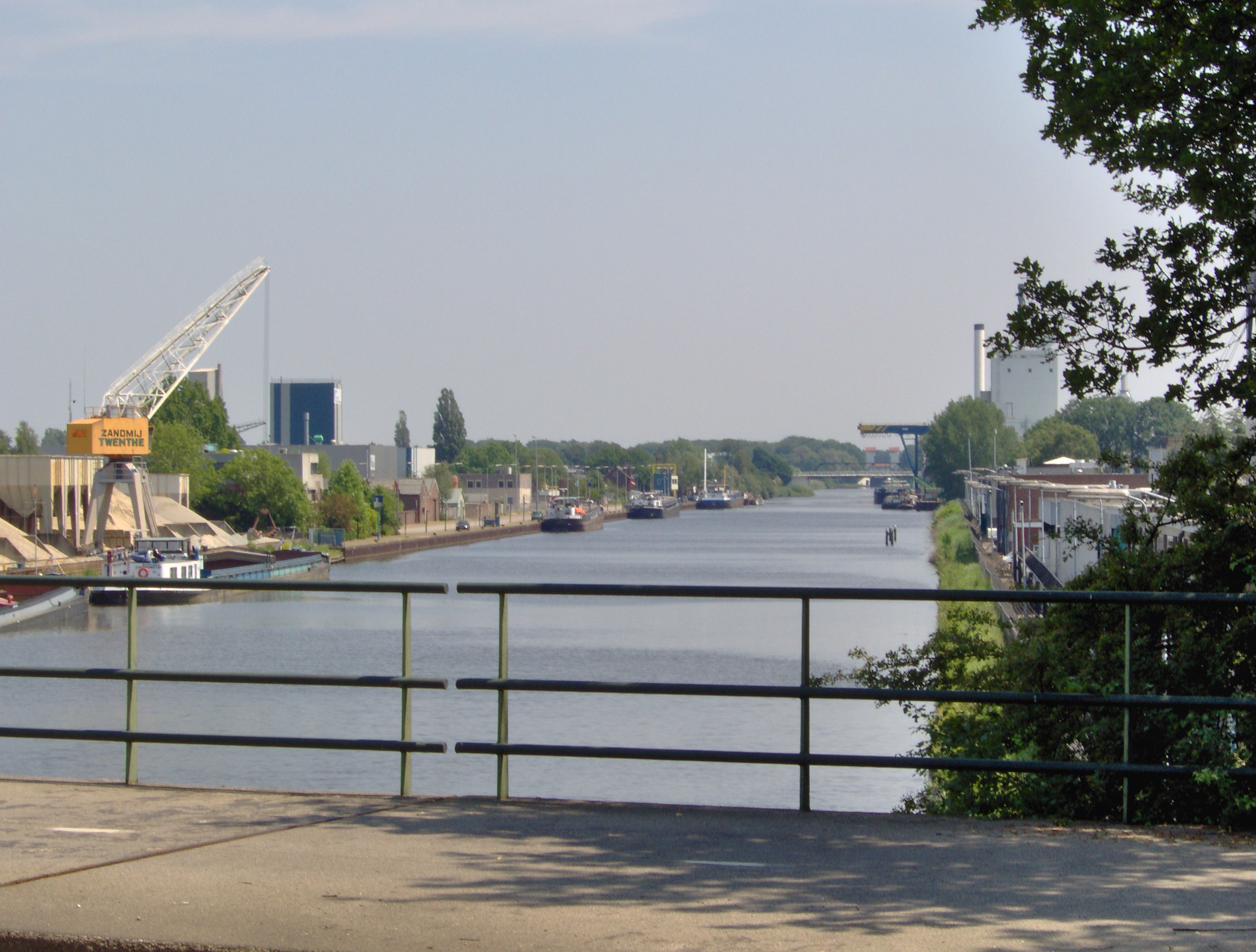
Hengelo today is a transportation hub before it is anything else. The Amsterdam-Berlin trains stop at Hengelo Railway Station, threading the city into the European rail corridor that runs on to Bad Bentheim, Rheine, Osnabruck, Hannover. The A1 motorway slips past - the same road that runs from Amsterdam to the German border - while the wider E30 carrying through traffic from Cork in Ireland to Omsk in Russia passes by. The Twentekanaal connects Hengelo's harbor to the river IJssel and the rest of the Dutch water network. The Bicycle Highway F35 threads Nijverdal, Wierden, Almelo, Borne, Hengelo, and Enschede into a single cyclable corridor. The Tragically Hip name-checked the town in 'At the Hundredth Meridian' after a memorable show at Metropool. The British band Spring Offensive named a song after it. For a city that was nearly erased by friendly bombs, Hengelo is now a stubbornly cosmopolitan crossroads.
From the Air
Located at 52.27 degrees north, 6.79 degrees east, in the Twente region of the eastern Netherlands. From cruise, Hengelo is part of the dense Twente urban cluster - Enschede to the southeast, Borne and Almelo to the northwest. The Twentekanaal is a clear waterway on the southern edge of the city. The Hengelo rail junction is identifiable as a major branching node on the Amsterdam-Berlin corridor. Enschede Airport Twente (EHTW) lies just east at about 10 km - look for the disused 05/23 runway. Munster Osnabruck (EDDG) is 65 km east; Schiphol (EHAM) is 170 km west. Oceanic climate with slightly warmer summers and cooler winters than the Dutch coast.