Henri Pittier National Park
A Swiss botanist who classified more than 30,000 plants in Venezuela never intended to become a park's namesake. Henri Pittier arrived in 1917 and spent decades in the coastal mountains of Aragua, cataloging species in cloud forests so dense that sunlight barely reaches the forest floor. In 1937, President Eleazar López Contreras decreed the area a national park under the name Rancho Grande - Venezuela's first. Sixteen years later it was renamed for the man who had made its case. At 107,800 hectares, Henri Pittier remains the largest national park in the Venezuelan Coastal Range, a place where altitude compresses entire climate zones into a single afternoon's hike.
A Mountain Pass Full of Wings
At 1,136 meters, the Paso de Portachuelo is a notch in the coastal range that funnels something extraordinary: birds. More than 79 species of migratory birds from the northern hemisphere pass through this gap, joining the 580-plus resident species already recorded in the park. That figure represents over 43 percent of all bird species in Venezuela and roughly 6 percent of the world's known birdlife - a density of 5.4 species per 10 square kilometers, among the highest anywhere on Earth. The Audubon Society of Venezuela has spent over a decade studying migration patterns at Portachuelo. Peregrine falcons, harpy eagles, military macaws, and the endangered helmeted curassow are all counted among the park's residents. For birders, this mountain pass is one of the most productive observation points in the Americas.
Four Layers of Green
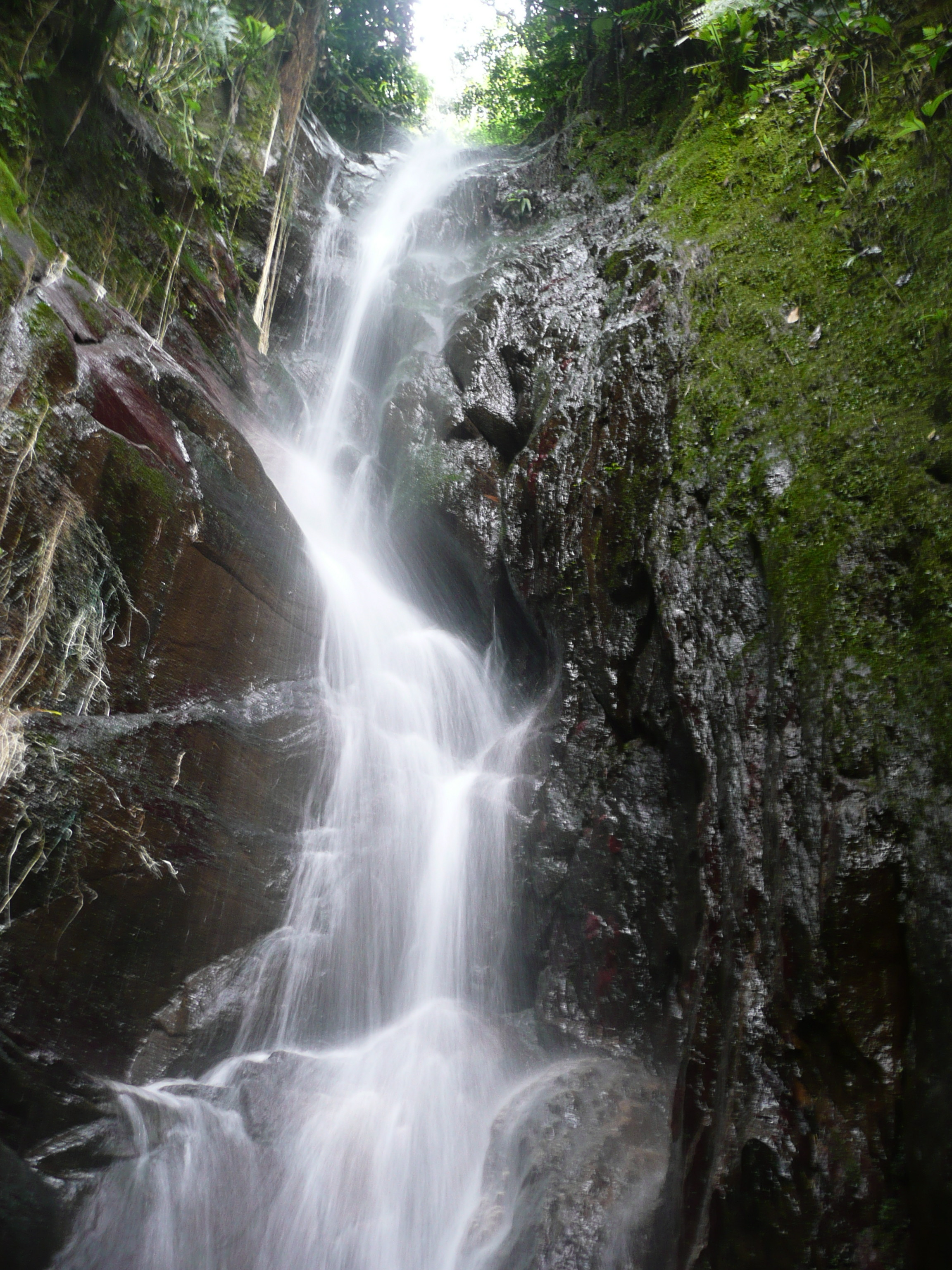
The park's cloud forests are built in four vertical layers: tall canopy trees draped with climbers, a mid-story of shrubs, a ground layer of herbs, and finally a carpet of mosses, lichens, ferns, and fungi. The signature tree is Gyranthera caribensis, known locally as el niño or cucharón, which averages 40 meters in height. Up to 150 different tree species have been recorded in a single quarter-hectare plot. Orchids, bromeliads, and aroids cling to every available surface as epiphytes. Below the cloud zone, lower-altitude forests give way to deciduous woodland, xerophytic scrub near the coast, and mangrove stands at La Ciénaga and Turiamo Bay. The range is staggering: from sea level to Pico El Cenizo at 2,436 meters, temperatures swing from 28 degrees Celsius on the coast to as low as 6 degrees in the highlands.
Nine Rivers and the Cacao Below
Nine major rivers - San Miguel, Turiamo, Ocumare, Cata, Cuyagua, Aroa, Cepe, Choroní, and Chuao - drain north from the mountains into the Caribbean, while the Guayabita, Colorado, Güey, and Limón flow south into Lake Valencia. These waterways make Henri Pittier an essential source of freshwater for surrounding towns and cities. In the lowland valleys watered by these rivers, some of the world's most acclaimed cacao grows, particularly in the village of Chuao, where criollo-variety beans have been cultivated since the sixteenth century. The park protects not only biodiversity but the water that sustains agriculture, industry, and the daily life of Aragua and Carabobo states.
Beaches, Surf, and the Road Down
Two roads cross the park from Maracay: one descends to Choroní through Las Delicias, the other drops to Ocumare de la Costa via Rancho Grande. Both are winding mountain routes that deliver travelers from cloud forest to Caribbean in under an hour. The beaches on the far side - Bahía de Cata, Cuyagua, Playa Grande, El Playón, Playa Chuao - draw vacationers from across Venezuela. Cuyagua is considered the country's best surfing beach. Some bays are accessible only by boat, keeping them quieter and cleaner. There are no hotels inside the park itself; INPARQUES manages the protected area, and lodging is found in the adjacent coastal towns. The Estación Biológica Rancho Grande, administered by the Central University of Venezuela since the 1940s, hosts researchers from around the world, drawn by the same extraordinary density of life that brought Henri Pittier himself to these mountains a century ago.
From the Air
Located at 10.38N, 67.619W in the Venezuelan Coastal Range, spanning northern Aragua and northeastern Carabobo states. The park rises from sea level on the Caribbean coast to Pico El Cenizo at 2,436 meters. From the air, the park appears as a dark green wall of forested mountains between the city of Maracay to the south and the Caribbean beaches to the north. The Paso de Portachuelo notch at 1,136 meters is visible as a gap in the ridgeline. Coastal bays including Bahía de Cata and Choroní are distinctive curved inlets. Nearest airports: Arturo Michelena International (SVVA) in Valencia, approximately 40 km west; Base Aérea El Libertador (SVBL) at Palo Negro near Maracay. Mountain terrain produces significant turbulence and orographic clouds, especially during the rainy season from April to November.