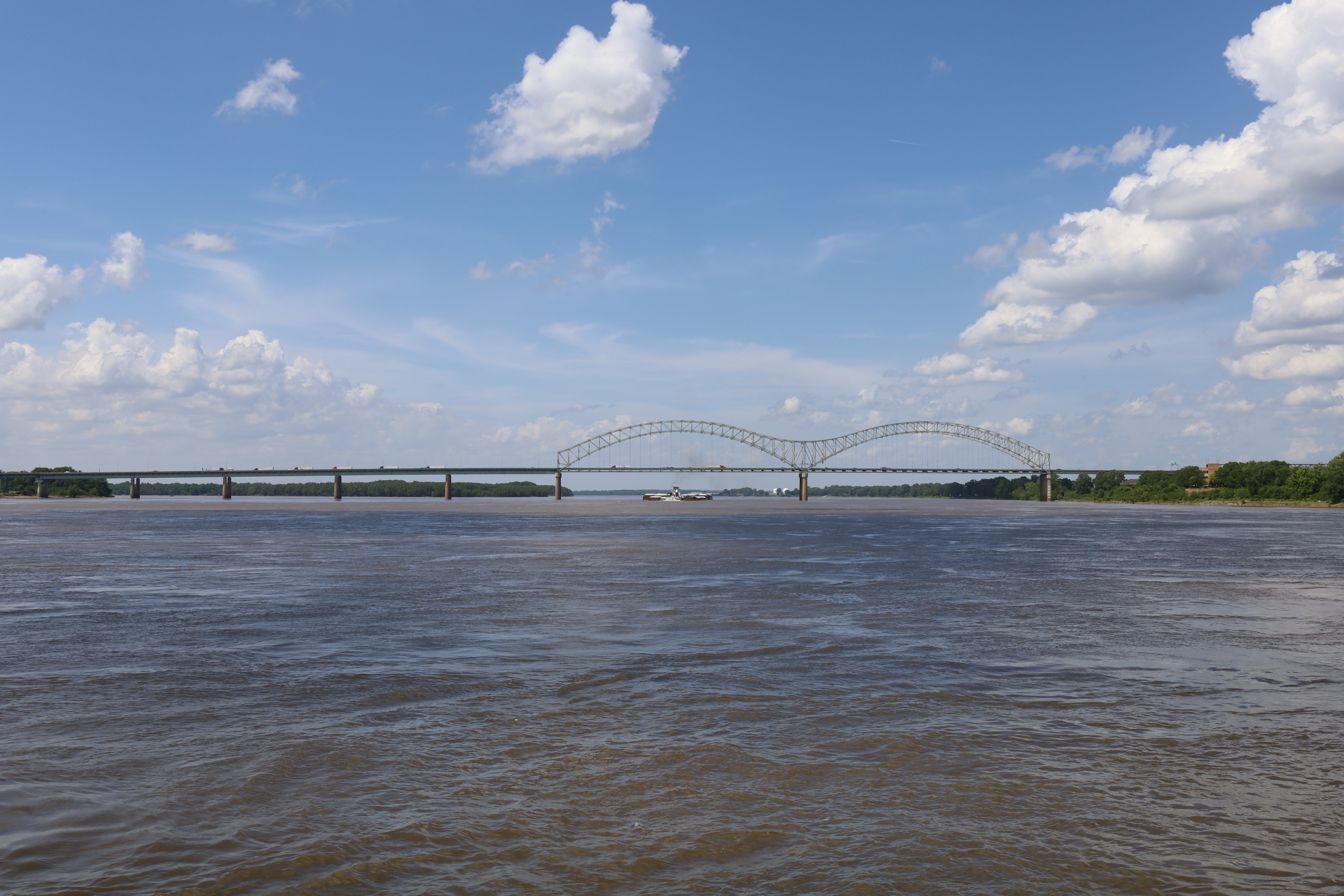
Hernando de Soto Bridge
Two steel arches rise side by side over the Mississippi River, forming a giant letter M that has become Memphis's unofficial signature against the night sky. The Hernando de Soto Bridge, carrying Interstate 40 between Tennessee and Arkansas, opened in 1973 after a bitter interstate feud over who should pay for it. Tennessee wanted a fifty-fifty split; Arkansas balked at matching a larger state's share. The compromise -- sixty percent Tennessee, forty percent Arkansas -- set the tone for a crossing that would demand attention, negotiation, and constant vigilance for the next half-century.
A Bridge Born of Compromise
Preliminary planning for the I-40 Mississippi crossing began in 1960 as engineers mapped the Memphis-to-Little Rock corridor. Before the new bridge existed, all cross-river traffic funneled through the Memphis & Arkansas Bridge on I-55, a congestion nightmare. The double-arch design was initially expected to cost just $12 million, but delays pushed the opening from 1971 to August 2, 1973, and the final price tag ballooned to $57 million. Locals christened it the "New Bridge" to distinguish it from the older I-55 crossing downstream, but the distinctive twin-arch silhouette soon earned it a more permanent nickname: the M Bridge. Its design mirrors the Sherman Minton Bridge between Louisville and New Albany, though Memphis's version carries only a single deck.
Mighty Lights Over the River
For years, the bridge glowed amber. Two hundred high-pressure sodium vapor lights traced the M shape starting in 1986, funded by $373,000 in private donations. River pilots occasionally complained that the glow reflected off the water and blinded them, so the city installed a remote switch to toggle the lights as barges passed beneath. During the catastrophic 2011 Mississippi River floods, workers had to remove the transformers to protect them from rising waters, leaving the bridge dark for two months. Then in 2016, the nearby Harahan Bridge debuted a sleek LED lighting system as part of its conversion to a pedestrian and cycling path called the Big River Crossing. The Hernando de Soto followed suit in 2018 with its own $14 million LED system, privately funded under an initiative called Mighty Lights. The two bridges can now synchronize their colors for special occasions, painting the Memphis riverfront in coordinated light displays.
Bracing for the Big One
The bridge sits within the New Madrid Seismic Zone, the region responsible for the devastating 1811-12 earthquakes that rang church bells as far away as Boston. Between 2000 and 2015, engineers undertook a massive seismic retrofit to ensure the structure could withstand a 7.7-magnitude earthquake. The main span, approach ramps, and downtown exit ramps were all reinforced, and a bridge section west of the main span was entirely rebuilt with earthquake resilience in mind. The federal government covered eighty percent of the cost, with Tennessee and Arkansas splitting the remainder. It was a sobering acknowledgment that this was not just a bridge but a critical cargo artery and one of the most important river crossings in the American interior.
The Crack That Almost Brought It Down
On May 11, 2021, a routine inspection revealed something terrifying: a partially fractured tie girder on the Span A North truss. Two of the four steel plates in the box-shaped tension member were completely cracked through, and the bottom plate was partially fractured. Only one plate held the bridge together. The inspecting engineer called 911 and ordered an immediate shutdown. Vehicle traffic and river traffic halted simultaneously. The discovery was alarming enough, but the investigation that followed was worse. Amateur photographs from 2016 already showed damage at the same site, and archived drone footage from a 2019 inspection confirmed the fracture had been visible for at least two years. The mandated hands-on inspections had simply not been performed. The responsible inspector was fired. Emergency repairs took months -- steel plates were bolted over the damaged girder, additional plating was installed, and the damaged beam was partially removed. Eastbound lanes reopened on July 31 and westbound on August 2. An engineering analysis traced the fracture to poor weld repairs made during the bridge's original construction in the early 1970s.
Sentinel of the Bluffs
Today the Hernando de Soto Bridge remains one of the most recognizable silhouettes on the lower Mississippi. Its twin arches catch the last light of sunset from the west and blaze with programmable LEDs after dark. The 2021 crisis forced a national reckoning with bridge inspection standards and the invisible deterioration hiding in aging infrastructure across America. From the Memphis bluffs or the flat Arkansas delta on the opposite bank, the M Bridge stands as both a practical lifeline and a reminder that the things we rely on most demand the closest attention.
From the Air
The Hernando de Soto Bridge is located at 35.153N, 90.064W, spanning the Mississippi River between Memphis, TN and West Memphis, AR. Its distinctive double-arch M shape is unmistakable from the air, especially at night when the LED lighting system is active. Best viewed at 2,000-4,000 feet AGL. Nearby airports include Memphis International (KMEM) to the south and West Memphis Municipal (KAWM) across the river. The bridge is easily spotted by following I-40 to its river crossing point.