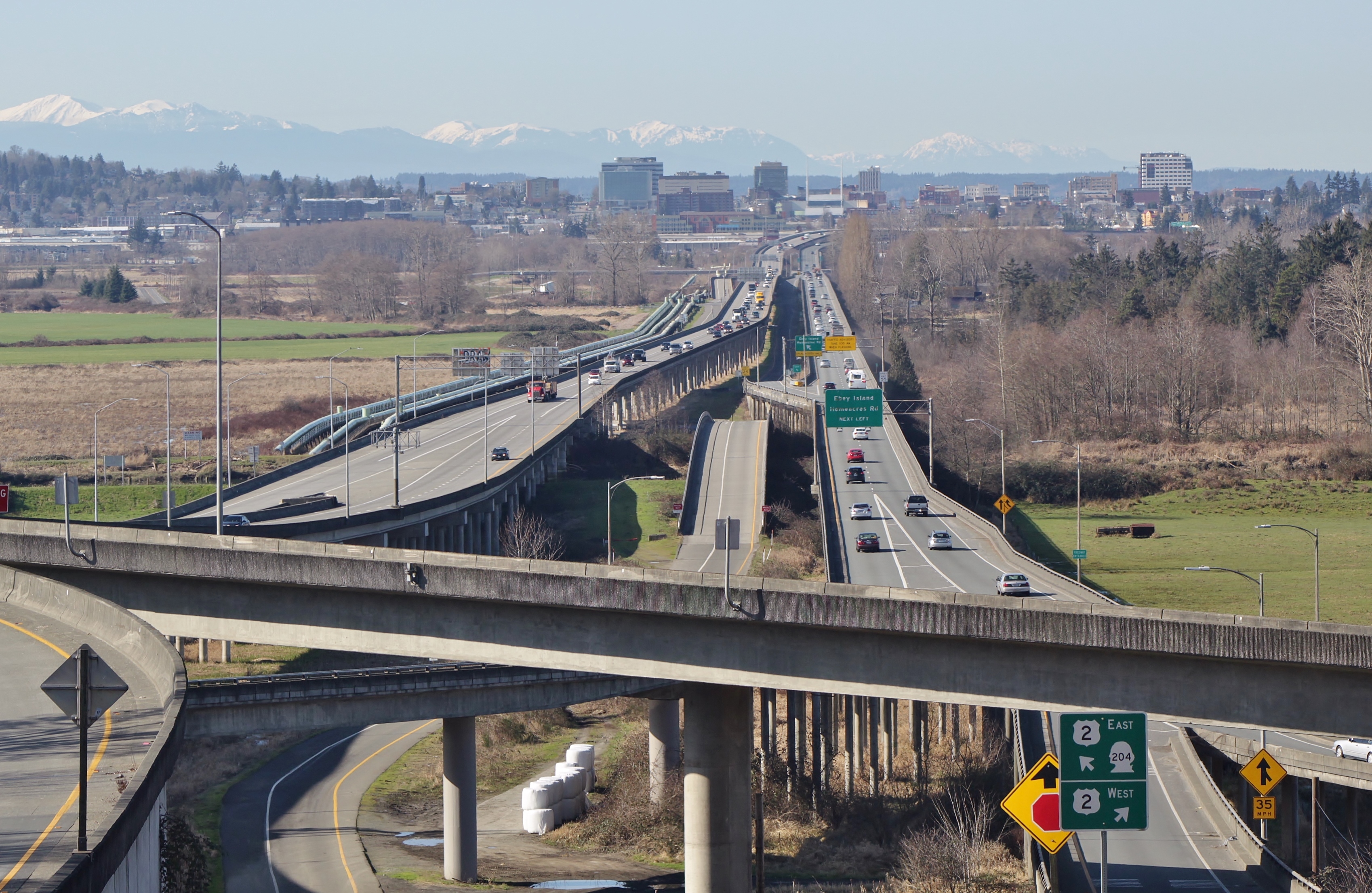
Hewitt Avenue Trestle
Commuters in Snohomish County have a name for it: the nightmare on Hewitt Avenue. The Hewitt Avenue Trestle, a 2.5-mile causeway carrying U.S. Route 2 across the Snohomish River, Ebey Island, and Ebey Slough, is one of those pieces of infrastructure that everyone depends on and nobody enjoys using. Narrow lanes, no shoulders, concrete barriers inches from your mirrors -- for decades, this stretch of road has been famous for inducing white-knuckle anxiety in drivers who had no choice but to cross it twice a day.
The Bridge That Wouldn't Stop Growing
The original wooden and concrete trestle opened on January 15, 1936, carrying both directions of traffic on a single structure that included a drawbridge over the Snohomish River. For over thirty years it served as the sole crossing, but by the 1960s, the growth of eastern Snohomish County demanded more capacity. A parallel westbound trestle partially opened on April 8, 1968, and was completed with ribbon-cutting ceremonies exactly a year later, on April 8, 1969, at a cost of $7.3 million. The pair was converted into an expressway connecting Interstate 5 on the west end to State Route 204 on the east. But the design carried forward a critical flaw: the lanes were too narrow and there were no shoulders. Drivers reported anxiety attacks. Hazardous conditions became routine.
A Hundred-Million-Dollar Fix
Between 1991 and 2001, Washington State built an entirely new eastbound trestle out of reinforced concrete at a cost of $100 million. The new structure was wider, safer, and modern -- everything the old westbound trestle was not. But that old westbound span remained in service, its narrow lanes and aging structure unchanged. Commuters heading toward Everett still gripped their steering wheels and held their breath. The disparity between the two directions of travel became a daily reminder of unfinished business: one direction, a modern highway; the other, a relic that felt like it belonged to a different era.
The Chokepoint That Won't Go Away
A 2018 Washington State Transportation Commission report laid out options for replacing the westbound trestle. The price tags ranged from $620 million to $2 billion, with potential funding from tolls generating up to $690 million. By 2024, over $25 million had been spent just studying the problem. The westbound trestle remains a critical chokepoint for communities in eastern Snohomish County -- Lake Stevens, Snohomish, Monroe -- where tens of thousands of residents funnel onto U.S. 2 each morning. Making matters worse, the structure is seismically vulnerable. Engineers estimate that after a major earthquake, it could take up to three years to replace, effectively severing the primary east-west corridor north of Seattle.
Crossing the Floodplain
From the air, the trestle's logic becomes clear. The Snohomish River delta is a broad, flat expanse of wetland and farmland where the river braids into sloughs before reaching Puget Sound. Ebey Island sits in the middle of this floodplain, separated from the mainland by Ebey Slough to the north and the main channel of the Snohomish River to the south. Building any crossing here means spanning not just water but an entire landscape that floods regularly. The twin ribbons of concrete stretch across this green expanse like a suture holding two halves of Snohomish County together -- one modern, one aging, both indispensable.
From the Air
Located at 47.979N, 122.162W. The trestle is a prominent east-west causeway visible crossing the Snohomish River floodplain and Ebey Island. Best viewed at 2,000-4,000 feet for full perspective of both parallel structures. Paine Field (KPAE) lies approximately 4 miles to the southwest. The trestle connects to the I-5 interchange at its western end, making it easy to identify from the freeway corridor.