Hirasawa Kanga Ruins: Where Ancient Bureaucrats Counted Rice
Carbonized grains of rice, charred black by a fire that ended the complex over a thousand years ago, still cling to the postholes where the granary pillars once stood. The Hirasawa Kanga ruins sit on the plains south of Mount Tsukuba in Ibaraki Prefecture, an unassuming patch of reconstructed buildings and earthworks that tells the story of how ancient Japan's central government reached into its eastern provinces. This was no castle, no temple, no monument to power built for show. It was an administrative office -- the local branch of an empire, where district officials tallied taxation rice, filed reports, and kept the machinery of the Ritsuryo state turning in the hinterlands of Hitachi Province. But dig deeper, and the site reveals an even older layer: pit dwellings from the late Jomon period, evidence of a community that thrived here millennia before any bureaucrat arrived.
The Ritsuryo Machine
In 715 AD, Japan's central government under the Ritsuryo system divided its provinces into administrative districts called gun, each composed of two to twenty townships. Every district needed a kanga -- an administrative complex built on a semi-standardized layout borrowed from Chinese governance models. The Hirasawa site was one such complex, positioned in the shadow of Mount Tsukuba in what was then Hitachi Province. According to the Hitachikoku Fudoki, a Nara-period geographic record, the land around Mount Tsukuba was governed by the Tsukuba kuni no miyatsuko, a regional lord whose capital lay to the south of the mountain. The Hirasawa site corresponds roughly to that location, placing it at the intersection of local power and imperial administration.
Fifty-Five Buildings in the Shape of Order
When construction workers broke ground for a housing development in 1975, they uncovered something far older than planned foundations. Excavations by the Ibaraki Prefecture Board of Education from 1973 to 1975, and again in 1993-1994, revealed the footprints of fifty-five buried-pillar buildings and four foundation-pillar buildings, all arranged in a distinctive U-shape that marks the standardized layout of a district administrative center. Most of these structures were raised-floor granaries -- warehouses specifically designed to store taxation rice collected from the surrounding townships. They stood in orderly rows, divided into two groups, their elevated floors keeping the grain dry above the damp Kanto plains. Fragments of Haji ware pottery, Sue ware, and roof tiles surfaced alongside the building traces, though the quantity of tiles was surprisingly small.
Layers Older Than Empire
The excavations uncovered more than Nara-period bureaucracy. Twenty-five pit dwellings -- semi-subterranean homes characteristic of Japan's prehistoric periods -- emerged from the same soil, dating to the late Jomon period. These dwellings push human habitation at this spot back thousands of years before the Yamato state expanded eastward, before provinces and districts existed, before anyone conceived of taxing rice in government granaries. The Jomon people who lived here occupied a landscape that would have been wetter and wilder, with Lake Kasumigaura extending further inland and the plains cut by small rivers and marshland. When the centralizing state chose this location for a district office, it was layering organized governance atop a place humans had already found worth settling for millennia.
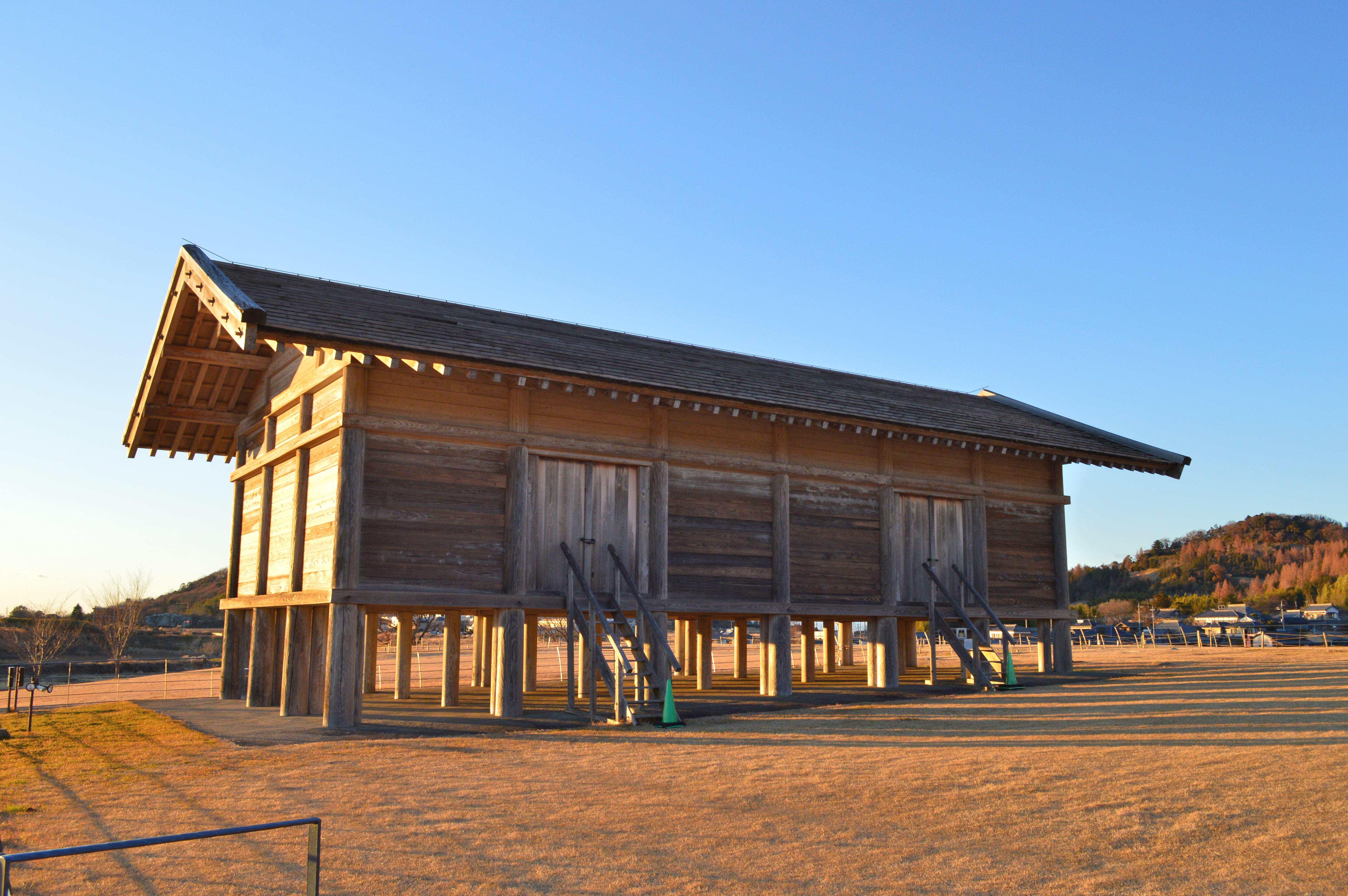
A Warehouse Rebuilt from Clues
The ruins opened to the public in 2003 with a full-scale reconstruction of one of the raised-floor warehouses, modeled after a similar structure at the ancient temple of Horyu-ji in Ikaruga, Nara. The reconstruction features earthen walls and a thatched roof -- the archaeologists chose thatch because the small quantity of roof tile fragments recovered from the site could not justify a tiled design. Alongside the warehouse, a 160-meter section of the defensive moat and wooden palisade has been rebuilt to the north and west, showing how the complex was enclosed. The moat had a trapezoidal cross-section, wider at the top and narrowing toward the bottom. Walking the site today, with the twin peaks of Mount Tsukuba rising to the north, the scale of the Ritsuryo system becomes tangible -- this was just one node in a network of identical complexes stretching across Japan's provinces, each one counting, storing, and reporting upward.
From the Air
Located at 36.178N, 140.103E on the Kanto Plain south of Mount Tsukuba. The reconstructed warehouse and palisade are visible as a small cluster of traditional-style buildings amid suburban development. Best viewed at 2,000-3,000 feet AGL approaching from the south, with the distinctive twin peaks of Mount Tsukuba (877m) providing an unmistakable landmark to the north. Ibaraki Airport (RJAH) lies approximately 20 nautical miles to the northeast. Tsukuba's modern science city sprawls to the southwest.