Historic Center of São Paulo
Three points on a map define where São Paulo began: Largo de São Francisco, Largo São Bento, and Praça da Sé. Connect them and you trace the "historical triangle," the patch of high ground between the Tamanduateí and Anhangabaú rivers where Jesuit priests Manuel da Nóbrega and José de Anchieta built a mission school on January 25, 1554. That school—the Pátio do Colégio—gave rise to a settlement, then a town, then a coffee capital, then the largest city in the Southern Hemisphere. The historic center still fits inside a comfortable walk, but it contains more layers of Brazilian history per square meter than anywhere else in the country.
The Triangle Where a City Germinated
The Sé district is the true nucleus. At its heart, the Pátio do Colégio has been rebuilt to echo the original 1554 Jesuit structure and now houses a museum dedicated to the city's founding. Nearby, the Monastery of São Bento has stood since nearly as long as São Paulo itself, its monks still chanting Gregorian plainchant and baking artisan bread—a pocket of medieval rhythm persisting inside a 21st-century metropolis. Praça da Sé anchors the geometry with the Metropolitan Cathedral, one of the largest neo-Gothic churches in the world, officially inaugurated in 1954 for the city's 400th anniversary though its towers were not fully completed until 1967. At the base of the cathedral steps sits the Zero Milestone marker, the point from which all distances in São Paulo are measured. Every road in this city of twelve million leads back here.
Coffee Barons, Concrete Towers, and a Revolution
Coffee money transformed the center in the late 19th and early 20th centuries. The Municipal Theatre, inaugurated in 1911, was designed by Ramos de Azevedo's architectural office to satisfy elite coffee barons who demanded opera venues rivaling those of Europe. Count Giuseppe Martinelli raised a 130-meter classical tower in the 1920s and 1930s—once the tallest building in South America—with a rooftop mansion for his own family. The Altino Arantes Building followed, its 161 meters echoing the Empire State Building in miniature. But grandeur coexisted with violence: during the Revolution of 1924, federal planes under President Artur Bernardes bombed the center and surrounding working-class neighborhoods in what became known as the "terrifying bombardment." The physical scars healed, but the episode left a reminder that São Paulo's growth was never smooth or guaranteed.
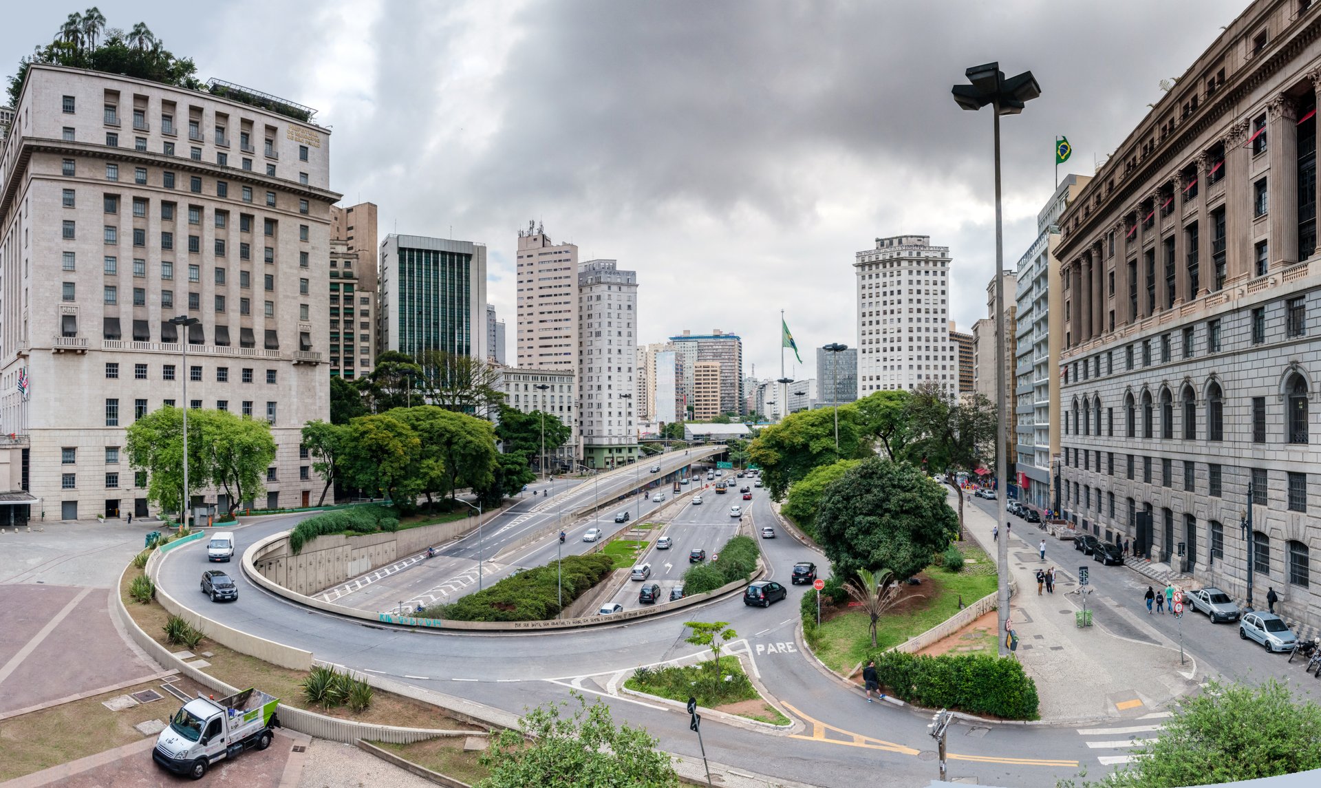
The Long Decline and the Pedestrian Experiment
By the 1970s, the center was still dense with corporations and department stores, its narrow streets choked with cars and pedestrians fighting for space. But the gravity of money was already shifting southwest—first to Avenida Paulista, then to Brigadeiro Faria Lima, then further still to the glass towers along the Pinheiros River. Companies relocated. Buildings emptied. Crime rose, and so did homelessness. The population drained away steadily through the 1980s, leaving behind a landscape of architectural grandeur slowly succumbing to urban decay. In 1976, Mayor Olavo Egídio Setúbal tried something radical: he closed twenty central streets to motor vehicles, creating one of Latin America's largest pedestrian zones. The experiment aimed to prioritize public transit and foot traffic, and it permanently changed the character of the area—though it could not, by itself, reverse the economic migration already underway.
Ghosts of the Silver Screen
Among the center's most haunting remnants are its old cinemas. The Cine Art Palácio opened in 1936 on Avenida São João as the Ufa Palácio and is now a landmarked shell—part abandoned, part given over to adult theaters, its doorstep sheltering people with nowhere else to go. The Cine Paissandu, which opened in 1957, stands in total abandonment, its ground floor converted into an informal parking lot. But survival stories exist too: the Cine Olido reopened after years of closure with seven screening rooms still decorated in 1950s style, and the Cine Marabá, dating to 1944, was refurbished and reactivated in 2009. These cinemas are the center's autobiography in miniature—stories of glamour, neglect, and the stubborn possibility of revival.
Reinvention in Progress
Since the early 1990s, municipal and state governments have poured resources into requalifying the center. The Anhangabaú Valley—once a traffic-clogged arterial—was converted into a pedestrian square for demonstrations, concerts, and cultural fairs. The Municipal Theatre and Largo São Bento were renovated. The Praça das Artes cultural complex rose between Avenida São João and the valley, housing concert halls and dance studios as a deliberate instrument of neighborhood revival. Oscar Niemeyer's sinuous Copan Building draws architecture students from around the world. Every Thursday evening, the Caminhada Noturna—a free Night Walk—departs from the Municipal Theatre steps, leading visitors through streets where five centuries of construction crowd together in a few blocks. The historic center is not yet what it was, and it will never be what it was. But it is becoming something else—a place where São Paulo remembers where it started, even as twelve million people keep pushing it outward.
From the Air
The Historic Center of São Paulo is located at 23.542°S, 46.633°W in the Sé and República districts. From the air, the dense cluster of early-to-mid-20th-century towers is distinguishable from surrounding modern development. Key landmarks visible at lower altitudes include the Metropolitan Cathedral's neo-Gothic spires, the Altino Arantes Building (161m, Empire State Building silhouette), and the Martinelli Building (130m). The Anhangabaú Valley creates a visible green-and-gray corridor through the district. Nearest major airports: Congonhas (SBSP/CGH), approximately 7 km south; Guarulhos International (SBGR/GRU), approximately 25 km northeast. Elevation approximately 760 meters on São Paulo's central plateau.