History of the Port of Tianjin
In 1318, monks at the Longwangmiao temple near the mouth of the Haihe River began raising white cloth flags on tall poles during the day and lighting lamps at night to guide ships into port. It was the first recorded navigational aid in the region, and it marked a moment when the waters off what is now Tianjin had become too busy for sailors to find their own way in. Seven centuries later, the port they were guiding ships into covers 121 square kilometers, stretches across 31.9 kilometers of quay, and handles more cargo than almost any port on Earth.
Canals, Grain, and Imperial Appetites
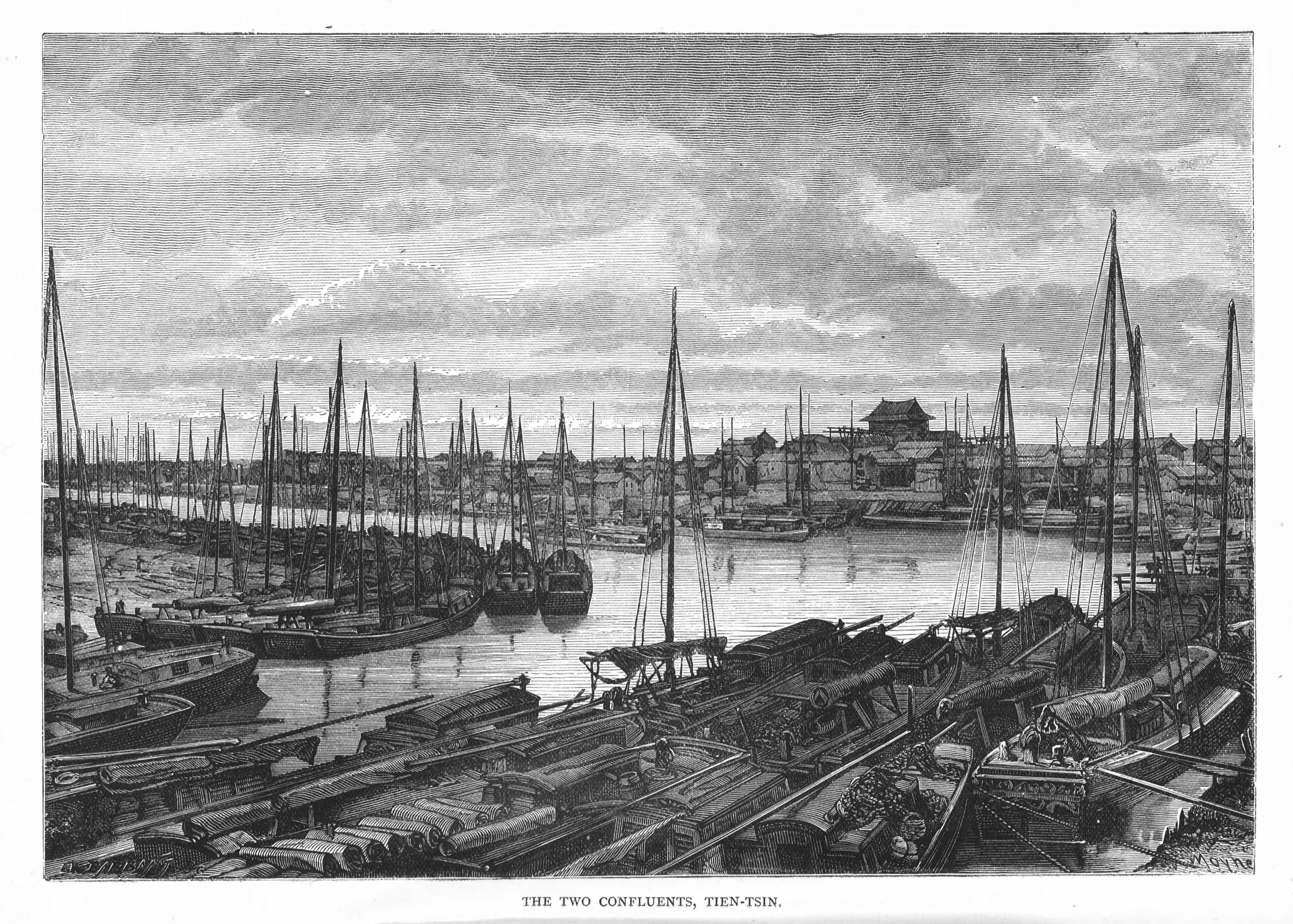
The port's story begins not with the sea but with rivers. In the Eastern Han dynasty, the warlord Cao Cao dug two canals connecting the Haihe to supply his campaigns against the Wuhuan. When Emperor Yang of the Sui dynasty completed the Grand Canal, the lower Haihe became a critical grain hub, funneling southern rice to the armies of the northeast. The Tang dynasty established Sanhui Harbor at the confluence of three rivers, where coastal ships and canal barges moved 500,000 dan of grain annually. By the time the Jin dynasty relocated its capital to what is now Beijing in 1153, the port at Zhigu was shifting 1.7 million dan per year. The Mongol Yuan dynasty pushed it further still, opening an audacious open-sea route in 1293 that cut the sailing time from the Yangtze to the Haihe from 120 days to under ten -- essentially the same route ships use today between Shanghai and Tianjin.
Gunboats at the River Mouth
When Western powers turned their attention to maritime access to Beijing, the Haihe estuary became a flashpoint. The Taku Forts, rebuilt in 1816 to guard the river mouth, saw fierce fighting during the Second Opium War. The 1860 Treaty of Tianjin opened the city to foreign trade and carved out the first of what would eventually be nine foreign concessions. A two-mile-wide sandbar at the Haihe mouth limited its depth to less than three meters at high tide, forcing seagoing vessels to anchor in Bohai Bay and lighter their cargo onto shallow barges. The Sino-British Taku Tug and Lighterage Company, founded in 1864, handled this awkward transfer. The Boxer Rebellion brought another battle for the forts, and the resulting Boxer Protocol expanded foreign occupation to Tanggu, where British, German, Japanese, and American companies built wharves that by 1940 amounted to 56 berths and over six kilometers of quayside.
Built by Occupation, Rebuilt by Revolution
In 1938, Japanese occupation forces decided the silting, icing Haihe and its obstructive sandbar were inadequate for their logistical needs. They began building a modern seaport outside the river estuary -- a project calling for 30 kilometers of breakwater, a 13.4-kilometer shipping channel, and three terminals. Japan's surrender in 1945 left the project half-finished. The retreating Nationalists compounded the damage with demolitions. When Communist forces captured Tanggu on September 17, 1949, they inherited a port silted into near-uselessness. Reopened on October 17, 1952, after years of dredging, the channel was only six meters deep and could handle ships of just 7,000 deadweight tons -- less than one five-hundredth of its present capacity.
Container Revolution and Catastrophe
Growth came slowly at first, but the port became a pioneer: in September 1973, Tianjin opened China's first international container ship route, and in 1980, it established the nation's first dedicated container terminal. The post-1979 reform era unleashed explosive expansion. Throughput passed 20 million tonnes in 1988, and by December 2001, the port became the first in North China to reach 100 million tonnes. But growth carried risks that regulation failed to match. On August 12, 2015, a series of explosions at a port chemical storage facility killed 173 people and injured nearly 800, a catastrophe that exposed failures in safety oversight at one of the world's busiest ports. Today, the port operates as a consolidated corporation under the Tianjin Port Group, a transformation from imperial grain wharf to modern logistics hub that spans two millennia and countless reinventions.
From the Air
Located at 38.98°N, 117.79°E on the western shore of Bohai Bay. The port complex is visible from altitude as an enormous industrial waterfront stretching along the Haihe estuary, with container terminals, bulk cargo facilities, and the distinctive four piers of Beijiang. Nearest airport: Tianjin Binhai International (ZBTJ/TSN), approximately 15 km northwest. At 5,000-10,000 feet AGL, the full extent of the port is visible, including the shipping channel extending into Bohai Bay.