Honey Island Swamp
Somewhere between the East and West Pearl Rivers, where the canopy closes overhead and the water turns the color of dark tea, the air itself changes. It thickens with the smell of decomposing vegetation and warm mud, and the only sounds are the splash of an alligator sliding off a log and the territorial hooting of a barred owl. This is Honey Island Swamp, 70,000 acres of bottomland hardwood and cypress-tupelo wetland in St. Tammany Parish, Louisiana -- named not for any sweetness in the water, but for the honeybees that once swarmed a small island at the swamp's edge. It is one of the least-altered river swamps remaining in the United States, a place where the wild still runs the show.
A River's Cradle
Honey Island Swamp sits in the floodplain of the Pearl River, which forms the border between Louisiana and Mississippi before emptying into Lake Borgne and the Gulf of Mexico beyond. The swamp stretches from U.S. Route 11 in the north to the brackish waters of Lake Borgne in the south, a corridor of wetland habitat that has survived largely because it was too waterlogged to farm and too remote to develop. Of its 70,000 acres, more than 35,000 are permanently protected as part of the Pearl River Wildlife Management Area, managed by the Louisiana Department of Wildlife and Fisheries. The Pearl River's seasonal flooding refreshes the swamp, depositing nutrients that sustain an ecosystem of staggering biological diversity.
Wild Residents
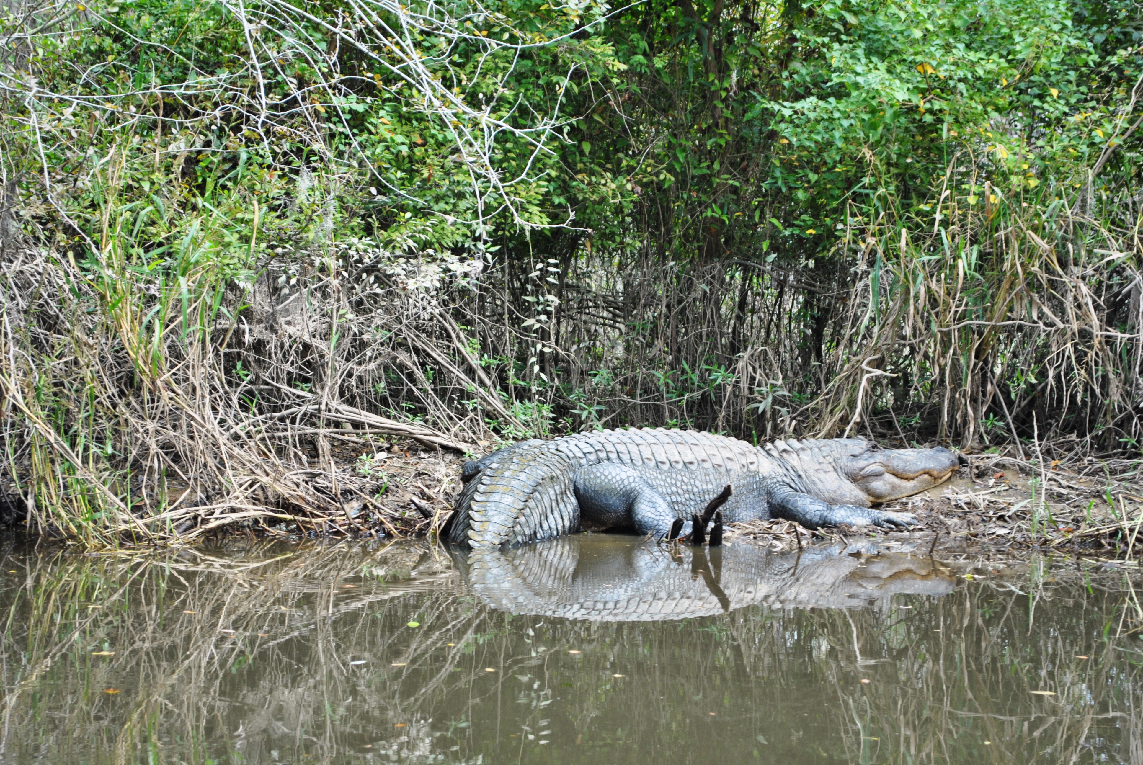
The species list for Honey Island reads like a catalog of the Gulf South's most iconic wildlife. American alligators patrol the waterways, sometimes reaching twelve feet in length. Alligator snapping turtles -- prehistoric-looking creatures with ridged shells and powerful jaws -- lurk in the deeper channels. Overhead, bald eagles and red-tailed hawks scan for prey, while brown pelicans and great blue herons work the shallows. The Louisiana black bear, once hunted to the brink of extirpation, still roams these bottomlands. Bobcats, red foxes, mink, and raccoons move through the understory. Beneath the dark water, alligator gar -- armored fish that can exceed a hundred pounds -- cruise alongside largemouth bass and the ancient paddlefish, a filter-feeder whose lineage stretches back to the Cretaceous period.
The Creature in the Cypress
No account of Honey Island Swamp is complete without its most famous -- and most elusive -- resident. Since at least the 1960s, locals and swamp tour guides have reported encounters with a large, bipedal, ape-like creature moving through the dense cypress stands. Described as a towering humanoid covered in matted gray hair, the Honey Island Swamp Monster occupies a niche in Louisiana folklore similar to Bigfoot in the Pacific Northwest or the Skunk Ape in the Florida Everglades. Retired air traffic controller Harlan Ford claimed to have filmed the creature in 1963, and his footage -- grainy, brief, and inconclusive -- has circulated among cryptozoology enthusiasts ever since. Whether the monster is real, misidentified wildlife, or pure swamp legend, it has become an inseparable part of the swamp's identity, drawing curious visitors alongside the birdwatchers and kayakers.
The View from Above
From a few thousand feet, Honey Island Swamp reveals its true scale: a vast, dark-green carpet of canopy broken only by the silver threads of waterways and the occasional open marsh. The Pearl River splits into its east and west channels, braiding around the swamp in a pattern that shifts with every major flood. Lake Borgne glimmers to the south, and beyond it, the open Gulf. The swamp's permanently protected core appears untouched -- no roads, no clearings, no structures -- a startling contrast to the developed land that presses in from every side. It is a reminder of what much of coastal Louisiana once looked like, before levees and drainage canals reshaped the landscape.
From the Air
Honey Island Swamp is centered at approximately 30.22N, 89.65W, filling the floodplain between the East and West Pearl Rivers in eastern St. Tammany Parish. From altitude, look for the dark-green canopy corridor running north-south between the two river channels, bounded by Lake Borgne to the south. The I-10 Twin Span bridge crosses nearby to the south. Nearest airports: Slidell Airport (KASD) approximately 8nm northwest, Louis Armstrong New Orleans International (KMSY) approximately 35nm west, Stennis International Airport (KHSA) approximately 15nm northeast. Best viewed at 2,000-4,000 feet AGL for swamp detail; at higher altitudes the entire Pearl River basin and Lake Borgne are visible.