Hooge Crater Cemetery
The circular depression at the cemetery entrance is not decorative. Sir Edwin Lutyens, the architect, designed it to evoke the mine craters that once pocked this landscape, massive holes blown by tons of explosives detonated in tunnels dug beneath enemy lines. Hooge Crater Cemetery takes its name from one such explosion, fired on July 19th, 1915, by the 175th Tunnelling Company. The crater it left was eventually filled in during the war itself, becoming a mass grave. The water-filled depression visible near the Bellewaerde Hotel today is something different: three German craters from 1916, landscaped by Baron de Wynck after the war into a memorial pond.
Crossroads of Carnage
The village of Hooge sits on the Bellewaerde Ridge, just four kilometers east of Ypres along the Menin Road. In 1914, a chateau here served as the British divisional headquarters for the sector. On October 31st, 1914, German shells struck the chateau, killing several senior officers from the 1st and 2nd Divisions in a single strike. From that moment, Hooge became a focal point of the fighting. The front line of the Ypres Salient ran directly through the village, and for three years the area saw almost constant combat. By war's end, nothing remained of the original village. The landscape was so churned by shells and mining that the pre-war ground level had essentially ceased to exist.
The Underground War
When surface attacks proved too costly, both sides dug. The British 175th Tunnelling Company, working with the 3rd Division, spent months excavating beneath German positions near the chateau. On July 19th, 1915, they detonated their charge, creating a massive crater. It was only the second British offensive underground attack in the Ypres Salient; the 173rd Tunnelling Company had blown five mines at Hill 60 three months earlier, but none approached the power of the Hooge charge. The British 6th Division seized the crater and surrounding area on August 9th. But the underground war continued. In June 1916, the Germans blew their own mines during an offensive against Canadian troops, creating the three craters that would later become the landscaped pond.
A Cemetery Begins
The 7th Division began the cemetery in October 1917, during the Third Battle of Ypres. Originally containing just 76 graves, it was expanded after the war through concentration of remains from the surrounding battlefields and smaller cemeteries. Many of the graves contain unidentified soldiers, known only to God, as the headstones say. The stone panels naming specific regiments offer the only clue to who might lie beneath: the West Yorkshire Regiment, the Lincolnshire Regiment, and dozens of others. The cemetery eventually grew to contain over 5,900 burials, of which more than half remain unidentified.
Those Who Rest Here
Among the identified dead are men whose stories capture the breadth of the Empire's sacrifice. Private Christopher James Alexander was an English ornithologist, mortally wounded near Passchendaele on October 4th, 1917. Private Patrick Joseph Bugden, an Australian, earned the Victoria Cross at Polygon Wood before being killed on September 28th, 1917. Major Albert Stewart, an Irish international rugby player, fell during the Battle of Broodseinde on October 4th, 1917. Scientists, athletes, farmers, clerks, they came from every corner of the British Empire to die in a Belgian village most had never heard of. The cemetery holds them all equally, their headstones arranged in the orderly rows that the Commonwealth War Graves Commission maintains with meticulous care.
Memory Preserved in Stone
Edwin Lutyens' design for Hooge Crater Cemetery is among the most distinctive of the war graves sites. The circular stone-faced depression at the entrance deliberately recalls the craters that defined this landscape, a memorial to the peculiar horror of mining warfare. Across the road stands the Hooge Crater Museum, founded in 1994 in what was once a chapel. The museum and cemetery together tell the story of a small patch of Belgian farmland that swallowed tens of thousands of lives. The original Hooge Crater is gone, filled with earth and bodies during the war when it became untenable to hold. But the name survives, and with it the memory of the explosion that briefly tore open the Flanders clay, revealing the lengths to which men would go to gain a few yards of ground.
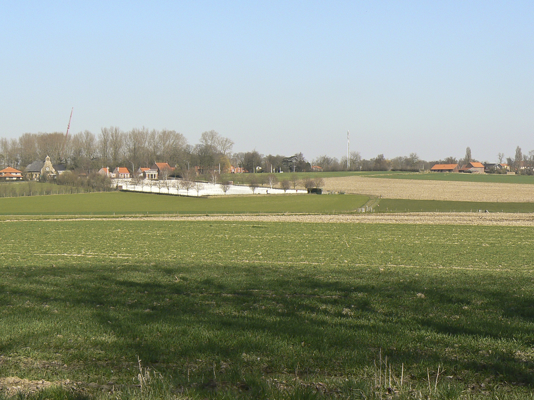
From the Air
Located at 50.846N, 2.943E on the Menin Road (N8) approximately 4km east of Ypres (Ieper), West Flanders, Belgium. The cemetery is visible from low altitude on the south side of the road, its white headstones distinctive against the green farmland. The Hooge Crater Museum sits opposite. The water-filled crater pond is visible near the Bellewaerde Hotel. The Bellewaerde Ridge rises gently in this area, part of the terrain that made the Ypres Salient so difficult to hold. Nearest airports: Kortrijk-Wevelgem (EBKT) 15km south, Ostend-Bruges International (EBOS) 40km northwest.
Sources
- Wikipedia - 175th Tunnelling Company
- CWGC - Hooge Crater Cemetery
- Twentieth Century Society - Hooge Crater Cemetery
- Wikipedia - Patrick Joseph Bugden VC
- Wikipedia - Christopher James Alexander
- CWGC - Major Albert Lewis Stewart DSO
- Hooge Crater Museum Official Website
- Western Front Association - The Disaster at Hooge