Horne Lake Caves Provincial Park
Jim and Delores Johnson of Nanaimo kept the secret for six years. In 1963, they had discovered Euclataws Cave near Horne Lake on Vancouver Island, a chamber of intact speleothems hidden beneath the forests of central British Columbia. They told no one outside their caving circle, because they had seen what happened to caves that were publicized too soon. The Main and Lower Main caves, known to loggers since the early 20th century, had already been stripped of many of their formations by the time the province placed a 29-hectare reserve around them in 1957. Euclataws was different, still pristine, and the Johnsons intended to keep it that way.
What the Darkness Preserved
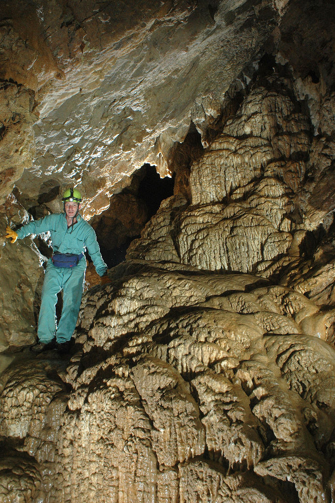
The caves that give this 158-hectare park its name are ancient limestone formations carved by water over millennia, tucked into the hills roughly 60 kilometers north of Nanaimo and 26 kilometers west of Qualicum Beach. The Qualicum First Nation knew these caves long before a geological report first mentioned them in 1912. Two of the caves, Main and Lower Main, became increasingly popular with the public after being publicized in 1939. In 1941, the larger Riverbend Cave was discovered, and by 1945 it had become a popular tourist destination. But popularity came at a cost: visitors broke off stalactites, carved their names into flowstone, and carried away formations that had taken thousands of years to grow.
A Secret Revealed, a Park Created
When word of Euclataws Cave finally spread around 1969, local cavers feared the worst. They approached the provincial government with an urgent case for protection, and in January 1971, Horne Lake Caves became a provincial park. Euclataws and Riverbend caves were fitted with gates, and guided tours began in Main, Lower Main, and Riverbend. But gates alone could not stop determined vandals. In 1984, a particularly destructive break-in at Riverbend Cave forced the province's hand. A comprehensive management plan followed in 1985, bringing improved visitor facilities and professionally managed cave tours. Four more caves have since been documented within the park: Cougar Cave, Eggshell Cave, Andre's Annex, and Riverbend Trail Slot Cave.
Above Ground, Another World
The park is more than its caves. Above the limestone chambers, dense forests of Douglas fir and western hemlock blanket the hillsides, fed by the moisture that funnels through the Qualicum River valley. The river itself runs through the park, offering hiking, fishing, and canoeing. The landscape sits in a transitional zone between the drier east coast of Vancouver Island and the rain-soaked west, giving the forest an unusual mix of species and a lush, layered canopy. The park is a 12-kilometer drive from the Horne Lake exit off Highway 19, and the approach road winds through second-growth forest that gradually gives way to the older trees closer to the caves.
Namesake and Legacy
The lake that gives the park its name honors Adam Grant Horne, a Hudson's Bay Company trader who explored the interior of Vancouver Island in the 1850s. Horne's journeys through the dense forest between Qualicum and the Alberni Valley were among the first European explorations of this rugged interior. Today the park exists because of a different kind of exploration: the patient, muddy work of cavers who understood that some discoveries are worth more when they are protected than when they are displayed. Every guided tour through the limestone passages is a reminder that the most fragile landscapes often survive only because someone chose not to tell the world about them, at least for a while.
From the Air
Located at 49.345N, 124.754W on central Vancouver Island, approximately 60 km north of Nanaimo. The park sits inland near Horne Lake, visible as a narrow body of water oriented northwest-southeast. Nearest airport is Comox Valley Airport (CYQQ), about 50 km to the northwest. Recommended viewing altitude 3,000-5,000 ft AGL for lake and forest context. Highway 19 is the major road reference running along the east coast.