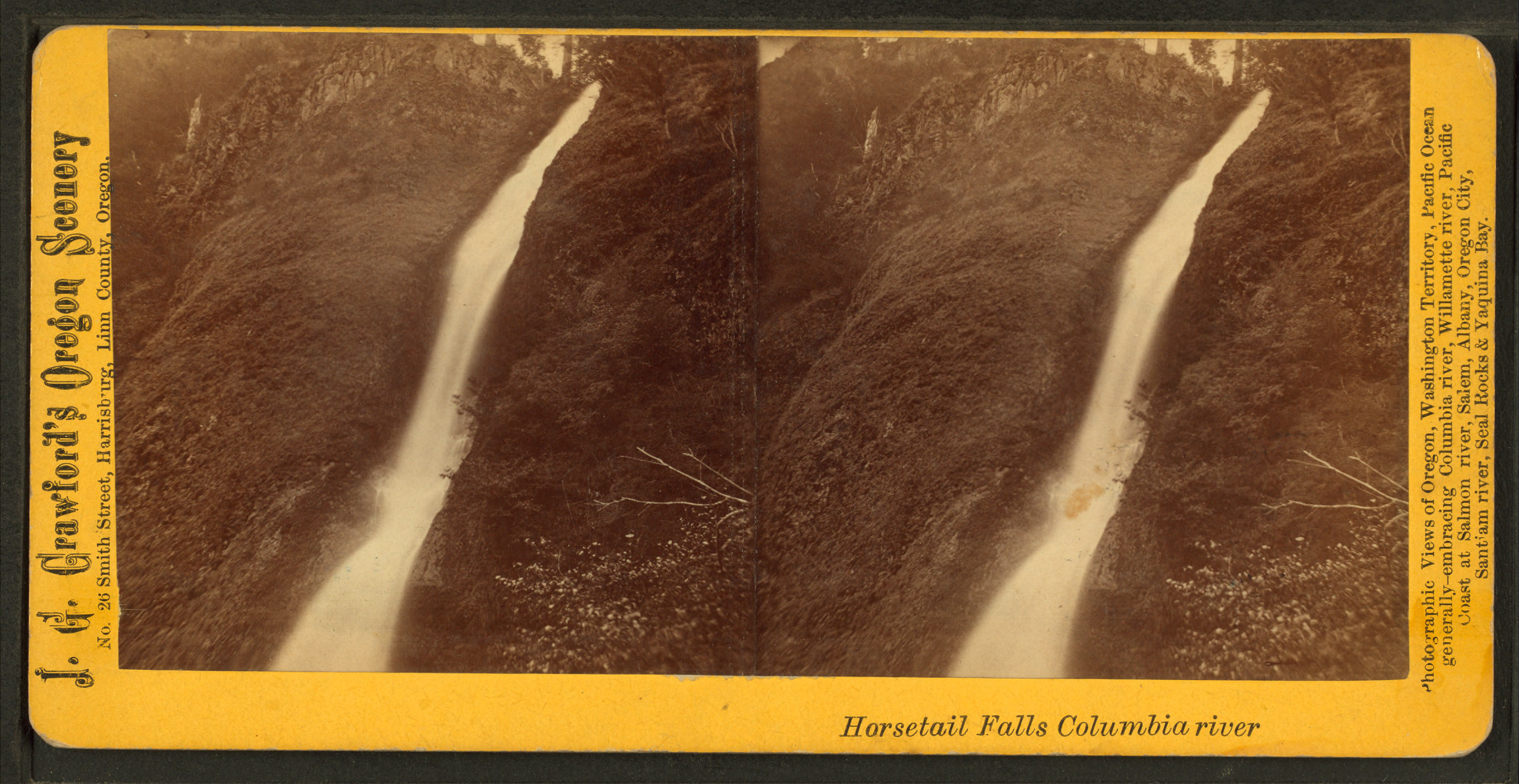
Horsetail Falls
The columnar basalt cliff face is curved just so, worn by millennia of water into a smooth, rounded surface that causes the falling creek to spread and flow in a distinctive pattern. Stand below Horsetail Falls in the Columbia River Gorge and you understand immediately how it earned its name: the water does not simply drop but streams downward in long, separated strands, catching air and light in ways that genuinely evoke a horse's tail caught in wind. Unlike many of the Gorge's famous cascades, this one requires no hike to reach. It tumbles directly beside the Historic Columbia River Highway, visible from the road, accessible within steps of where you park. Yet for those willing to climb, an upper falls awaits, one with a trail that passes behind the falling water itself.
The Shape of Falling Water
Geology created the distinctive form of Horsetail Falls. The water of Horsetail Creek drops over a cut in the columnar basalt cliff within the Oneonta Gorge, but it is the rounded, overhanging shape of the rock face that gives the falls their character. As water cascades over this curved surface, it separates into individual streams rather than falling as a single sheet. The effect is remarkably like hair, or the streaming tail of a horse at full gallop. This natural sculpture requires no interpretation, no imagination to see what early visitors saw when they gave the falls its name.
Two Falls, One Creek
There are actually two waterfalls along Horsetail Creek, connected by a trail that climbs the forested slopes above the highway. The lower falls, the famous Horsetail Falls itself, sits roadside and accessible. But continue up the trail and you reach Upper Horsetail Falls, also known as Ponytail Falls, where the path does something remarkable: it passes directly behind the cascade. Hikers can stand in the space between cliff and falling water, the roar of the falls surrounding them, spray misting their faces. The U.S. Forest Service urges caution on these trails, where steep cliffs and uncertain footing have claimed lives.
Dangers Along the Trail
The beauty of the Gorge trails masks genuine hazards. In May 2016, a tragedy unfolded at Horsetail Falls when 37-year-old Stephanie Cohen attempted to rescue her son after the footing at the trailhead gave way beneath him. She fell dozens of feet and was fatally injured; her son survived with minor injuries. The incident serves as a grim reminder that the same geological forces that created these spectacular landscapes also present real dangers. The trails here are not paved paths through manicured parks but routes carved through active, dynamic terrain where rock can crumble and footing can fail without warning.
A Century-Old Bridge, Modernized
The Horsetail Falls Bridge carries the Historic Columbia River Highway across the creek just below the falls. Built in 1914, this reinforced concrete slab span is listed on the National Register of Historic Places as a contributing structure to the highway's historic designation. What makes the bridge particularly interesting is its 1998 modernization: engineers strengthened the original 1914 structure using fibre-reinforced plastic, a cutting-edge material that allowed them to preserve the historic appearance while ensuring the bridge could handle modern traffic loads. It stands as an example of how historic preservation and engineering advancement can work together.
The Waterfall Corridor
Horsetail Falls is one jewel in what travelers along the Historic Columbia River Highway call the waterfall corridor, a stretch of road where cascade after cascade presents itself to drivers and hikers. The easy accessibility of Horsetail Falls makes it an ideal starting point for exploring this remarkable concentration of waterfalls. From here, visitors can continue to Oneonta Falls, though that neighbor requires considerably more effort to reach. The contrast is part of what makes this stretch of the Gorge so appealing: dramatic natural beauty available at every level of commitment, from roadside viewing to serious backcountry hiking.
From the Air
Horsetail Falls is located at coordinates 45.5896N, 122.0687W in the Columbia River Gorge, within Mount Hood National Forest at approximately 200 feet elevation. The falls appear from the air as a white streak against dark basalt within Oneonta Gorge. The Historic Columbia River Highway and Interstate 84 run parallel through this corridor, with the falls visible between them. Nearest airports include Portland International (KPDX, 30nm west) and Troutdale Airport (KTTD, 20nm west). The falls are part of a visible chain of waterfalls along this section of the Gorge.