Hosokura Mine: Eleven Centuries Underground
The tunnels run five kilometers east to west and three kilometers north to south, threading through more than 150 veins of lead, zinc, and silver beneath the mountains of northern Miyagi Prefecture. For over a thousand years, someone has been digging here. The Hosokura Mine was discovered during the early Heian period -- the Daido or Jogan era of the 9th century -- making it one of the oldest continuously worked mines in Japan. By the time it closed in February 1987, it had yielded 26 million tonnes of ore grading 1.59 percent lead and 4.12 percent zinc, along with 12.8 million ounces of silver. The mountain gave generously. It also demanded a cost that no production statistic can measure.
A Thousand Years of Ore
For centuries, the Hosokura deposit drew miners to the remote mountains near what is now the city of Kurihara, in the old town of Uguisuzawa. The mine's fortunes shifted dramatically in 1934, when Mitsubishi Mining acquired management rights and launched an aggressive modernization program. Under Mitsubishi's direction, Hosokura grew into one of the leading lead and zinc operations in Japan. Ten major veins and over 150 minor ones were mapped and exploited across the sprawling underground network. Production of crude ore reached its peak in 1970, when the mine was pulling 75,000 tons per month from the earth. The tunnels branched and descended, following the geology deeper into the mountain.
The Men Who Did Not Choose to Dig
During World War II, the mine became something else entirely. Designated as Sendai POW Camp 3-B, Hosokura received approximately 300 Allied prisoners of war in January 1945 -- 234 Americans and 50 British servicemen among them. The British contingent included survivors of the Horuku Maru, a transport ship sunk in Manila Harbor. These men were forced to mine lead and zinc for Mitsubishi under brutal conditions. Across Mitsubishi's four wartime mine operations, records document the deaths of at least 30 POWs, including 27 Americans. In July 2015, Mitsubishi Materials became the first Japanese private corporation to formally apologize for the use of Allied prisoners as forced labor during the war -- seventy years after the men had last emerged from these tunnels.
The Economics of Collapse
The global recession of the 1970s hit commodity mines hard, and Hosokura was no exception. As metal prices fell and operational costs rose, the mine that had once been among Japan's most productive became increasingly difficult to sustain. Month by month through the early 1980s, the economics deteriorated. In February 1987, after more than a millennium of continuous or near-continuous operation, the Hosokura Mine closed permanently. The silence in the tunnels must have been remarkable -- the first true quiet those passages had known in generations. An entire town had grown around the mine, and its closure reverberated through the community of Uguisuzawa and the broader Kurihara region.
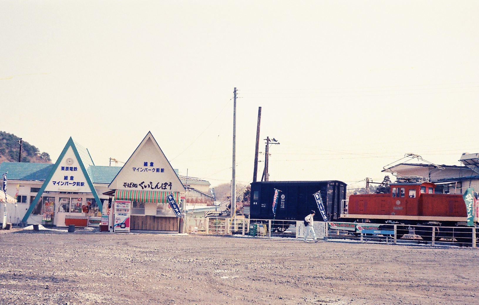
Walking Where They Worked
In 1990, three years after the last ore cart rolled, Kurihara opened the Hosokura Mine Park on the site. Today visitors walk through portions of the original main tunnel, following explanation boards that trace the mine's geological and industrial history. The park presents the mine as a story of engineering and endurance -- 1,100 years of human persistence against rock. What the explanation boards do not mention is the wartime chapter. The Allied prisoners who dug these same tunnels under compulsion are absent from the displays. The mine's transformation from industrial site to tourist attraction preserved the tunnels but edited the narrative, leaving visitors to discover the fuller history elsewhere. The mountains above the park remain beautiful, green, and quiet -- offering no clue to the complexity of what happened below.
From the Air
Located at 38.808°N, 140.900°E in the mountainous interior of northern Miyagi Prefecture, near the city of Kurihara. The mine site is nestled in a narrow valley surrounded by forested peaks of the Ou Mountains. From altitude, look for the clearing and park facilities in the valley between ridgelines. Best viewed at 3,000-5,000 feet AGL. Sendai Airport (RJSS) lies approximately 55 nautical miles to the south-southeast. The terrain is rugged and mountainous, with limited flat ground. National Route 457 runs through the area.