Howard Air Force Base
The only five-star general in Air Force history chose the site himself. In May 1939, Major General Henry "Hap" Arnold returned to Panama two decades after leading the first air unit to the Isthmus and picked a patch of jungle 460 meters from the Pacific Ocean for a new air base. He suggested naming it after Major Charles H. Howard, a friend and former subordinate who had flown in Panama in the late 1920s and died in an air crash in 1936. On December 1, 1939, Howard Field became official. What began as a clearing in tropical forest would grow into the bastion of American air power across Central and South America for more than fifty years.
Jungle Runway to Cold War Nerve Center
Construction crews arrived in 1941, and Howard Field hosted both fighter and bomber aircraft through World War II, guarding the Pacific approach to the Panama Canal. After the war the base went quiet -- inactivated on January 1, 1950, its land turned over to the Army. But geography is destiny at a canal, and by December 1961 all USAF flying operations in Panama had relocated to Howard. On October 1, 1963, the Air Force officially reclaimed it. The reason was simple: Howard's 2,600-meter runway was the only jet-capable American airfield south of the Rio Grande. That distinction made it indispensable for decades of Cold War operations, counter-narcotics missions, and humanitarian relief flights across Latin America.
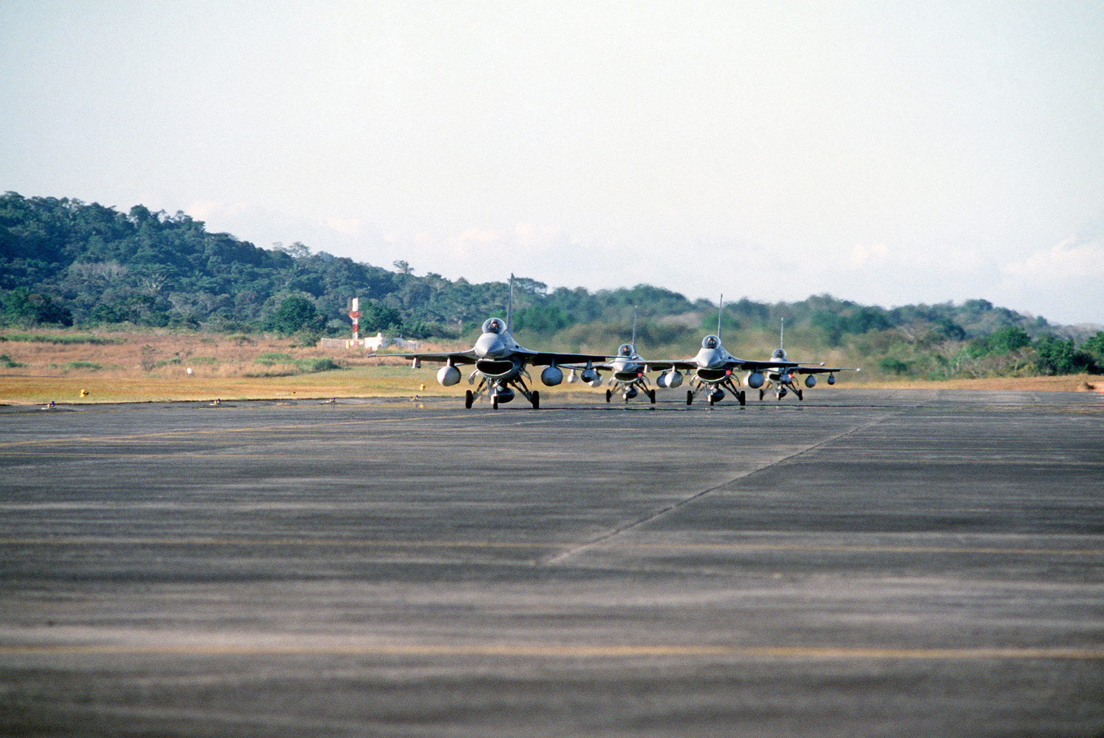
The Machines of Howard
At its peak Howard was a remarkably diverse airfield. C-130 Hercules transports rotated through on 90-day detachments under mission names like CORONET OAK and VOLANT OAK, operated by the Air Force Reserve and Air National Guard. F-4 Phantoms and later F-16 Fighting Falcons cycled through for training exercises and air sovereignty patrols. A-7 Corsair IIs made appearances. C-27 Spartans handled shorter-range missions, while executive jets carried senior Southern Command officers. Search-and-rescue helicopters stood ready around the clock. Personnel tracked drug traffickers moving north from South America, coordinated disaster relief across the region, and ran joint exercises with allied nations -- all from a strip of concrete bordered by jungle and ocean.
A Name with Many Lives
Before it was Howard, the site cycled through identities that mirror the Canal Zone's own restless history. Bruja Point Military Reservation in 1928, Fort Bruja in 1929, then Fort Kobbe in 1932 -- named after Major General William A. Kobbe, who died in 1931. The airfield section became Howard Field in 1939, then Howard Air Base in 1941, and finally Howard Air Force Base when the Air Force became its own branch. Each renaming reflected a shift in American strategic thinking: from coastal artillery to airpower, from hemispheric defense to global reach. The 24th Wing, Howard's host unit from 1968 onward, carried the accumulated weight of all those transformations.
Lowering the Flag
The Torrijos-Carter Treaties of 1977 made the ending inevitable, though it took two decades to arrive. Department of Defense elements began drawing down more than a year before the December 31, 1999 deadline for returning the Canal Zone to Panama. The last fixed-wing American aircraft departed Howard on May 1, 1999. On November 1 of that year, the 24th Wing inactivated and the base passed to the Panamanian government. The jungle airfield that Hap Arnold selected in 1939 reopened in 2014 as Panama Pacifico International Airport, a civilian hub surrounded by a growing commercial development zone. The runway Arnold built to project American power now welcomes regional airlines. The control tower still stands, but the call signs have changed.
From the Air
Howard Air Force Base (now Panama Pacifico International Airport, MPPA) is located at 8.915N, 79.600W, on the Pacific side of the Panama Canal, 9.7 km southwest of Balboa. The 2,600-meter runway is oriented roughly north-south. The Bridge of the Americas is a prominent visual reference just to the east. Nearby airports include Marcos A. Gelabert International Airport (MPMG) 8 km northeast and Tocumen International (MPTO) 30 km east. Best viewed at 3,000-5,000 feet AGL approaching from the Bay of Panama, where the runway and former military infrastructure are clearly visible against the surrounding development.