Huangya Pass
The Great Wall of China stretches thousands of kilometers across northern China, but not all of its sections are created equal. At Huangya Pass, the wall climbs a steep and abrupt mountain ridge in the northern reaches of Jizhou District, a landscape so rugged that the fortification feels less like a border marker and more like something carved directly from the rock itself. This section stands approximately 78 miles north of urban Tianjin, far from the tourist crowds that mob Badaling near Beijing, yet carrying a history that predates those famous sections by centuries.
Built Before the Ming Dynasty Rebuilt It
Huangyaguan -- the Chinese name for the pass -- was originally constructed during the Northern Qi dynasty, more than 1,400 years ago. The Northern Qi, a short-lived kingdom that controlled much of northern China from 550 to 577 AD, built defensive walls as a matter of survival against nomadic threats from the Mongolian steppe. Their wall at Huangya was a frontier fortification, part of a broader network of defenses that would later be incorporated into the Ming dynasty's more famous reconstruction. When the Ming emperors undertook their massive expansion and renovation of the Great Wall beginning in the late fourteenth century, Huangya Pass was reinforced with brick walls, transforming the older rammed-earth and stone structure into something more durable and formidable.
The Mountain Ridge Fortress
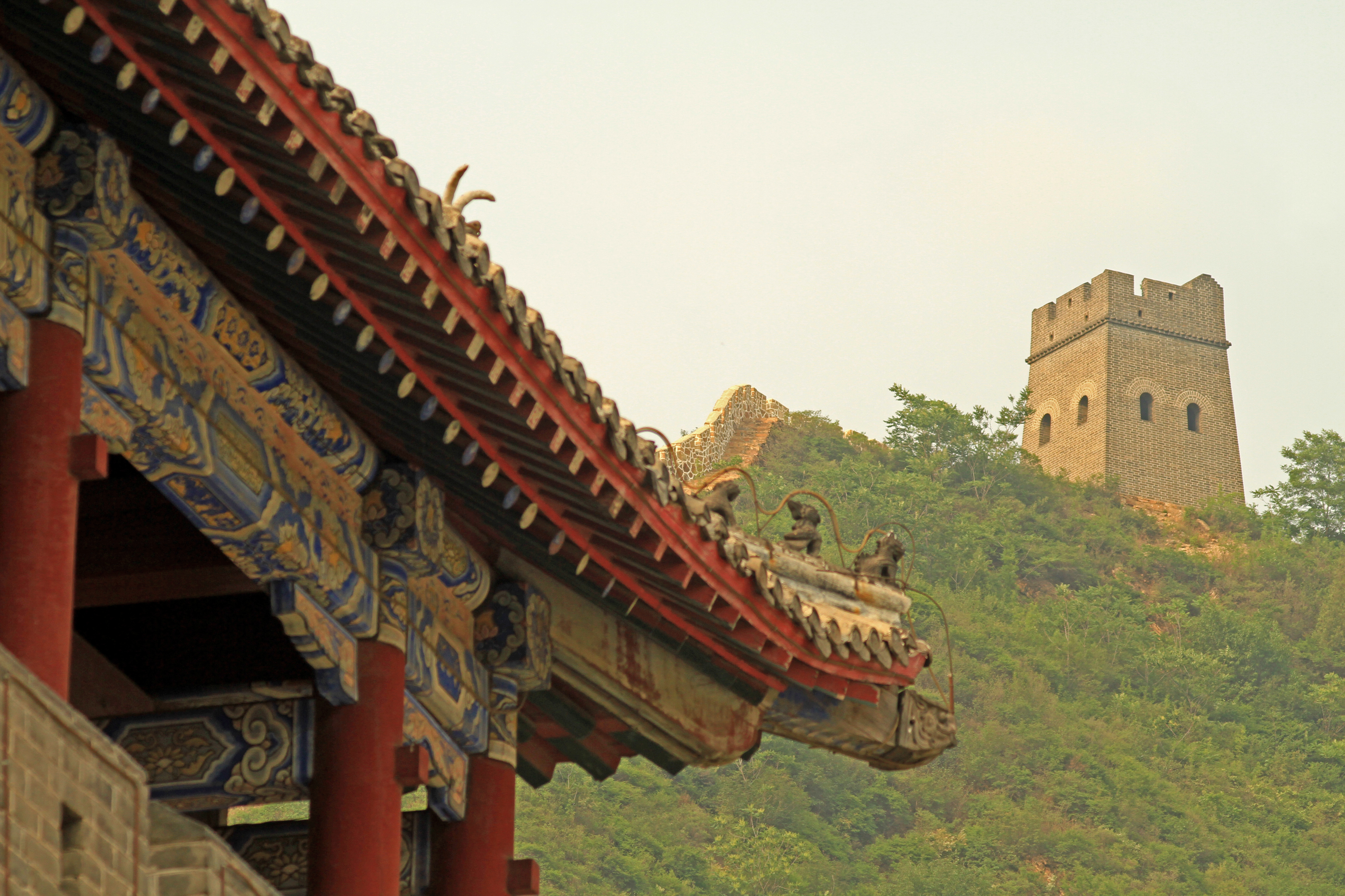
What makes Huangya Pass distinctive among Great Wall sections is the terrain it traverses. The wall follows a steep, abrupt mountain ridge that offers commanding views of the approaches from the north. This was not a wall built across gentle foothills; it was a fortification designed to exploit the natural defensive advantages of precipitous slopes and narrow defiles. For centuries, the pass served as a critical chokepoint along the northern frontier. Any invading force moving south through the mountains toward the heartland of North China would have to contend with these walls, their watchtowers, and the garrisons that manned them. The position was strong enough that it continued to function as a meaningful defensive point long after many other sections had fallen into disuse.
Restoration and Recognition
By the late twentieth century, Huangya Pass had suffered from the same neglect that affected most non-iconic sections of the Great Wall. In 1984, a major restoration effort was launched that repaired over three kilometers of wall, along with 20 watchtowers and one water pass -- a structure designed to allow streams to flow through the wall without compromising its defensive integrity. Two years later, in 1986, the pass was officially listed as a protected heritage site. Today, Huangya Pass functions as a major tourist attraction within the Tianjin municipality, drawing visitors who want to experience the Great Wall without the overwhelming crowds of the more famous sections closer to Beijing. The restored sections offer a vivid impression of what the wall looked like at its functional peak, while the surrounding mountain landscape remains largely undeveloped.
Where Tianjin Meets the Wall
Most people associate Tianjin with its port, its foreign concession architecture, and its proximity to Beijing. Few realize that the municipality extends far enough north to include a section of the Great Wall itself. Huangya Pass is that connection -- a reminder that Tianjin's administrative boundaries reach deep into the mountainous terrain that once defined the frontier between settled China and the nomadic north. Standing on the restored wall at Huangya, looking south toward the distant plains, you can understand why this geography mattered so much. The mountains here are not the gentle rolling hills of a scenic backdrop. They are abrupt, angular ridges with limited passes, and the wall threads along their crests like a stone spine, linking tower to tower in a chain of mutual observation. Each watchtower could see the next, creating a visual relay system that could transmit warnings across vast distances in minutes.
From the Air
Located at 40.23N, 117.41E on a steep mountain ridge in the northern part of Jizhou District, Tianjin municipality. The Great Wall section is clearly visible from the air as it follows the ridge crest. The nearest major airport is Tianjin Binhai International (ZBTJ/TSN), about 130 km to the south. Beijing Capital International (ZBAA/PEK) is approximately 100 km to the west. Terrain is mountainous with limited landing options. Best viewed from 3,000-6,000 feet AGL.