Ichijōdani Asakura Family Historic Ruins
For four centuries, the valley kept its secret. Rice paddies covered the streets where samurai once walked. Farmers tilled soil above buried gardens and temple foundations. Then, in 1967, archaeologists began digging into a narrow valley in Fukui Prefecture, and an entire medieval city started rising from the earth. Ichijodani -- the fortified capital of the Asakura clan -- had been waiting beneath the surface since Oda Nobunaga razed it in 1573. What emerged was one of Japan's most complete pictures of Sengoku-period urban life: a lord's mansion, samurai residences, merchant quarters, craft workshops, temples, and four exquisite Japanese gardens, all preserved by the very destruction that ended them.
A Fortress Carved by Nature
The Asakura chose their capital wisely. Ichijodani sits in a narrow valley branching off the Asuwa River, roughly 500 meters wide and three kilometers long. Mountains wall the valley on three sides -- east, west, and south -- while the river guards the northern approach. In 1471, when Asakura Toshikage displaced the Shiba clan as military governor of Echizen Province, he recognized this natural fortress for what it was. He sealed the valley's northern and southern ends with walls and gates, then built hilltop fortifications on the surrounding ridges. Within this enclosed space, he constructed his fortified mansion at the center, surrounded by the homes of his relatives and retainers. Merchants, artisans, and Buddhist monks followed, filling in the spaces between.
A Little Kyoto in the Mountains
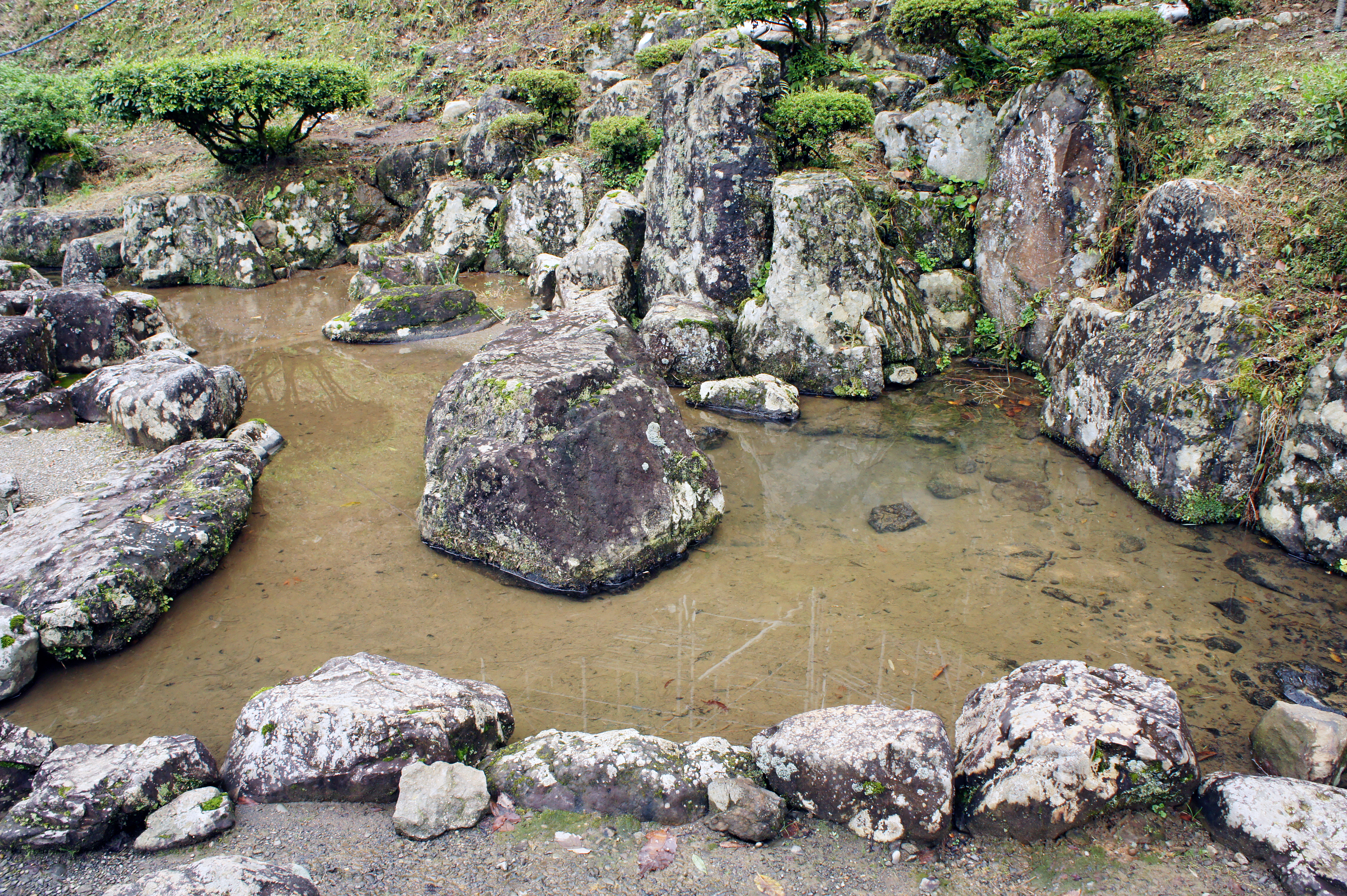
What made Ichijodani remarkable was not its military strength but its cultural ambition. When the Onin War tore Kyoto apart starting in 1467, Toshikage offered sanctuary to fleeing artists, scholars, and craftspeople. The refugees brought the capital's refinement with them, and Ichijodani blossomed into an unlikely center of culture deep in the mountains of Echizen. By the time of Asakura Takakage, who led the clan from 1493 to 1548, the valley town had swelled to over 10,000 inhabitants. Excavations have confirmed the sophistication: elegantly decorated rooms in the lord's residence, libraries, and four Japanese gardens that earned designation as Special Places of Scenic Beauty. The Asakura built something rare in wartime Japan -- a place where military power and aesthetic refinement coexisted.
The Fall of the Valley
The end came swiftly. The Asakura maintained close ties to the Ashikaga shogunate, and when Oda Nobunaga seized Kyoto, the Asakura found themselves on the wrong side of history. Shogun Ashikaga Yoshiaki appointed Asakura Yoshikage as regent and begged for help driving Nobunaga from the capital. Nobunaga responded with invasion. After decisive victories at the Siege of Kanegasaki and the Battle of Anegawa in 1570, the entire Asakura domain lay exposed. In 1573, Nobunaga's armies swept into Echizen and burned Ichijodani to the ground. Yoshikage fled, was betrayed by his own kinsman Asakura Kageakira, and took his own life. A century of Asakura rule ended in fire and ash, and the valley fell silent.
Unearthing a Lost World
The excavations that began in 1967 have continued for over five decades, and the scale of what they have uncovered is staggering. Approximately 1.7 million artifacts have been pulled from the earth, and 2,343 of them carry national designation as Important Cultural Properties. The entire 278-hectare site holds the status of Special Historic Site, one of Japan's highest protections. Archaeologists mapped the full layout of the town -- the lord's house, samurai streets, merchant quarters, craft workshops, and temples -- creating a remarkably complete picture of daily life in a Sengoku-period castle town. A 200-meter stretch of the main street has been reconstructed with samurai and merchant residences, and four buried gardens were carefully restored. The Ichijodani Asakura Family Site Museum displays the most significant finds, from ceramics and weapons to the small personal objects of people whose names are lost to history.
From the Air
Located at 36.00N, 136.30E in a narrow mountain valley southeast of Fukui city center. From the air, look for the distinct valley formation branching off the Asuwa River, with mountains enclosing three sides. The reconstructed street and archaeological site are visible as a cleared area within the forested valley. Nearest airport is Komatsu Airport (RJNK), approximately 55 km to the north-northeast. Fukui Airport (RJNF) is a smaller regional field closer at about 15 km northwest. The valley orientation runs roughly north-south, making it distinctive when approaching from altitude.