Ichkeul National Park
Ichkeul is a survivor. It is the last remaining lake in a chain that once extended across the breadth of North Africa -- a series of freshwater and brackish bodies that provided habitat for migratory birds traveling between Europe and sub-Saharan Africa. The others are gone, drained or silted or diverted over centuries of human modification. Ichkeul endures in northern Tunisia, a UNESCO World Heritage Site since 1980, though it came close to following its sister lakes into oblivion.
A Lake That Changes Its Chemistry
Ichkeul's ecology depends on a remarkable seasonal transformation. In winter, six wadis feed fresh water into the lake, diluting its salinity and creating the conditions that attract vast flocks of migratory waterfowl. In summer, as the wadis dry up, the lake connects to the Mediterranean Sea through Bizerte Lake via the Tinja channel, and saltwater flows in, raising salinity dramatically. This annual oscillation between fresh and salt creates a dynamic ecosystem -- different plant and animal communities thrive in each season, and the lake's character shifts completely over the course of a year. The park covers a rectangular area of roughly 11.4 by 20 kilometers, centered on the lake and the wetlands that surround it.
Three Hundred Thousand Wings
In certain winters, more than 300,000 ducks, geese, and coots have gathered on Lake Ichkeul simultaneously. Over 200 bird species have been recorded in the park, and three species of global conservation concern breed or winter here: the white-headed duck, the ferruginous duck, and the marbled duck. Pink flamingos wade the shallows. Storks nest in the surrounding marshes. The park also supports approximately 500 plant species, their distribution shaped by the salinity gradient that the lake's seasonal chemistry creates. The marshes of sedge and rush that fringe the lake provide critical feeding and resting habitat for birds completing journeys that span continents.
The Dams That Nearly Killed It
In the 1980s, dams were built on three of the main rivers feeding Lake Ichkeul. The effect was devastating. With less fresh water flowing in during winter, the lake's salinity stayed high year-round. The freshwater plants that migratory birds depended on -- particularly the beds of sedge that ducks and geese consumed -- gave way to salt-tolerant species that offered little food value. Waterfowl numbers plummeted from an average of 250,000 to a fraction of that. In 1996, UNESCO placed Ichkeul on its List of World Heritage in Danger. The park that had been protected as a game reserve since the Hafsid dynasty in the thirteenth century was dying under the weight of modern agricultural demands.
Rescue and Return
Tunisian authorities responded by ending the agricultural use of the lake's waters, reducing the pressure on its hydrology and allowing salinity levels to begin recovering their natural seasonal rhythm. The freshwater plants gradually returned, and with them, the birds. By 2006, the recovery was sufficient for UNESCO to remove Ichkeul from the endangered list. The park today is accessible from Bizerte via the RN 11 road, or from Tunis via Mateur on the RN 7. Its entrance sits where the road crosses the Mateur-Tinja railway -- a prosaic gateway to a landscape that has been valued by every civilization that has controlled this part of North Africa. Hafsid sultans hunted here. French colonists mapped its birds. And now, each winter, the wadis fill with rain, the fresh water dilutes the salt, the sedge beds thicken, and the sky darkens with wings. Ichkeul is still the last lake in the chain. But it is no longer dying.
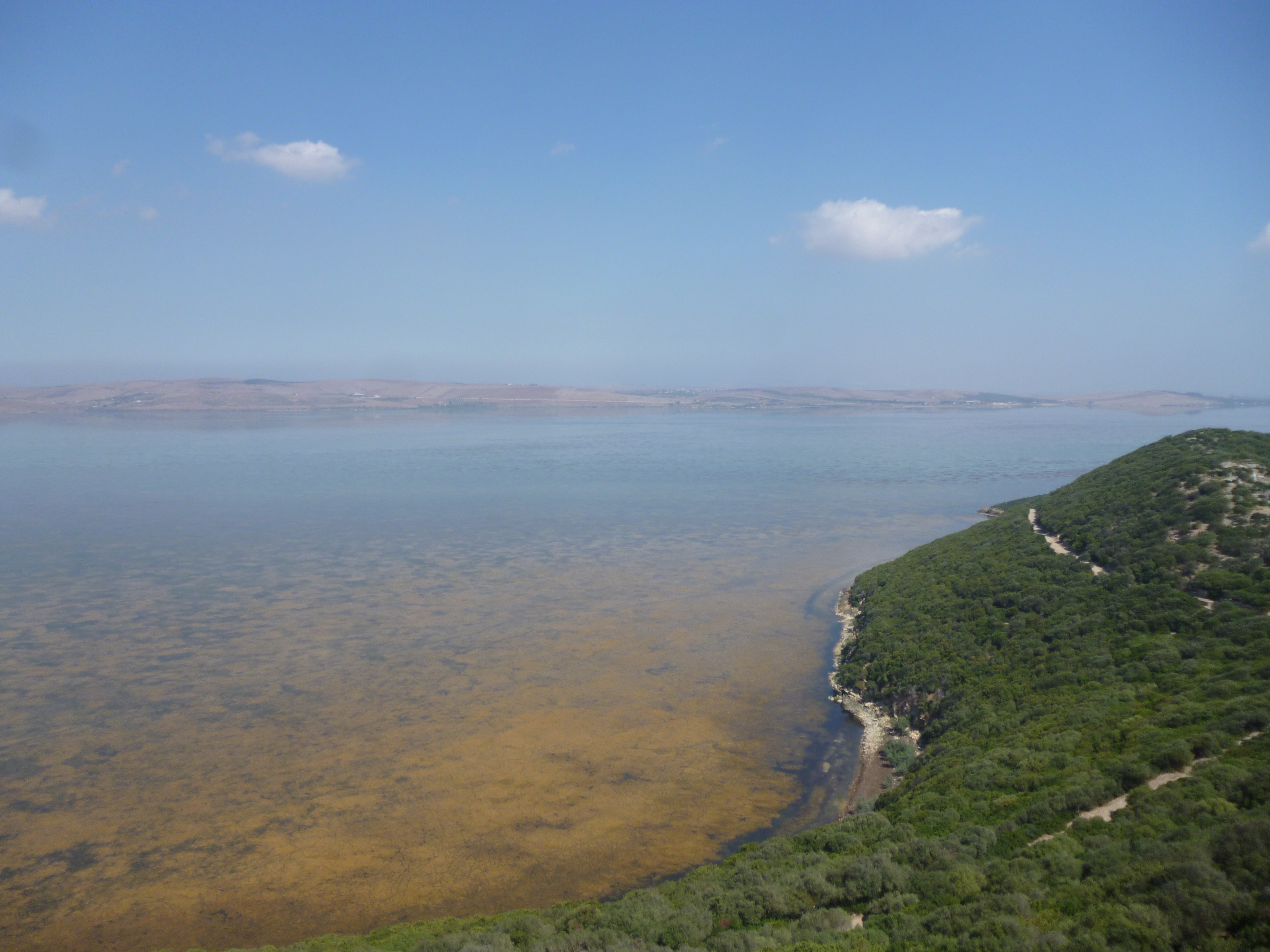
From the Air
Located at 37.12N, 9.66E in northern Tunisia, approximately 25 km southwest of Bizerte. Lake Ichkeul is clearly visible from altitude as a large body of water surrounded by marshland, with Djebel Ichkeul rising above its southern shore. Nearest airports: Tunis-Carthage International (DTTA), approximately 75 km southeast. The connection to Bizerte Lake via the Tinja channel is visible, as is the transition from the lake's wetlands to the surrounding agricultural land.